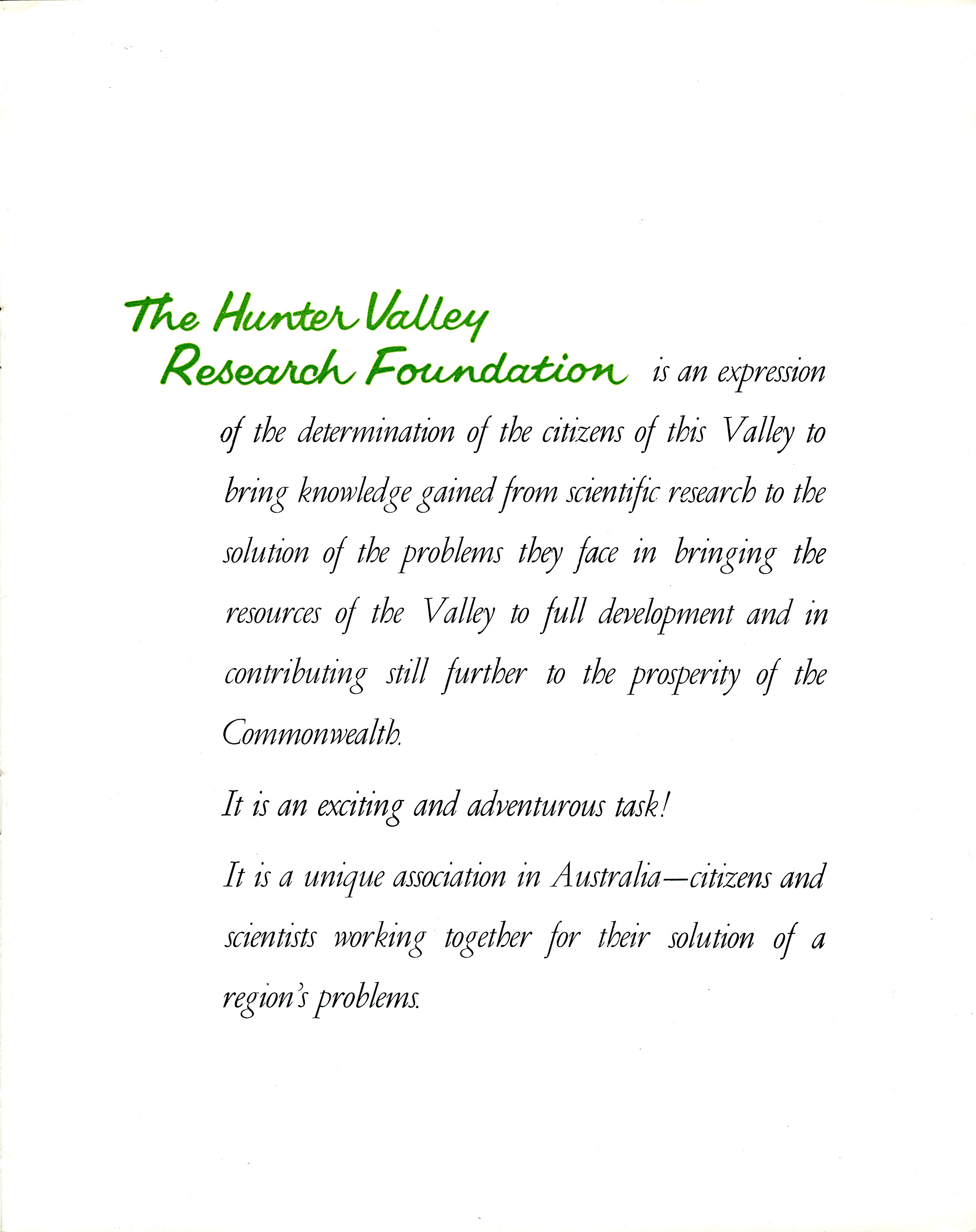
“The Hunter Valley Research Foundation is an expression of the determination of the citizens of this Valley to bring knowledge gained from scientific research to the solution of the problems they face in bringing the resources of the Valley to full development and in contributing still further to the prosperity of the Commonwealth. It is an exciting and adventurous task! It is a unique association in Australia – citizens and scientists working together for their solution of a region’s problems” – Hunter Valley Research Foundation Annual Report 1964
Introduction
The listing of the archives of The Hunter Valley Research Foundation represents the surviving archival records dating from the Foundation’s inception in the 1950s to the early 2000s.
The records were in a fire proof safe at its complex of offices and laboratories at 55 Downie Street Maryville (on the banks of Throsby Creek).

The land was being sold, and in 2016 around 57 boxes of archives were collected along along with a huge bundle of maps and plans, artefacts, films reels and photographs and taken into the custody of the University of Newcastle’s Archives (in Cultural Collections, now Special Collections).

Accessioning began in April 2017, and the listing below is thanks due to the work of volunteer Peter Trenbath who took over a year to complete.
The Birth of the Hunter Valley Research Foundation

The Hunter Valley Research Foundation was born in the aftermath of the 1955 Maitland Floods, when then Professor of Economics at Newcastle University College, Professor Cyril Renwick, addressed a gathering of 600 dairy farmers to map out a course of recovery for the Region’s economy. It was decided that what was needed was independent scientific research into the total environment, in order to plan and safeguard the future economic viability of the Hunter Region.
The Foundation was incorporated as a Company Limited by Guarantee on 13 September 1956. It officially appointed its first Directors and held its first meeting on the 22nd September 1956, with Professor Cyril Renwick as its Director of Research; a position which he held until 1985. The second CEO was Dr W.E.J. Paradice, who was succeeded in late 2013 by Dr Brent Jenkins. Read more about this story here: https://livinghistories.newcastle.edu.au/nodes/view/66963 and https://www.hrf.com.au/about-us/our-history


Listen to an Interview recorded with Professor Cyril Renwick 14 September 1984 in two parts:
The Formation of the new Hunter Research Foundation (HRF)
The Hunter Research Foundation (HRF) signed a Memorandum of Understanding with the University of Newcastle to become an official Research Centre of the University in 2017.
As part of the agreement, the Hunter Valley Research Foundation Ltd ceased to exist from 31 December 2016 and its mission incorporated into the new Hunter Research Foundation Centre at the University (located in NEWSpace).
2016 marked the Hunter Valley Research Foundation’s 60th year of operation as an independent regional research organisation. During that 60 year period it had amassed an archive of original material that entered into the custody of the University after December 2016.
The Director of the Hunter Research Foundation is Professor Roberta Ryan. Read more about their work here: https://www.hrf.com.au/
The Institute for Regional Futures
On the 22 April 2022 the University of Newcastle established its third flagship research institute; the Institute for Regional Futures to build on the 60+ year tradition of the Hunter Valley Research Foundation and Hunter Research Foundation Centre to be aligned with the College of Social and Human Futures.
Historic Weather Records
The material also contains historic material predating the Foundation and donated from families in the Hunter Valley, especially with regards to weather and climate records dating from the 1840s. You can learn more about the research that has come from those records, under the leadership of Conjoint Professor Howard Bridgman. In compiling this archival listing we were delighted to locate a missing set of weather records from the Wollong Homestead from January-April 1894. They will be incorporated into the data set in due course. More information can be found here:
https://hunterlivinghistories.com/category/weather-records-climatic-data/
THE HUNTER VALLEY RESEARCH FOUNDATION (HVRF)
Conduit: Kim Britton Received: 27 October 2016
HUNTER VALLEY RESEARCH FOUNDATION – MINUTE BOOKS
C3108 The Hunter Valley Research Foundation Minutes Book 22/9/1956 – 2/121963
C3109 The Hunter Valley Research Foundation Minutes Book 3/2/1954 – 7/2/1966
C3110 The Hunter Valley Research Foundation Minutes Book 7/3/1966-22/7/1969
C3111 The Hunter Valley Research Foundation Minutes Book 3/11/1969-12/12/1972
C3112 The Hunter Valley Research Foundation Minutes Book 20/2/1973-22/10/1976
C3113 The Hunter Valley Research Foundation Minutes Book 6/12/1976-3/3/1983
C3114(i) Board Minutes and Executive Papers, 1967-1969
C3114(ii) Board Minutes and Executive Papers, 1970-1972
C3115(i) Board Minutes and Executive Papers, 1973
C3115(ii) Board Minutes and Executive Papers, 1975-1976
C3115(iii) Board Minutes and Executive Papers 1977
C3115(iv) Board Minutes and Executive Papers 1978
C3115(v) Board Minutes and Executive Papers and Annual General Meeting Minutes 1979
C3116(i) Board Minutes and Executive Papers 1985-1990
C3116(ii) Board Minutes and Executive Papers 1992
C3117(i) Board Minutes and Executive Papers with the notation, “NB Dec. ’92 BP filed with 1993” 1992
C3117(ii) Board Minutes and Executive Papers 1993
C3117(iii) Board Minutes and Executive Papers with the notation, “June ’94 missing” 1994
C3118(i) Advisory Panel Minutes 1957-1962
C3118(ii) Advisory Panel Minutes 1956-1961
C3119(i) Advisory Panel Minutes 1967 and 1969
C3119(ii) Siltation Research Committee Minutes 23/4/74
C3119(iii) Hydrology Research Committee Minutes 22209
C3119(iv) Economic Research Committee Minutes 22580
C3119(v) Geology Groundwater Research Committee 22797
C3120(i) Land Use Research Committee 22334
C3120(ii) Balance Sheets and Income and Expenditure Accounts 1957-1973
C3120(iii) Audited Financial Statements 1959-1979
C3120(iv) Salary Books 1974-1979
C3120(v) Salary Books 1977-1980
C3120(vi) Annual Holidays Record Book 1974-1980
C3121(i) Cash Book 1956-1958
C3121(ii) Cash Book 1958-1959
C3121(iii) Cash Book (No.2) 1958-1959
C3121(iv) Cash Book 1958-1960
C3121(v) General Ledger 1958-1960
C3121(vi) Sydney Account 1966-1967
C3121(vii) General Ledger 1975-1983
C3121(viii) Sundry Debtors Book 1975-1981
C3121(ix) Orders and Invoices Book 1974-1975
C3122(i) Last Will and Testament of Donna Lee Russo 2005
C3122(ii) Memorandum and Articles of Association of Litmus Pty. Ltd. 1981
C3122(iii) Duplicate set of readings taken during Operation Midas 22272
C3122(iv) Correspondence of Sir Allen Fairhall, KBE containing: letters to HVRF Committee members, Milton Morris MLA, 40th Anniversary of HVRF, Memorandum and Articles of Association of HVRF (2 copies), CSIRO, Minutes of First meeting of HVRF 1955-1996
C3122(v) Three copies of the Newcastle Herald containing 25th Anniversary Supplement of the Hunter Valley Research Foundation 29843
HUNTER VALLEY RESEARCH FOUNDATION – PRESS CLIPPINGS
C3123(i) Press Clippings 1955-April 1958
C3123(ii) Press Clippings April 1958-January 1959
C3123(iii) Press Clippings March 1959-February 1960
C3124(i) Press Clippings February 1960-April 1960
C3124(ii) Press Clippings May 1960-September 1960
C3124(iii) Press Clippings September 1960-August 1961
C3125(i) Press Clippings August 1961-October 1962
C3125(ii) Press Clippings September 1962-August 1963
C3126(i) Press Clippings August 1963-October 1964
C3126(ii) Press Clippings January 1965-September 1966
C3127(i) Press Clippings September 1966-January 1969
C3127(ii) Press Clippings December 1971-June 1973
C3128(i) Regional Data for Eastern Australia Report 1972
C3128(ii) Hunter Valley Research Foundation Data Bank Report (x3 copies) c.1970s
C3128(iii) Australian Regional Studies Booklets (x3 copies) 1968
C3128(iv) Directory of Tertiary Industry: City of Cessnock (x3 copies) 1970
C3128(v) Directory of Tertiary Industry: Newcastle and Lake Macquarie (x2 copies) 1969
C3128(vi) Directory of Tertiary Industry: Newcastle and Lake Macquarie – Financial (x3 copies) c.1970s
C3128(vii) Directory of Tertiary Industry: Newcastle and Lake Macquarie – Professional and Community Services (x3 copies) c.1970s
C3129(i) Directory of Tertiary Industry: Port Stephens (x3 copies) c.1970s
C3129(ii) Directory of Tertiary Industry: Automotive Industry (x3 copies) c.1970s
C3129(iii) Directory of Tertiary Industry: Newcastle and Lake Macquarie – Transport (x3 copies) c.1970s
C3129(iv) Directory of Tertiary Industry: Dungog Shire (x3 copies) c.1970s
C3129(v) Directory of Tertiary Industry: Gloucester and Stroud (x3 copies) c.1970s
C3129(vi) Directory of Manufacturing 1966
C3129(vii) Directory of Manufacturing 1969
C3130(i) Directory of Manufacturing – Distributors 24593
C3130(ii) Directory of Manufacturing Establishments in the Hunter Region 1978
C3130(iii) Directory of Retail and Selected Services for the Hunter Region including Wyong and Manning Shires (x2 copies) 1978
C3130(iv) Directory of Manufacturing Establishments in the Hunter Region (x2 copies) 1985
C3131(i) Directory of Manufacturing for Newcastle and the Hunter Region, 3rd Ed. No 13 (x2 copies) 1972
C3131(ii) Directory of Manufacturing for Newcastle and the Hunter Region 1968
C3132(i) Directory of Manufacturing for Newcastle and the Hunter Region (2nd copy) 1968
C3132(ii) Publications List – 1st, 2nd, 3rd Ed. (marked as 1,3,3 copies) n.d.
C3132(iii) Publications List, 10th Ed. 1983
C3132(iv) Publications List, 11th Ed. 1984
C3132(v) Publications List, 13th Ed. 1986
C3132(vi) Publications List, 14th Ed 1987
C3132(vii) Publications List, 17th Ed. 1990
C3132(viii) Publications List. 18th Ed. 1991
C3132(ix) Publications List, 19th Ed. 1992
C3132(x) Publications List (no edition marked) 1994
C3132(xi) Publications List (no edition marked) 1996
HUNTER VALLEY RESEARCH FOUNDATION – ANNUAL REPORTS
C3133(i) Annual Report (x2) 1964 – Hunter Valley Research Foundation Annual Report 1964
C3133(ii) Annual Report (x2) 1965
C3133(iii) Annual Report (x2) 1966
C3133(iv) Annual Report (x2) 1967
C3133(v) Annual Report (x2) 1968
C3133(vi) Annual Report (x2) 1969
C3133(vii) Annual Report (x2) 1970
C3133(viii) Annual Report (x2) 1971
C3133(ix) Annual Report (x2) 1972
C3133(x) Annual Report (x2) 1973
C3133(xi) Annual Report (x2) 1974
C3133(xii) Annual Report (x2) 1975
C3133(xiii) Annual Report (x2) 1976
C3133(xiv) Annual Report (x2) 1977
C3133(xv) Annual Report (x2) 1978
C3133 (xvi) Annual Report (x2) 1980 (no 1979 in papers)
C3133(xvii) Annual Report (x2) 1981
C3133(xviii) Annual Report (x2) 1982
C3133(xix) Annual Report (x2) 1983
C3133(xx) Annual Report (x2) 1984
C3133(xxi) Annual Report (x2) 1985
C3133(xxii) Annual Report (x2) 1986
C3133(xxiii) Annual Report (x2) 1987
C3133(xxiv) Annual Report (x2) 1988
C3133(xxv) Annual Report (x2) 1989
C3133(xxvi) Annual Report (x2) 1990
C3134(i) Annual Report (x2) 1990 (no 1991 in papers)
C3134(ii) Annual Report (x2) 1992
C3134(iii) Annual Report (x2) 1993
C3134(iv) Annual Report (x2) 1994
C3134(v) Annual Report: 40th Anniversary Report marked by hand 1995 (c.1996)
C3134(vi) Annual Report – also Special Newsletter (1/97) 1996
C3134(vii) Annual Report – also Special Newsletter (1/98) 1997
C3134(viii) Annual Report 1998
C3134(ix) Annual Report 1999-2000
C31334(x) Annual Report 2000-2001
C3134(xi) Annual Report 2001-2002
C3134(xii) Annual Report 2002-2003
C3134(xiii) Annual Report 2003-2004
C3134(xiv) Annual Report 2004-2005
C3134(xv) Annual Report (x2) 2009-2010
C3134(xvi) Annual Report (x2) 2010-2011
C3134(xvii) Hunter River Floods: Report of the NSW Legislative Assembly 1890
C3134(xviii) Water Conservation Commission: Wollombi Brook – Extracts from the Report on the Hunter River Floods of 1949 and 1930 1949
C3134(xix) Department of Public Works NSW: Hunter River Flood Mitigation Reports on the Flooding of Louth Park 21398
C3134(xx) US Army Corps of Engineers: Water Resource Policies and Authorities Flood Plain Information Studies 22371
C3134(xxi) Book of Statistics and Diagrams to accompany 1982 Annual Report 1982
C3135(i) Geological Survey of the Southern Coalfields of NSW – Maps and Sections 1914
C3135(ii) NSW Department of Mines: Geology and Mineral Resources of the Southern Coalfields – Maps and Sections 1912
C3135(iii) NSW Department of Mines: Monograph of the Carboniferous and Perm0-Carboniferous Invertebrata of NSW, No. 5 (x2 copies) 1910
C3135(iv) Description of the Palaeozoic Fossils of NSW, No. 6 1898
C3136(i) Etheridge R and Olliff S, Palaeontology Memoir No.7: The Mesozoic and Tertiary Insects of NSW 1890
C3136(ii) Woodward A s, Palaeontology Memoir No.9: The Fossil Fishes of the Talbragar Beds 1895
C3136(iii) Woodward A S, Palaeontology Memoir No.10: The Fossil Fishes of the Hawkesbury Series at St. Peter’s 1908
C3136(iv) Etheridge R, Palaeontology Memoir No.11: A Monograph of the Cretaceous Invertebrate Fauna of New South Wales (x2 copies) 1902
C3136(v) Walkon A B, Palaeontology Memoir No.12: Part 1 – Fossil Plants from Cockabutta Mountain and Talbragar 1921
C3136(vi) Chapman F, Palaeontology No.14: Foraminifera of the Permo-Carboniferous Limestones 1905
C3136(vii) Department of Decentralization and Development – NSW Areas for Planning @ 1/1/67 1967
C3136(viii) Newcastle City Council: Newcastle 150 Years. 1947
C3136(ix) Butler Leo, Symphony On A City – The Story of Newcastle (x3 copies) c.1950s
C3136(x) Renwick C C, Three Decades of Work as a Director of Research 1985
C3137(i) Results of Rain, River and Evaporation Observations made in NSW during 1892 1893
C3137(ii) Results of Rain, River and Evaporation Observations made in NSW during 1893 1894
C3137(iii) Results of Rain, River and Evaporation Observations made in NSW during 1894 1895
C3137(iv) Results of Rain, River and Evaporation Observations made in NSW during 1896 1897
C3137(v) Results of Rain, River and Evaporation Observations made in NSW during 1898 1900
C3137(vi) Results of Rain, River and Evaporation Observations made in NSW during 1899 1901
C3137(vii) Results of Rain, River and Evaporation Observations made in NSW during 1901-1902 1904
HUNTER VALLEY RESEARCH FOUNDATION – BOARD OF DIRECTORS
C3138 HVRF Board of Directors Minutes 22/9/56-2/12/59
C3139 HVRF Board of Directors Minutes 3/2/60-6/7/60
C3140 HVRF Board of Directors Minutes 3/8/60-4/9/61
C3141 HVRF Board of Directors Minutes 2/4/62-11/6/62
C3142 HVRF Board of Directors Minutes 11/5/63 – 6/4/64
C3143(i) HVRF Monograph 29: Saunders D M, Town and District in the Hunter Valley Region (x 2 copies) 1968
C3143(ii) HVRF Monograph 30: McCalden G, Muswellbrook – An Urban Case Study, Part I 1968
C3143(iii) HVRF Monograph 31: McCalden G, Muswellbrook – An Urban Case Study, Part II 1968
C3143(iv) HVRF Monograph 32: McMahon T M, The Barrington Region NSW (x 2 copies) 1969
C3143(v) HVRF Momograph 33: Short K C, Shopping Patterns in Newcastle, NSW (x 2 copies) 1970
C3144(i) HVRF Monograph 34: Frecker G B, The Reliability of Water Resource Systems (x 2 copies) 1971
C3144(ii) HVRF Monograph 35: Richmond R N, Agricultural and Economic Aspects of Water Use (x 2 copies) 1971
C3144(iii) HVRF Monograph 36: Kriek P N – contains two envelopes wrapped in brown paper marked “Not to be released without the permission of the Director n.d.
C3144(iv) HVRF Monograph 36 [different to C3144(iii)]: Walsh R, The Housebuilding Industry in New South Wales (x 2 copies) 1972
C3145(i) HVRF Monograph 38: Maiden A S, Growth Needs of Local Government in the Hunter Region and Adjoining Areas (x 2 copies) 1974
C3145(ii) HVRF Monograph 40: Garlick S, Changes in the Input-Output Multipliers in the Hunter Region (x 2 copies) 1984
C3145(iii) The Hunter Foundation: List of Projects (x 2 copies) 1968-1969
C3145(iv) HVRF Research Report 32: Finke E, A Study of Land Resources in the Shire of Singleton 1977
C3145(v) Trowbridge B, Recreation Seminar for Local Government in the Hunter Region – A Report prapared for the City of Newcastle Sports Council 1982
C3145(vi) Research Report: The Hunter Valley Research Foundation (x 2 copies) 1959-1961
C3145(vii) HVRF Datex Report: A Year In Progress ( x 2 copies) 1967
C3146(i) Pamphlet: Population of the the Upper Hunter Region of New South Wales (x 2 copies) 1963
C3146(ii) Land Research Series No. 8: General Report on the Lands of the Hunter Valley – CSIRO, Melbourne ( x 2 copies) 1963
C3146(iii) Report: Resource Management in Time of Drought (enclosed in brown paper) n.d.
C3146(iv) Diagrams and detailed descriptions of land systems of the Hunter Valley – from CSIRO General Report on the Lands of the Hunter Valley (No. 8 in series) 1963
C3146(v) Wind Speed and Direction Data (Bureau of Meteorology) at Williamtown, NSW 1951-1957
C3146(vi) Dark Rain Circular compiled by HVRF 1960
C3146(vii) HVRF Directory: List of Directors and Staff 1960
C3146(viii) HVRF: List of Film Borrowings 1962-1967
C3146(ix) Water Testing Results at Seaham and Raymond Terrace 1957-1966
C3146(x) Meterological Observations for Wollong, NSW (handwritten original in table form) January to April 1894 [TRANSFERRED TO A5438(x) 10/7/2023]
C3146(xi) Report: Road to Decentralization (enclosed in brown paper) n.d.
C3146(xii) HVRF Monograph 39: Renwick C, A Study of Wine in the Hunter Valley Region of New South Wales 1977
C3147(i) Pamphlet: The Hunter Valley region – information relating to employment, industry, education, income etc. 1962
C3147(ii) Short K C, Consumer Mobility in Newcastle, NSW (x 3 copies) 1968
C3147(iii) HVRF: Reprint from BP Journal, “Accelerator” (enclosed in brown paper) n.d.
C3147(iv) Report: Annual Conference of Floood Mitigation Authorities of New South Wales, Nowra, NSW (x 2 copies) 24198
C3147(v) Renwick C, The East Coast of Australia and the Growth of the Hunter Region Witjhin the Complex (x 2 copies) 1969
C3147(vi) Renwick C, The Work of the HVRF in relation to Regional Growth and Agricultural Problems 1966
C3147(vii) HVRF Advisory Panel Meeting 25542
C3147(viii) Renwick C, Regional Planning – Competing Water Uses in the Hunter Valley of New South Walers ( x 2 copies) 1966
C3147(ix) Renwick C, Planning for Water Use 1966
C3147(x) Coloured Brochure: The Hunter Valley Research Foundation 1955-1957 ( x 2 copies) 1957
C3147(xi) Pamphlet: A Message from The Hunter Valley Research Foundation ( x 2 copies) 1965
C3147(xii) HVRF: General Information Bulletin ( x 2 copies) 22525
C3147(xiii) Journal: “Canberra Comments”, Vol. 20, No. 11 – official organ of the Associated Chambers of Commerce of Australia ( x 2 copies) 24412
C3147(xiv) Renwick C, The Vernon Report and Decentralization ( x 2 copies) 24139
C3147(xv) Renwick C, The Fundamental Concepts of River Basin Planning 24289
C3147(xvi) HVRF: Survey of Tertiary Industry – Statement of Aims and Methodology ( x 2 copies) 1968
C3147(xvii) Renwick C, Planning for Water Use ( x 2 copies) 24381
C3147(xviii) Renwick C, The Benefits of Increasing Primary, Secondary and Tertiary Industry to Rural Service Centres 1963
C3147(xix) Journal: “The Living Earth”, Vol. 8, No. 3 23285
C3147(xx) HVRF: Soil Conservation Circulars c.1960s
C3147(xxi) HVRF: Population Analysis of the Hunter Valley 1980
C3148(i) “PIX” Magazine, Vol.19, No.14 April 5 1947
C3148(ii) Bank of New South Wales Publication: “Your Asset – The Soil”, Conservation for Permanent Agriculture 1957
C3148(iii) Booklet: “Port Developments in Sydney and Newcastle” ( x 2 copies) 1968
C3148(iv) Killen N and Stanton P J (eds), “Development of Our Export Potential” – Proceedings of HVRF Conference May 1968
C3148(v) Ephemera: 1972-1973 Christmas Cards wrapped in brown paper marked (3) 1973
C3148(vi) Ephemera: 1 x Australian Flag (poor condition) n.d.
C3148(vii) Ephemera: 1 x Australian Flag and 1 x NSW State Flag (good condition) n.d.
C3149(i) Booklet: “Back to Singleton September 15-26 1926” 1926
C3149(ii) Booklet: “The Baroona Estate – The Property of Mr. A A Dangar c.1930s
C3149(iii) Booklet: “Beresford NSW – The Young Giant of the North” c.1930s
C3149(iv) Booklet: “Memento of Maitland Floods 1893 – 1913” c.1930s
C3149(v) Walker A, “Coaltown: A Social Survey of Cessnock” 1945
C3149(vi) Bloomfield W A G, “Cessnock 1826-1954 – A History of the Cessnock District with a special supplement on the Catholic Parish of Cessnock” 1954
C3149(vii) Booklet: Saint Patrick’s Day Celebration Maitland, Golden Jubilee 1899-1948 1948
C3149(viii) Lecture Notes: “History of Economic Though”, Professor C Renwick January – November 1960
C3149(ix) HVRF Papers: Investment and Economic Growth, Physical Resources, Urban Growth, Human Resources, Social Investment c.1970s
C3149(x) Programme: 28th Annual HVRF Dinner, Newcastle Tattersalls Club 25026
C3149(xi) Report of the Newcastle Region Development Committee on the Proposed Future of the Newcastle Region 1955
C3149(xii) HVRF Paper: Hunter Valley Rural Production – series of hand drawn graphs and notations 1965
C3150(i) Maitland Mercury: Editorials and Floods, Vol. I, 1861 -1867 (photographed copies) n.d.
C3150(ii) Maitland Mercury: Editorials and Floods, Vol. II, 1867 (photographed copies) n.d.
C3150(iii) Maitland Mercury and Hunter River General Advertiser: “A Diary of Hunter Valley Floods”, first published 1843 n.d.
C3150(iv) Maitland Mercury Centenary Supplement – Maitland 1835 – 1935 1935
C3150(v) Sydney Morning Herald, original copy, 22 July 1968 1968
C3150(vi) Newcastle Morning Herald, original copy, pp. 21-28 only, 5 May 1966 1966
C3150(vii) The Singleton Argus, original copy, 14 November 1958 1958
C3151(i) Press Clippings relating to HVRF 1968
C3151(ii) Press Clippings relating to HVRF 1971
C3151(iii) Press Clippings relating to HVRF 1972
C3151(iv) Press Clippings relating to HVRF 1973
C3151(v) Press Clippings relating to HVRF 1974
C3151(vi) Press Clippings relating to HVRF 1975
C3151(vii) Press Clippings relating to HVRF 1976
C3152(i) HVRF Promotional Brochure Series (numerous brochures) c.1970s
C3152(ii) HVRF: “Monitoring the Hunter Region of NSW”, (x 2 copies) 1983
C3152(iii) Brochure: HVRF National Data Service ( x 2 copies)) 1971
C3152(iv) “Flood Plain Information for the Hunter Valley of NSW” – HVRF 1963
C3152(v) Papers relating to HVRF Research Plan : Urban Studies, The Dairy Industry 1966
C3152(vi) Renwick C, Drought Warning – HVRF publication 1966
C3152(vii) Rainfall Data recorded at Adamstown, NSW (x 2 copies) 16 January 1973 – 13 June 1974
C3152(viii) “Public Attitudes towards Community Recreation Facilities” – prepared for NSW Sport and Recreation Service September 1974
C3152(ix) “Tourism in the Tamwoth – Armidale Region” – HVRF publication May 1974
C3152(x) “The Hunter Regional Leisure Plan” – HVRF publication ( x 2 copies) 1977
C3153(i) Renwick C, The Benefits of Increased Primary, Secondary and Tertiary Industry to Rural Service Centres (x 2 copies) 1966
C3153(ii) Paradice W, The Role of Social Sciences in Natural Resource Management 1990
C3153(iii) Paradice W, HVRF Financial and Program Review 1985
C3153(iv) Paradice W, Directions for the HVRF in the 1980’s 1984
C3153(v) “The Hunter Input Output Model” – HVRF Publication c.1980s
C3153(vi) “An Investors Guide to the Hunter Region” 1977
C3153(vii) Hunter District Water Board Customer Survey 1987
C3153(viii) HVRF Research Summary February 1987
C3153(ix) HVRF Research Summary July 1987
C3153(x) “Feasibility Study for Hosting the World Students Games, Newcastle NSW” January 1983
C3153(xi) Hunter Region Labour Markets Report, No. 4, – HVRF Publication June 1988
C3153(xii) Hunter Region Labour Markets Report, No. 4, – HVRF Publication June 1988
C3153(xiii) Proceedings of the HVRF Recreation and Tourism Seminar, Pokolbin, NSW (x 2 copies) July 1988
C3153(xiv) Paradice W, The Coal Chain and the Hunter Valley (x 2 copies) 1988
C3153(xv) “Tourism in the Hunter Valley” – HVRF Publication October 1988
C3153(xvi) Paradice W, Economic and Community Development in the Hunter Region – An Overview November 1988
C3153(xvii) Driver B, Krumpe E & Paradice W, Predicting Leisure Choice Behaviour – A Paper prepared for the Royal Institute of Parks and Recreation, Sydney, NSW October 1988
C3153(xviii) Hughes B, Quarterly Hunter Region Economic Update – National and International Economic Trends ( x 2 copies) April 1989
C3154(i) Notes prepared for NSW Local Budgeting 1989
C3154(ii) Background information to assess Newcastle’s Capability to Undertake the Frigate Project March 1989
C3154(iii) “Marketing the Hunter Region” – HVRF Publication November 1990
C3154(iv) Economic Forecasts for Local Government Budgeting August 1990
C3154(v) Paradice W & O’Connell P, Tourism Stratagies for Local Councils: Market Approach and Planning Process, April 1991
C3154(vi) McLaughlin W, Black C & O’Connell P, The Tweed Shire Tourism Strategy 1991
C3154(vii) Paradice W, Tourism Planning and Local Government – paper presented at NSW Tourism Commission, Sydney, NSW July 1992
C3154(viii) Paradice W, Responding to Structural Change: The Hunter Region Experience 1992
C3154(ix) Economic Forecasts for NSW Local Governemt Budgeting 1993
C3154(x) Paradice W, The Challenge of Regionalism: NSW Local Government Conference October 1993
C3154(xi) Paradice W, Tourism and Local Government: Issues, Impediments and Actions October 1993
C3155(i) Black C and O’Connell P, Enhancing Regional Structural Change: A Case Study in Community Consultation 1993
C3155(ii) Black C and O’Connell P, Resident-Visitor Synergies in the Local Government Context 1993
C3155(iii) Newsprint Coverage for 1993 (HVRF Clippings) 1993
C3155(iv) Australian Bureau of Statistics: Input-Output Tables 1994-1995 – Total Multip[liers for Output, Employment, Income 1994
C3155(v) Media Coverage, First Quarter (1/1/94 – 18/4/94) 1994
C3155(vi) Media Coverage, Second Quarter (18/4/94 – 27/7/94) 1994
C3155(vii) Media Coverage, Third Quarter (28/7/94 – 5/12/94) 1994
C3155(viii) Economic Forecasts for NSW Business and Local Government 1994
C3155(ix) Economic Forecasts for NSW Business and Local Government 1992
C3155(x) HVRF Future Directions Workshop – Transcripts Oct. 1994
C3155(xi) O’Connell P and Stinson T, Rural Community Development – Where Are We Up To? June 1995
C3155(xii) O’Connell P and Stinson T, Migration and Its Implications for Regional Development 1995
C3155(xiii) Hunter Tourism Facts – HVRF Paper 1995
C3155(xiv) Local Government and Tourism: Facilities for Growth – HVRF Paper 1995
C3155(xv) HVRG Lecture Series – Transcripts 1996
C3155(xvi) Economic Forecasts for NSW Business and Local Government, 1996-1997 & 1997-1998 1996
C3155(xvii) Economic Forecasts for NSW Business and Local Government 1995-1996 & 1996-1997 1995
C3156(i) Hunter Water Corporation Ltd. Customer Survey (3 x Volumes) 1996
C3156(ii) O’Connell P and Gordon R, Community Perceptions of Council Performance: What to Compare 1996.
C3156(iii) Paradice W, Scone and The Future: The future development of the Scone LGA 1996
C3156(iv) Paradice W, Port Stephens and The Future: The future development of the Port Stephens LGA 1996
C3156(v) O’Connell P and Gordon R, Local Government Benchmarking – A Basis for Best Practice 1996
C3156(vi) O’Connell P, Establishing Community Dialogue 1996
C3156(vii) Paradice W, Images of The Future and the Perceived Role of Technology 1996
C3156(viii) HVRF Media Coverage and Presentations, January – December 1997 1997
C3156(ix) HVRF Lecture Series – Transcripts 1997
C3156(x) Central West Overview December 1997
C3156(xi) Orana Region Overview September 1997
C3156(xii) HVRF 36th Annual Sydney Lunch – Transcript of Speeches 26 March 1997
C3156(xiii) Paradice W, The Role of Sister City Programs in the Future Development of Hunter Region Communities 1997
C3157(i) Hunter Water Corporation Ltd. Domestic Customer Survey (x 2 copies) 1997
C3157(ii) Hunter Water Corporation Ltd. Customer Survey 1997
C3157(iii) HVRF Lecture Series – Transcripts 1998
C3157(iv) HVRF Economic Forecasts for NSW Business and Local Government, 1997-1998 & 1998-1999
C3157(v) Hodyl K, Quality of Life – Presentation to HVRF Newcastle Dinner 1998
C3157(vi) O’Connell P, Community Involvement in Tourism Planning 1998
C3157(vii) HVRF Lecture Series – Transcripts 1999
C3157(viii) HVRF Media Coverage and Presentations, January – December 1999 1999
C3157(ix) Paradice W, Baby Boom or Bust? 1999
C3157(x) HVRF 36th Annual Sydney Lunch – Transcript of Speeches April 1999
C3158(i) O’Connell P, The Future of Local Government 1999
C3158(ii) Forecasts for the CPI, March – June 2000 February 1999
C3158(iii) HVRF Lecture Series – Transcripts 2000
C3158(iv) Hunter Region Economic Indicators Data Book June 2000
C3158(v) The Hunter Wine Industry 1998 – 199, HVRF Paper March 2000
C3158(vi) Paradice W, Adress to Sponsors at the 37th Annual Sydney Luncheon 30 March 2000
C3158(vii) Region 2000: A Prospectus for Investors in the Hunter Region 2000
C3158(viii) O’Connell P, Developing Sustainability Measures for Regions 2000
C3158(ix) Paradice W, Working in the Hunter in the Twenty-First Century 2000
C3158(x) Paradice W, Making Sense of the 2001 Census 2002
C3158(xi) Hunter Region Social Indicators Index (x 2 copies) 2002
C3158(xii) HVRF Lecture Series – Transcripts 2001
C3158(xiii) HVRF Publications List, 28th Edition 2001
C3158(xiv) Shelland D and Searles A, The Other Person Technique – Telephone Surveys 2001
C3158(xv) Paradice W, Address to Sponsors at the 38th Annual Sydney Luncheon 22 March 2001
C3158(xvi) Paradice W, Brawn, Brains and Ballast – Infrastructure Development 2001
C3158(xvii) Seales A, Recent Trends in Job Markets 2003
C3159(i) Robinson K, Wollombi Catchment Area: Interim Report on Land Use Survey, Monograph No. 1 1959
C3159(ii) Pattison A, The Instrumentation of the Wollombi Brook Catchment, Monograph No. 2 ( x 2 copies) 1960
C3159(iii) March D, The Wool Industry in the Hunter Valley, Monograph No.3 (x 2 copies) 1960
C3159(iv) Renwick C, The Hunter Valley Economy 1947-1957, Monograph No. 4 1960
C3159(v) March D, The Dairy Industry in the Hunter Valley, Monograph No. 5 (x 2 copies) 1960
C3159(vi) Burley T, The Land Cover Survey, Monograph No. 6 ( x 2 copies) 1961
C3159(vii) Pattison A, The Formulation and Operation of Field Experiments Using Radio Active Isoptopes for Tracing Salt Movement: Section 1, Monograph No. 7 ( x 2 copies) 1961
C3159(viii) Pattison A, The Formulation and Operation of Field Experiments Using Radio Active Isoptopes for Tracing Salt Movement: Section 2, Monograph No. 7 ( x 2 copies) 1961
C3159(ix) McMahon T, Results of a Pumping Test at Warkworth, Monograph No. 8 ( x 2 copies) 1961
C3159(x) Burley T, The Land Cover Pattern, Monograph No. 9 ( x 2 copies) 1961
C3159(xi) Renwick C, The Hunter Valley Economy 1947-1960, Monograph No. 10 ( x 2 copies) 1961
C3160(i) Murray J, The Tertiary Sector, Monograph No. 11 ( x 2 copies) 1962
C3160(ii) Burley T, The Land Utilization Survey, Monograph No. 12 ( x 2 copies) 1962
C3160(iii) Grady J, An Economic History of The Wollombi From The Beginnings to 1857 ( x 2 copies) 1963
C3160(iv) Burley T, Some Aspects of Agricultural Activities in the Hunter Valley (x 2 copies) 1963
C3160(v) March B, The Dairy Indistry in the Hunter Valley, Second Reprint 1963
C3160(vi) King H, The Urban Pattern of the Hunter Valley 1963
C3160(vii) McMahon T, Irrigating the Alluvium of the Hunter Valley 1965
JOURNAL OF THE HUNTER VALLEY RESEARCH FOUNDATION (1957-1969)
C3160(viii) The Journal of the Hunter Valley Research Foundation (x 2 copies) 1957
C3160(ix) The Journal of the Hunter Valley Research Foundation (x 2 copies) December 1957
C3160(x) The Journal of the Hunter Valley Research Foundation (x 2 copies) June – December 1958
C3160(xi) The Journal of the Hunter Valley Research Foundation (x 2 copies) June – December 1959
C3160(xii) The Journal of the Hunter Valley Research Foundation (x 2 copies) June – December 1960
C3161(i) The Journal of the Hunter Valley Research Foundation (x 2 copies) January – June 1961
C3161(ii) The Journal of the Hunter Valley Research Foundation (x 2 copies) July – December 1961
C3161(iii) The Journal of the Hunter Valley Research Foundation (x 2 copies) December 1962
C3161(iv) The Journal of the Hunter Valley Research Foundation (x 2 copies), Vol VII, No 1 1963-1964
C3161(v) The Journal of the Hunter Valley Research Foundation (x 2 copies), Vol VII, No 2 1964
C3161(vi) The Journal of the Hunter Valley Research Foundation (x 2 copies), Vol VIII, No 1 1965
C3161(vii) The Journal of the Hunter Valley Research Foundation, (x 2 copies), Vol IX, No 1 1966
C3161(viii) The Journal of the Hunter Valley Research Foundation, (x 2 copies), Vol X November 1967
C3161(ix) The Journal of the Hunter Valley Research Foundation, (x 2 copies), Vol II 1968
C3161(x) The Journal of the Hunter Valley Research Foundation, (x 2 copies), Vol XII 1969
RAIN AND RIVER OBSERVATIONS (1878-1891)
C3161(xi) Rain and River Observations Made In New South Wales During 1878 1878
C3161(xii) Rain and River Observations Made In New South Wales During 1879 1879
C3161(xiii) Rain and River Observations Made In New South Wales During 1880 1880
C3161(xiv) Rain and River Observations Made In New South Wales During 1881 1881
C3161(xv) Rain and River Observations Made In New South Wales During 1882 1882
C3161(xvi) Rain and River Observations Made In New South Wales During 1883 (2 x copies) 1883
C3161(xvii) Rain and River Observations Made In New South Wales During 1884 1884
C3161(xviii) Rain and River Observations Made In New South Wales During 1885 1885
C3161(xix) Rain and River Observations Made in New South Wales During 1887 1887
C3161(xx) Rain and River Observations Made In New South Wales During 1888 1888
C3161(xxi) Rain and River Observations Made In New South Wales During 1889 1889
C3161(xxii) Rain and River Observations Made In New South Wales During 1891 1891
C3161(xxiii) Coal Resources of the Newcastle-Maitland District, NSW Government Publication 1926
C3161(xxiv) Notes on the Utilization of Coal Resources in New South Wales, NSW Government Publication 1927
C3161(xxv) The Composite and Porosity of the Intake Beds 0f The Great Australian Artesian Basin, NSW Government Publication 1915
C3161(xxvi) The Great Artesian Basin and Source of Its Water, NSW Government Publication 1914
C3162(i) General Report on The Lands of The Hunter Valley, CSIRO Melbourne 1963
C3162(ii) Geology and Mineral Resources of the Western Coalfields: Maps, and Sections c.1920s
C3162(iii) Edgeworth David T W, The Geology of The Hunter River Coal Measures 1907
C3162(iv) Jaquet J B, The Iron Ore Deposits of New South Wales 1901
C3162(v) Etheridge R, Carboniferous and Permo-Carboniferous of NSW: Part I – Celentera 1891
C3162(vi) Carne J, Geology of The Western Coalfields 1908
C3163(i) Etheridge R, The Invertebrate Fauna of the Hawkesbury-Wainamatta Series of NSW 1888
C3163(ii) Etheridge R, The Tertiary Flora of Australia 1880
C3163(iii) Etheridge R, Coal and Plant Beds of the Pa’aeozoic and Mesozoic Age in Early Australia and Tasmania 1890
C3163(iv) Etheridge R, The Fossil Fishes of the Hawkesbury Series at Gosford 1890
C3163(v) Etheridge R, Carboniferous and Permo-Carboniferous Invertebrae of NSW: Part 2 – Crustacea 1892
C3163(vi) Directory of Retail and Selected Service Establishments for the Hunter Region including Wyong and Manning Shires 1978
C3163(vii) Directory of Manufacturing Establishments for the Hunter Region, 5th Edition 1985
C3163(viii) A Summary of Manufacturing in the Hunter Region 1985
HUNTER VALLEY RESEARCH FOUNDATION
Conduit: Kim Britten Received: 27 October 2016
C3167(i) Correspondence: The Prime Minister, Senator Spooner 1959-1983
C3167(ii) Correspondence: NSW Public Service Board, The Premier of New South Wales 1960-1969
C3167(iii) Correspondence: Department of Industrial Development and Decentralization 1963-1964
C3167(iv) Correspondence: NSW Public Service Board, The Premier of New South Wales 1960-1963
HUNTER VALLEY RESEARCH FOUNDATION – PHOTOGRAPHS
C3168(i) Staff Photographs: b & w and colour proof sheets taken in the HVRF Office. Names recorded: Cheryl Moxham, Margaret Engel 1986
C3168(ii) Staff Photographs: b & w and colour proof sheets taken in the HVRF Office. Names recorded: Nick Keller, Wej Paradice, Andrew Searles, Penny (?), Chris Crossley; Proof Sheets of HVRF Staff (1967), Staff (2004): Wendy Chester, Clare Hogues, Sally Saunders, Joelle Richardson, Renee Hawkins, Robin McDonald, Jane Price, Therese Innes, Hristine Hodyle, Andrew Searles, Janet Deans, Maree Campbell, Russ Redford, Wej Paradice, Ruth McLeod, Staff (2007): Michael Jonita, Jeremy Bennett, Greg Marshall, Brigid Mccarthy, Janet Deamer, Donna Brown, Renee Hawkins, Caroline Veldhuizen, Russ Redford, Jane Price, Evan Stevenson, Wej Paradice, Andrew Searle, Megan Blanch, Kim Britten, Tjerese Innes, David Shelland, Clare Hogue, Shanthi Ramathan, Marilynne Cromarty, Robin McDonald c.1980s, 1967, 2004
C3168(iii) Staff Photopgraphs: Colour Board photoographs, proof sheets, 1 x b & w proof sheet and 1 B 7 W negative – no names recorded 2004
C3168(iv) Staff Photographs: B & W and colour. Names recorded, R Edmonds, R Redford, S McLeod, W Paradice, G Shanahan, D Davidson, J Knight, P Ray, S Garlick, G Agland, P Geary, C Crossley, M Engel, R Redford, M Jensen, A Clough, W Lennon, G Connell, C Renwick, L Ainsworth. Black and white photograph marked, ” Vales Point Shire President Dr McHenry.” Black and white photograph with names recorded – (/) Harding, A D Tweedie, J Clancy, J R Bult, K W Robinson, C Renwick, C S Christian 1977, 1959, 1964
C3168(v) Board of Directors Photograph (1995) and (2004) 1995, 2004
C3168(vi) Past Directors Photographs with some names recorded: Dr Allan Pattinson, Phillip Hughes, Roger Geary, Bruce Tyrell, Judy White, Professor Carter, D L McLarty, A Young, F Finnian, K Booth, MHR, Paul Broad 1962, 1980
C3168(vii) Board of Directors Photographs (1994) and (1998) 1994, 1998
C3168(viii) Staff Photograph. Names recorded – A Pont, I Skaines, J Trigger, L Ainsworth, P Risby, S Browne, M Bernard, G Bagley, S Mzachera, C Crossley, M Engel, H Garlick, S Garlick, J Knight, J Hipwell 1981
C3168(ix) Staff Photographs: miscellaneous b & W with some names recorded – R McFonald, A Cowan, I Skaines, E Redford, A Moloney, E Rumpe, Dr Beverley Driver (Fulbright Scholar July-September 1988), Kate (?) and 1 x colour photograph with names recorded – Nick Killin and Peter O’Connell 1980, 1986
C3168(x) Staff Photographs: b & w proof sheets with no names recorded; colour proofsheet with no names recorded 1995, 2002
C3168(xi) Staff Photographs: clour photographs with some names recorded – W Pardice (” signing the cheque that gor the HVRF out of debt”), Phillip Waldron, Sue Mulloin 1998-2000
C3168(xii) Photograph: colour photograph marked, “2000 Geog. Comp. Winners” 2000
C3168(xiii) Photographs: b & w colour photograph of Dr Wej Paradice and 1 pencil sketch (unsigned) of Dr Wej Paradice 1990s – 2000
C3168(xiv) Staff Photographs: colour polaroids with no names recorded c. 1990s
C3168(xv) Staff Photographs: 2 x colour photographs with no names recorded; 1 colour photograph marked, ” HVRF Economic Researcher Fiona Tier” c.1990s and 2003
C3168(xvi) Staff Photographs marked “Staff Outings” c.1990s
C3168(xvii) Staff Photographs: M Musgrove, S Davis, J Lowe, R McLeod, E Stevenson, M Campbell, K Hodyle, M Gomerty, J Herraman 1999
C3168(xviii) Staff Photographs: colur photographs with no names recorded 1990s
C3168(xix) Staff Photographs: marked “On the Job – Telephoning, Interviews, Enquiries” 1990s
C3169(i) Staff Photograph marked “HVRF Advisory Panel”: Terence Byrley (Land Research Officer), Alan Atkins, W Burgess (NCC Town Clerk), Robert van der Graaff (CSIRO), Cyril Catt, G Butler, A Johnson, Alderman Frank Purdue (Lord Mayor of Newcastle) 28/2/1975
C3169(ii) Staff Photograph marked “T Piggott on PWD Launch ‘Carrington” with the Scintillation Counter”, C Renwick, D March, A Atkins, R Walsh, P Coulter, K Short, P Kriek, R Richman, J Watkins, H Solomon, C Catt c.1980s
C3169(iii) Staff Photographs marked “Photos From The Lunchroom Wall 2011”: not all named – R Redford, N Audeen 1989
C3169(iv) School Photographs: Dr W Paradice with Wendy Timms, Avondale College, 1989; Luke O’Connor, St Clare’s High School, Taree 1998 with Newcastle Herald Press Clipping, 14/12/1998
1989, 1998
C3169(v) Photograph: b & w photograph taken at a dinner in Melbourne (no names recorded) c.1980s
C3169(vi) Photographs marked “Group Photos/Events” – some names and events recorded: Neville Wran (Premier of NSW) and Cyril Renwick (1981), Paul Landa MLA (1977), Jack Renshaw (Premier of NSW) (1950s), Guests at 1974 Dinner, Guests at 1977 Dinner, Sir Alister McMullin (President of The Senate) and Most Rev Dr John Toohey (Roman Catholic Bishop of Maitland) (1974), Cyril Renwick and Talbot Duckmanton(Managing Director of the ABC) (1974), Rt Rev Ian Shevill (Bishop of Newcastle 1974), Captain R J Ritchie( Managing Dricetor, QANTAS 1974), Hon R J Askin (Premier of NSW 1974), Sir John Walton, Rt Hon Sir William McKell, Governor General of Australia 1947-1949 (1974), Hon Milton Morris (1974), Sir Bede Callaghan (1974), Ted Fitzsimmons, Sir William Dobell, Les Saddington’s funeral (1962), A G Levy, Eugene Kaplan( US TRade Mission), Alderman Frank Purdue (1961) c.1950s, c.1960s, 1973, 1977,1981
C3169(vii) Photograph: 28th Annual Dinner: Sir James Rowland, Governor of NSW, Lady Rowland, Dame Leonie Kramer 1986
C3169(viii) Photograph: NSW Minister of Education visiting HVRF: E Wetherill MLA, Mrs Wetherill, Cyril Renwick 11 April 1961
C3169(ix) Photograph marked “Our Advisers Hear About the Appeal”: Butcher, Lingard, Chandler,Herzog, Piggott, Pattison, Corbett, Peters, Garden, Betz, Allen, Gregory, Mccaffrey, Munro, Breden, Bourke, Shapcott, McLarty, Butler, Green, Mclennan, Robinson, Ritchie, Harrison, Book November 1957
C3169(x) Photographs: b & W photographs taken on overseas tours: C Renwick, M Mu;beck (Cairo 1957), The Hague, (?) McGarden (1957), V Pambhejara, L Canfield, T P Singh (1957), Group Photograph, The Hague (1957) 1957
C3169(xi) Photographs marked “Portraits/Group Photos” – no names recorded c.1960s – 1980s
C3169(xii) Photographs marked “Portraits/Group Photos: names recorded: Brownwyn Lang, Peter Risby, A Pattison, Cyril Renwick, T Hannaford, Hon R J Askin (Premier of NSW), Sir William McKell (Governor-General of Australia 1947-1949), R J Hefferan (Premier of NSW), Sir Alister McMullin, Leo Butler (1960), K Booth MLA, M Morris, MLA, A Landa MLA, L Saddington MLC, Alderman Frank Purdue (opening of Hosuing Commission Flats, Parkway Avenue, Hamilton c.1960s), C Hartnett, F Finnian (HDWB), Farewell to Leo Butler (1961), Hon A Fairhall MHR (1961) 1960-1961
C3169(xiii) Photograph: HVRF Dinner 13/7/1959 1959
C3169(xiv) Photograph marked “At Grahamstown when Premier announced first Direct Aid for Five Thousand Pounds” – Leo Butler, F Finnian (HDWB) n.d.
C3169(xv) Photographs: opening of Glenbawn Dam, Hon JJ Cahill, Premier of NSW and Hon. E Wetherall, MLA, Minister for Conservation 1958
C3169(xvi) Photographs marked ” Hunter Valley Research, Chief Secretary’s Building, 5th Floor, 47 Bridge Street Sydney c.1960s
C3169(xvii) Photographs marked “Open Week 1965” 1965
C3169(xviii) HVRF Negatives: no dates, in original Agfacolor Wallets c.1960s
C3170(i) Staff Photographs: miscellaneous collection with some names recorded: Paradice, Beltz, Sayers,, Consett 1980-1987
C3170(ii) Photographs marked “Past Functions and Dinners”: names recorded include C Renwick, Neville Wran (Premier of NSW), Sir Bede Callaghan, HVRF Maiden Handicap at Newcastle Jockey Club (1999), Hon Allen Fairhall , C Jacka, E Wetherall, J B Simpson MLA, 18th Annual Sydney Lunch (1981) 1959-1981
C3170(iii) Photographs: 1989 Dinner 1989
C3170(iv) Photographs: HVRF Annual Sydney Lunch 2001
C3170(v) Photographs marked “Functions SGP” – no names recorded c.2000s
C3170(vi) Photographs marked “Melbourne Lunch) – no names recorded c.1980s
C3170(vii) Photograph of Board of Directors: Broad,Pattison, Owens, White, Geelig, McNaughton, Tyrell, Paradice, Doyle 1999
C3170(viii) Photographs marked “Construction HVRF: Historic:” – 2 x photographs c.1950s; of photographs detailing the construction of the Macquarie Building (1969) c.1950s – 1969
C3170(ix) Photographs marked “Field Shots” some annotated as Wool, ECAFE 7th Regional Water Resources Conference (September 1966), Tree Nursery, Scone, Water Search Rig, Reatining wall under construction at Maitland (28/4/1962) 1962-1966
C3170(x) Photographs marked, “Field Shots with Titles: – some annotated as Jack Gardiner at the Agricultural Hotel, Singleton; Heavy Traffic, Charlestown; The Store Development, Charlestown; Big W, Kotara; Kotara Petrol Station c.1960s
C3170(xi) Staff Photographs – some annotated as HVRF Open Week 21/6/67; Board of Directors 1961; Staff 1972; Research Staff 1968; Mark Hallett, Ray Walsh, Hon L B Saddington, CBE; Maurice Daley, R Sutherland; C Renwick; G McCalden; J Rees; A Wilson. 1961-1972
C3170(xii) Photographs: HVRF Building and Grounds; 1 b & W proof sheet 1975
C3170(xiii) Photographs: Centre Hill Dam, Tennessee USA; annotated photos from Bill O’Neill 1957
C3170(xiv) Photographs marked “Site Photos – Reports and Surveys” – some annotated: Soil Samples; Tocal 1969, Tocal Dam 1969; Tocal College Chapel 1969; Williams Bridge 1962; Newcastle Harbour; Lee Wharf; Open Week 1965; Dr Edwin Krumpe and Dr Beverly Driver (Fulbright Scholars 1988-1989); River Bank at Broke; T & G Building, Hunter Street, Newcastle
1962-1989
C3170(xv) Photographs annotated as: Dead Bull, Pokolbin, 1957; Dredge, Newcastle Harbour; 1957 Drought; Snowfall at Ellalong; The Coal Loader – Carrington Basin; Lee Wharf; two paintings by Denis Southam (15), Cessnock High School; Floodgates at Paterson River 1957- c 1960s
C3170(xvi) Photographs annotated as: Beef Cattle at Mulbring; T McMahon, Research Officer at Wollombi Brook; Last Inn at Wollombi (1955); North Arm, Hunter River (1960); Kooragang – Eastern Nitrogen; BHP; Chart of Southern Pacific Ocean to 1764; Retaining Bank at the Hunter River, Largs 1955-1960
C3170(xvii) Photographs: Wollombi Street Scenes c.1890s – 1957
C3170(xviii) Photograph: Flood Damage, Maitland(?) c.1955
C3170(xix) Photographs marked “Seaham Project” – no annotations c.1950s
C3170(xx) Photographs and b & W Proofs: Aberdeen, Denman, Muswellbrook – held by R Rowe WC & IC, East Maitland n.d.
C3171(i) Photographs: Tamworth, NSW: Taminda (manufacturing district of Tamworth), NEN (Television Station), 2TM (Radio Station), Anzac Park, Farrer Agricultural HS, Tamworth HS, Tamworth Airport, Peel Street, Paradise Park c.1960s
C3171(ii) Photographs: HVRF Staff: no annotations c.1970-1980
C3171(iii) Photographs: Walgett Survey – 22 b & w photographs of Walgett c.1960s
C3171(iv) Photographs: Newcastle Sites including Christ Church Cathedral, City Hall, Customs House, Civic Park, Foreshore, MI Motorway (F3) c.1980s
C3171(v) Photographs: Historical Newcastle including “Newcastle Flyer” at Newcastle Station, Newcastle Harbour, A F Toll Industries, Watt Street, Royal Newcastle Hospital c.1970-1980s
C3171(vi) Photographs: HVRF Staff, Directors and Official Guests at various functions including Don George, Judy White, HE Rear-Admiral Sir David Martin, Governor of New South Wales and Lady Martin, HE Air Marshal Sir James Rowland, Governor of New South Wales and Lady Rowland, Dame Leonie Kramer, Richard Face MLA, Hon Justice Michael Kirby, Hon, N Greiner, Premier of New South Wales, HE Mr Bill Hayden, Governor-General of the Commonwealth of Australia and Mrs Hayden, Mark Evans, Leo Butler, Laurie Molyneaux, Leo Butler, Cyril Renwick, John Fitzgerald, Bruce Fergus c.1980-1986
C3171(vii) Photographs: colour photographs of HVRF functions compiled by Sue Maiden c.1980s
C3171(viii) Photographs: HVRF Building and Grounds – annotated as building damage, Weather Station (1964), Entrance and Main Building (1997), trees before poisoning (1976) 1964-1997
C3171(ix) Photographs: annotated as Wollombi Brook (1965), Bulga c.1965-1970
C3171(x) Photographs: Tocal Dam 1968
C3171(xi) Photographs: some staff and Newcastle street scenes ( no annotations) c.1960s
C3171(xii) Photographs: relating to HVRF and annotated as – J Watt, P Kriek, M Fisher, R Ellis, full scale experiments at North Arm, Hunter River (1949), Hunter River (3/9/1960), PWD Launch, “Guillemont” (13/9/1960), Sediment Measuring Apparatus, Macquarie Building (1970), Parson’s Creek Catchment, Wollombi (1949 Flood), depleted Chichester Dam (1965), Tom McMahon and Warren Hardy (14/3/1963), W McLarty, A Pattison, L Butler, L Saddington, J Gregory, Cyril Renwick (1951) 1949-1963
C3171(xiii) Photographs: not annotated but includes Scuba Divers, Drilling Truck, Glennie’s Creek
c.1960s
C3171(xiv) Photographs: HVRF Staff – Cyril Renwick, Colin Paul, David Stibbard, Warren Hardy, Brian Chicken c.1960-1990
C3171(xv) Photographs: Australia Hotel, Sydney – Council of Private Sector Investors in the Hunter Region Luncheon and Launch (c.1970s) c.1970s
C3171(xvi) Photographs: construction of HVRF Office Portico c.1970s
C3171(xvii) Photographs: Launch of the Land Resources Research Project, Muswellbrook, NSW: Hon J J Cahill (Premier), D McLarty, Leon Punch, MLA, E Wetherell MLA, Ald, R Cousins, A Fairhall MHR, R J Bray 13/7/1959
C3171(xviii) Photographs: 3 b& w negatives – 2 of Newcastle Harbour and one of Maitland Floods, Newcastle Post Office, Brown’s News Stand @ Newcastle Post Office, NBN Studio interiors c.1955-1960s
C3172(i) Photographs marked “Original and Past Work of the Foundation” – some annotated as Cypress Pines in the North-West, Payne’s Crossing Bridge (1956), AAEC staff lifting isotopes (1964), Newcastle Vegetable Markets (c.1950), Buttai Trial Catchment (1956), Advisory Panel of HVRF (1957), WD & IC boring apparatus @ Warkworth Dam (1958), Hunter River floods @ Belmore Bridge (1962), flooded farms @ Woodville (1963), Hunter Street Mall (c.1980s), new flood boats @ Raymond Terrace (1956), Newcastle Harbour dredge (c.1960s), Tocal College (c.1970s), Warkworth (c.1960s), Middlebrook (c.1960s) 1956-c.1980s
C3172(ii) Photographs marked “Original and Past Work of the Foundation” – some annotated as Rise of Hunter River in the Mt Royal Range (November 1956), Bulga (1956), Macquarie Building (1970), Tom McMahon (1960s), Staff (1961), floods @ Phoenix Park (May 1962), floods at Maitland (1955) 1955-1970
C3172(iii) Photographs: HVRF Staff – no annotations c.1980s
C3172(iv) Photographs: colour photographs of HVRF Weather Station c.1980s
C3172(v) Photographs: Newcastle Harbour and Hunter Valley – not annotated c.1960s
C3172(vi) Photographs: Hunter Valley – not annotated c.1960s
C3172(vii) Photographs – some annotated – Parson’s Creek steamflow, Paterson (main street), Paterson Bridge, stock pond, Gresford(1965), silage pits, Gresford (1965), stock watering at Gresford (1965), Wollombi (1953), Chichester Dam in drought, irrigation from Paterson to Vacy
c.1953-1965
C3172(viii) Photographs: some annotated as Wollombi Brook, Neron Creek, Wollombi 1956-c.1960s
C3172(ix) Photographs: some annotated as A Wilkinson, Pokolbin (1957), Buttai (1956), Glennies Creek (1983), Mt Dangar, west of Sandy Hollows, Mulbring, Vacy, 1957 drought, Mt Royal 1956-1983
C3172(x) Photographs: original folder marked, “Newcastle Historical Photographs 1968-1969) – not annotated 1968-1969
C3172(xi) Booklet: handwritten proof booklet pre-publication with typed text and pinned black and white photographs 1963
C3172(xii) Photographs: Tocal Dam c.1960s
C3172(xiii) Photographs: Lee Wharf, Newcastle Harbour, Oak Factory, Hexham NSW c.1960s
C3172(xiv) Photographs: colour and black and white photographs of Cyril Renwick c.1980s
C3172(xv) Photographs: Hunter Street, Newcastle, Kotara Fair, Newcastle NSW c.1960s
C3172(xvi) Photographs: Wollombi and surrounding district c.1960s
C3173(i) Photographs marked, “Field Works and Instruments” – not annotated c.1960s
C3173(ii) Photographs marked, “King Edward Park” c.1960s
C3173(iii) Strip Films marked, “Valley (/)/Scenery” – not annotated n.d.
C3173(iv) Photographs: Paterson Valley n.d.
C3173(v) Photographs marked, “Water Resources” – not annotated but various photographs of staff and equipment 1957-c.1960s
C3173(vi) Photographs: Drilling Equipment and Australian Army Staff – not annotated c.1970s
C3173(vii) Photographs marked, “Operation Cyprus” – not annotated c.1960s
C3173(viii) Cartoons: origianl cartoons of Cyril Renwick by Fairbairn, cartoonist for the Newcastle Morning Herald 1969
C3173(ix) Photographs: Sydney – Newcastle dual pipeline(n.d.); grape harvesting at Tyrrell”s Vineyard, Pokolbin (n.d.) n.d.
C3173(x) Photographs – BHP Newcastle 1963-1975
C3173(xi) Photographs marked, “Rail – Hunter(?) – some annotations – Ulan Line; electrification 1982
C3173(xii) Photographs marked “Hunter Power Stations” – includes Vales Point, Eraring, Liddell, Bayswater, Munmorah 1969
C3173(xiii) Photographs marked,”Maitland Floods 1955″ 1955
C3173(xiv) Photographs marked, “Industry – Hunter” 1968-1970
C3173(xv) Photographs marked, “Newcastle – General” c.1960s – 1970s
C3174(i) Photographs: copies of b&W photographs marked : “Hydrology Plates 1-22: – some annotated as Standard 8” Rain Gauge, Mort Type Automatic Rain Gauge, Stevens Stage Height Recorder c.1960s
C3174(ii) Photographs: series of b&W prints – Plates 1-10, 15-30, 31-38, 41-69 – some annotated as Newcastle 1820 (print), Newcastle Harbour, Maitland, Denman, Neath, Muswellbrook c.1950s – 1960s
C3174(iii) Photographs in folder marked, “The Research Centre November 1978, Folder of photos kept in office safe” November 1978
C3174(iv) Photographs: b&W proof sheets, 3 x slides and 3 x rolls of unprocessed films marked, “Mary Valley Photos(??) (sic) 1971
C3174(v) Photographs: series of B&W and 3 x cololur photographs of the HVRF Centre – annotated as “new portable building, Council attending broken water main, tearing into the bamboo, new Hall Street fence” September 1991
C3174(vi) Photographs marked, “Country Towns: Upper Hunter” – some annotated as Merriwa Shire Council Library, CBC Bank Scone, Wollombi Township, Glennies Creek Dam (1982), Foster – Tuncurry Bridge, Murrurundi (looking SE) 1960s – 1982
C3174(vii)(a) Photographs: folder marked, “Aerial Photos of Newcastle” – one annotated as Newcastle 1960 c.1960s
C3174(vii)(b) Photographs: folder marked, “Aerial Photos of Newcastle” c.1960s
C3174(viii) Photographs marked “Dinner File 2 August 1976″ 2/8/1976
C3174(ix) Photographs : 6 x colour photographs annotated ,”Sydney – Newcastle Dual Pipeline, April 1981” 1981
C3174(x) Photographs: series of B&W photographs – not annotated but printed on postcards c.1950s
C3174(xi) Photographs: 16 x folders of negatives – fifteen not marked – one annotated, “HVRF Dinner 11 July 1960” July 1960
C3175(i) Photographs: 2 B&W photographs of the funeral of The Hon. L W Saddinton, CBE, MLC, Christ Church Cathedral, Newcastle 27 September 1962
C3175(ii) Photographs: 2 B&W photographs taken at the east end of Newcastle looking towards the NSW State Dockyard c.1960s
C3175(iii) Photographs: B&W country scenes – one annotated, “dying cow, Pokolbin” (21/11/1957); one annotated, “North Arm, Hunter River, 13/9/1960” 1957-1960
C3175(iv) Photographs: series of unmarked b&W photographs – country scenes – possibly Hunter Valley c.1950s
C3175(v) Photographs: series of b&w photpgraphs – some marked as, “rail trucks abandoned near the tunnel at Cox’s Gap, the well used in the Warkworth Pumping Test (R Turner, R Roberston, A Pattison), Mt Dangar near Sandy Hollow, abandoned bridge pylon west of Kerabee near Maitland” c.1906s
C3175(vi) Photographs: “Hydrology Plates 1-22” c.1960s
C3175(vii) Photographs: Staff photographs – HE Air Marshal Sir James Rowland, Governor of New South Wales and Professor Cyril Renwick, Con(no surname), D D McLarty in naval uniform c.1940s – 2002
HUNTER VALLEY RESEARCH FOUNDATION
Conduit: Kim Britten
C3178(i) Shortland County Council Annual Report 1957
C3178(ii) Shortland County Council Annual Report 1958
C3178(iii) Shortland County Council Annual Report 1959
C3178(iv) Shortland County Council Annual Report 1960
C3178(v) Shortland County Council Annual Report 1961
C3178(vi) Shortland County Council Annual Report 1962
C3178(vii) Shortland County Council Annual Report 1963
C3178(viii) Shortland County Council Annual Report 1964
C3178(ix) Shortland County Council Annual Report 1965
C3178(x) Shortland County Council Annual Report 1966
C3178(xi) Shortland County Council Annual Report 1967
C3178(xii) Shortland County Council Annual Report 1968
C3178(xiii) Shortland County Council Annual Report 1969
C3178(xiv) Shortland County Council Annual Report 1970
C3178(xv) Shortland County Council Annual Report 1971
C3178(xvi) Shortland County Council Annual Report 1972
C3178(xvii) Shortland County Council Annual Report 1973
C3178(xviii) Shortland County Council Annual Report 1991
C3178(xix) Dairying in the Hunter Valley 1974-1964 1966
C3178(xx) Growth of the City of Newcastle and the Lake Macquarie Shire 1954-1963 (x 2 copies) 1964
C3178(xxi) River Basin Research 1962
C3178(xxii) Flood Plain Information for the Hunter Valley, NSW 1963
C3178(xxiii) Hunter Valley Drought 1964-1965 1965
C3178(xxiv) Essays in Regional Science ( x 2 copies) 1965
C3178(xxv) A Library Usage Survey for the Newcastle Regional Library, NSW (x 2 copies) 1968
C3178(xxvi) Shopping Patterns in Muswellbrook, NSW (x 2 copies) 1968
C3178(xxvii) Second Water Plan ( x 2 copies) 1971
C3178(xxviii) Plans for Water Resource Development in the Hunter Valley ( x 2 copies) 1965
C3178(xxix) Pollutiion Control in the Hunter Valley Region, NSW, No. 12 (x 2 copies) 1971
C3178(xxx) Purchase Card Formats for Climate and water Resources Date, No. 13 ( x 2 copies) 1971
C3178(xxxi) Part Time Farming in the Paterson Valley, NSW, No. 15 (x 2 copies) 1971
C3178(xxxii) The Tocal Farm Dam, No. 16, (x2 copies) 1971
C3178(xxxiii) Estimation Precidures for Regional Income Studies, No. 17 (x 2 copies) 1972
C3178(xxxiv) Tourism in the Newcastle and Hunter Valley Region, No. 18, (x 2 copies) 1972
C3178(xxxv) Tourism in the Newcastle and Hunter Valley Region – Part II, No. 18, (x 2 copies)
1973
C3178(xxxvi) Water Resources, Irrigation and Agriculture in Victoria, No. 20 (x 2 copies) 1973
C3178(xxxvii) Water Resources, Irrigation and Agriculture in Queensland, No. 21 (x 2 copies) 1973
C3179(i) Water Resources, Irrigation and Agriculture in New South Wales, No. 22 ( x 2 copies) 1973
C3179(ii) Transport and Planning Goals for the Newcastle Region, No. 24 (x 2 copies) 1973
C3179(iii) The Road Haulage Industry in the Newcastle Region, No. 26 ( x 2 copies) 1973
C3179(iv) Regional Variation in Value Added by Manufacturing, No. 27 (x 2 copies) 1974
C3179(v) Tourism and Visitor Industry in the Snowy Mountains – Cooma Region, No. 28 (x 2 copies) 1974
C3179(vi) The Ringing Grooves of Change: Collected Papers, No. 29 1963-1976 1976
C3179(vii) Measurement of Value Added by Manufacture and Its Relation To Productivity, No. 30 (x2 copies) 1976
C3179(viii) Third Hunter Region Water Plan, No. 31 ( x 2 copies) 1976
C3179(ix) Land Resources in the Shire of Singleton, No. 32 (x 2 copies) 1977
C3179(x) The Built Environment of the Shire of Singleton, No. 33 (x 2 copies) 1977
C3179(xi) Manilla folder marked, “Photographs for RR33” – contains report draft, press clippings and B & W photographs 1977
C3179(xii) Manufacturing Industry in the Hunter Region, No. 34 (x 2 copies) 1978
C3179(xiii) Report on Regional Roads, No. 35 ( x 2 copies) 1978
C3179(xiv) Manpower Planning in Australia and the Hunter Region of NSW, No. 36 (x 2 copies) 1978
C3179(xv) A Materials Handling Study of the Hunter Region, No. 37 1980
C3180(i) Garlick S and H, Manpower Planning Study, Part II, No.38 ( x 2 copies) 1981
C3180(ii) Bagley C and Trigger J, The Future of An Historic Park: King Edward Park management Strategy, No. 39, (x 2 copies) 1981
C3180(iii) Garlick S and Staines I, Regional Employment and economic Impacts of the Reduction in BHP Steelmaking in Newcastle, No. 40, (x 2 copies) 1983
C3180(iv) Paradice W, Recreation Use at The Chichester Management Area, Dungog, NSW, No. 41, (x 2 copies) 1986
C3180(v) Leaving or Staying? Students in Years 7-10 in Hunter Region Schools, No. 42 ( x 2 copies) 1987
C3180(vi) Paradice W, An Evaluation of Industrial relations in the Hunter Region, No. 43 ( x 2 copies) 1987
C3180(vii) Paradice W and Krumpke E, The Sydney-Sider: Day Visits to Newcastle, No. 44, (x 2 copies) 1989
C3180(viii) Driver B and Krump[e E, An Evaluation of Models of Human Decision Making for Predicting Leisure Choice Behaviour, No. 45, ( x 2 copies) 1990
C3180(ix) Black C, NSW: A Regional Analysis – The Better Way to Decisions, Vol. I, No. 46 (x 2 copies) 1990
C3180(x) Black C, NSW: A Regional Analysis – The Better Way to Decisions, Vol. II, No. 46 (x 2 copies) 1990
C3180(xi) Black C, NSW: A Regional Analysis – The Better Way to Decisions, Vol. III, No.46 ( x 2 copies) 1990
C3180(xii) Marsault A and Paradice W, Attitudes Towards Pollution in the Hunter Region December 1990-June 1992, No. 47, (x 2 copies) 1992
C3180(xiii) Black C, Hunter Region and Central Coast Property and Building Market, December 1991 ( x 2 copies) 1991
C3180(xiv) Lang P, An Assessment of Recreation and Tourism in the Hunter Region of NSW, No. 48, ( x 2 copies) 1992
C3180(xv) Black C, Hunter Region and Central Coast Property and Building Market, 1991 – 1992 1993
C3180(xvi)
Black C, Hunter Region and Central Coast Property and Building Market, 1993-1994
1994
C3180(xvii) Black C, Hunter Region and Central Coast Property and Building Market, 1992 – 1993 1993
C3181(i) Martell T, Hunter Region and Central Coast Property and Building Market, 1993-1994 ( x 2 copies) 1994
C3181(ii) Martell T, Hunter Region and Central Coast Property and Building Market, 1994-1995 ( x 2 copies)
1995
C3181(iii) Paradice W, Hunter Region and Central Coast Building Approvals, 1995-1996 ( x 2 copies) 1996
C3181(iv) Report on the Prevention of Floods in the Hunter, NSW Legislative Assembly 1869
C3181(v) Report on ther Hunter River Flood Mitigation Committee, NSW Department of Conservation, ( x 2 copies) 1948
C3181(vi) A Report on the Flood of February 1955 in the Hunter Valley of NSW, Hunter Valley Conservation Trust 1955
C3181(vii) This is Newcastle, NSW ( x 2 copies) – promotional booklet prepared by the Newcastle City Council 1960
C3181(viii) This is Newcastle, NSW ( x 2 copies) – promotional booklet prepared by the Newcastle City Council 1961
C3181(ix) This is Newcastle, NSW ( x 2 copies) – promotional booklet prepared by the Newcastle City Council 1962
C3181(x) This is Newcastle, NSW ( x 2 copies) – promotional booklet prepared by the Newcastle City Council 1963
C3181(xi) This is Newcastle, NSW ( x 2 copies) – promotional booklet prepared by the Newcastle City Council 1964
C3181(xii) This is Newcastle, NSW ( x 2 copies) – promotional booklet prepared by the Newcastle City Council 1965
C3181(xiii) This is Newcastle, NSW ( x 2 copies) – promotional booklet prepared by the Newcastle City Council 1966
C3181(xiv) This is Newcastle, NSW ( x 2 copies) – promotional booklet prepared by the Newcastle City Council 1967
C3181(xv) This is Newcastle, NSW ( x 2 copies) – promotional booklet prepared by the Newcastle City Council 1968
C3181(xvi) This is Newcastle, NSW ( x 2 copies) – promotional booklet prepared by the Newcastle City Council 1969
C3181(xvii) This is Newcastle, NSW ( x 2 copies) – promotional booklet prepared by the Newcastle City Council 1970
C3181(xviii) This is Newcastle, NSW ( x 2 copies) – promotional booklet prepared by the Newcastle City Council 1971
C3181(xix) This is Newcastle, NSW ( x 2 copies) – promotional booklet prepared by the Newcastle City Council 1972
C3181(xx)
This is Newcastle, NSW ( x 2 copies) – promotional booklet prepared by the Newcastle City Council
1973
C3181(xxi) This is Newcastle, NSW ( x 2 copies) – promotional booklet prepared by the Newcastle City Council 1974
C3181(xxii) This is Newcastle, NSW ( x 2 copies) – promotional booklet prepared by the Newcastle City Council 1975
C3181(xxiii) This is Newcastle, NSW ( x 2 copies) – promotional booklet prepared by the Newcastle City Council 1976
C3181(xxiv) This is Newcastle, NSW ( x 2 copies) – promotional booklet prepared by the Newcastle City Council 1979
C3181(xxv) This is Newcastle, NSW ( x 2 copies) – promotional booklet prepared by the Newcastle City Council 1980-1981
C3181(xxvi) This is Newcastle, NSW ( x 2 copies) – promotional booklet prepared by the Newcastle City Council 1981-1982
C3181(xxvii) This is Newcastle, NSW ( x 2 copies) – promotional booklet prepared by the Newcastle City Council 1983
C3181(xxviii) This is Newcastle, NSW ( x 2 copies) – promotional booklet prepared by the Newcastle City Council 1984
C3181(xxix) This is Newcastle, NSW ( x 2 copies) – promotional booklet prepared by the Newcastle City Council 1985
C3181(xxx) This is Newcastle, NSW ( x 2 copies) – promotional booklet prepared by the Newcastle City Council 1986
C3181(xxxi) This is Newcastle, NSW ( x 2 copies) – promotional booklet prepared by the Newcastle City Council 1987
C3181(xxxii) This is Newcastle, NSW ( x 2 copies) – promotional booklet prepared by the Newcastle City Council 1990
C3181(xxxiii) This is Newcastle, NSW ( x 2 copies) – promotional booklet prepared by the Newcastle City Council 1991-1992
C3182(i) “Visit The Source” – Our Regional Briefing Centre in Newcastle ( x 2 copies) 1982
C3182(ii) A Water Plan for the Hunter Valley During 1966-1971 ( x 2 copies) 1966
C3182(iii) The HVRF Information Booklet 1960 1960
C3182(iv) “Thirty Basic Titles” – A Guide to the Literature produced by the HVRF ( x 2 copies)
1983
C3182(v) Publications List, 7th Edition 1977
C3182(vi) “Thirty Basic Titles” – A Guide to the Literature produced by the HVRF ( x 2 copies) 1983
C3182(vii) Publications List, 29th Edition 2002
C3182(viii) CD-ROM: Newcastle and the Hunter Region, 2002-2003 2003
C3182(ix) Revised List of Local, State and Federal Representatives 1991-1992
C3182(x) Investing in the Hunter Region: A Record of Major Companies ( x 2 copies) 1979
C3182(xi) Hartnett C, Curtin and McKell: Architects of Regionalism in Australia ( x 2 copies) 1984
C3182(xii) Parker B, Ecinomic Outlook and Asset Allocation Strategies for Citigroup Ltd. 2003
C3182(xiii) O’Connell P & Paradice W, Economic Growth and Employment in the Hunter Region 1986
C3182(xiv) Paradice W, The Hunter Region: Present and Future 1986
C3182(xv) Coloured Charts: The Hunter Valley Alamanc (1 x A3 size and 2 A x 4 size) 1982
C3182(xvi) The Hunter Region Great Cliché Explosion Book (HVRF) 1978
C3182(xvii) An Investors Guide to the Hunter Region (x 2 copies) 1977
C3182(xviii) Garlick S, The Structure of Financial Flows in the Hunter Region 1983
C3182(xix) Hollows G, HVRF 2002 Lecture Transcript (x 2 copies) 2002
C3182(xx) Upper Hunter Regional Update, March Quarter 2003 2003
C3182(xxi) Newcastle and Hunter Region Report 1996-1997 (x 2 copies) 1997
C3182(xxii) Newcastle and Hunter Region Report 1998 – 1999 (x 2 copies) 1999
C3183(i) Newcastle and Hunter Region Report, 2000-2001 (x 2 copies) 2001
C3183(ii) Newcastle and Hunter Region Report, 2002-2003 (x 2 copies) 2003
C3183(iii) Daly M, Unbound Typescript ‘- “The Development of Newcastle and Lake Macquarie, 1954-1963” – MS dated 1966 1966
C3183(iv) A Summary of Manufacturing in the Hunter Region 1983
C3183(v) Monitoring the Hunter Region 1983
C3183(vi) Garlick S, Industrial Development in the Hunter Region: Problems and Planning 1984
C3183(vii) Renwick C, A Review of Water Resources of the Hunter Region 1984
C3183(viii) Paradice W, Socio-Economic Demographic Predictions for the Hunter Region 1985
C3183(ix) Renwick C, Three Decades of Work (original, unpublished manuscript) 1985
C3183(x) Skaines I, A case Study of Cessnock Vineyards, NSW 1986
C3183(xi) Paradice W, Hunter Region Labour Market and Economic Report, No. 1 1986
C3184(i) Paradice W, Hunter Region Labour Market and Economic Report, No. 2 1986
C3184(ii) Paradice W & Prosser G, The Aaplication of Market Research to Recreation Planning 1987
C3184(iii) Sample of HVRF folder used to present published works to sponsors (shows early 1970’s shot of the Administration Centre) 1987
C3184(iv) O’Connell P, Regional Labour Policy – A Time for Re-Appraisal 1987
C3184(v) HVRF Lecture Series 2003 – Printouts of Transcripts 2003
C3184(vi) The HVRF Register of Directors and Members, 1956-1961 (includes Mortgage Register for the same date range) 1956-1961
C3184(vii) Burley T, The Land Utilization Pattern in the Hunter Valley, No. 15 (x 2 copies) 1963
C3184(viii) Burley T, Agricultural Land Use in the Hunter Valley, No. 16 (x 2 copies) 1963
C3185(i) King H, The Urban Patterns of the Hunter Valley, No. 17 (x 2 copies) 1963
C3185(ii) King H, The Urban Patterns of the Hunter Valley – (PLATES), No. 17 (x 2 copies) 1963
C3185(iii) Kriek P, Report on a Silt Tracing Test in Newcastle Harbour, December 1960, No. 18 (x 2 copies) 1963
C3186(i) Coffey W, A Bibliography of the Hunter Region, No. 19 (x 2 copies) 1964
C3186(ii) McMahon T, Hydrologic Features of the Hunter Valley, NSW, No. 20 (x 2 copies) 1964
C3186(iii) McMahon T, Irrigation of the Alluvium of the Hunter Valley, No. 21 (x 2 copies) 1965
C3186(iv) March D, Value of Production in Hunter Valley Rural Industries 1947-1964, No. 22 (x 2 copies) 1966
C3186(v) Kriek P, Silt Tracing Tests on Newcastle Harbour August and September 1964, No. 23 (x 2 copies) 1966
C3186(vi) Daly M, Growth of Newcastle and its Suburbs, No. 24, ( x 2 copies) 1966
C3186(vii) Daly M, Growth of Newcastle’s Regional Influence, No. 25 ( x 2 copies) 1966
C3186(viii) McMahon T, Low Flow Characteristics of Streams in the Hunter Valley, No. 26, (x 2 copies) 1967
C3186(ix) McMahon T, Storage Draft Characteristics of Hunter Valley Streams, No. 27, (x 2 copies)
1967
C3186(x) Daly M, Land Use in the Newcastle and Lake Macquarie Regions No. 28, (x 2 copies)
1967
C3187(i) Journal of the Hunter Valley Research Foundation, June 1957 (x 2 copies) 1957
C3187(ii) Journal of the Hunter Valley Research Foundation, December 1957 1957
C3187(iii) Journal of the Hunter Valley Research Foundation, June – December 1958 (x 2 copies)
1958
C3187(iv) Journal of the Hunter Valley Research Foundation, June – December 1959 (x 2 copies) 1959
C3187(v) Journal of the Hunter Valley Research Foundation, June – December 1960 (x 2 copies) 1960
C3187(vi) Journal of the Hunter Valley Research Foundation, January – June 1961 (x 2 copies)
1961
C3187(vii) Journal of the Hunter Valley Research Foundation, July – December 1961 1961
C3187(viii) Journal of the Hunter Valley Research Foundation, December 1962 1962
C3187(ix) Journal of the Hunter Valley Research Foundation, Vol. III, No. 1 ( x 2 copies) 1963-1964
C3187(x) Journal of the Hunter Valley Valley Research Foundation, Vol. III, No. 2 ( x 2 copies)
1964
C3187(xi) Journal of the Hunter Valley Research Foundation, Vol. III, No. 1 ( x 2 copies) 1965
C3187(xii) Journal of the Hunter Valley Research Foundation, Vol. IX, No. 1 ( x 2 copies) 1966
C3187(xiii) Journal of the Hunter Valley Research Foundation, Vol. X 1967
C3187(xiv) Journal of the Hunter Valley Research Foundation, Vol. II ( x 2 copies) 1968
C3187(xv) Journal of the Hunter Valley Research Foundation, Vol. 12 1969
C3187(xvi) This is Newcastle, NSW – promotional booklet prepared by the Newcastle City Council and The Hunter Valley Research Foundation 1960-1978
C3187(xvii) This is Newcastle and Hunter Region – promotional booklet prepared by the Necwastle City Council and The Hunter Valley Research Foundation 1979-1992
C3187(xviii) City of Maitland Mayoral Report 1945
C3187(xix) Northumberland County Council Report: Market Value of Property and the cost of a Rail Head at Civic Station, Newcastle 1950
C3187(xx) Northumberland County Council: Economic Survey 1951
C3187(xxi) Hunter Valley Research Foundation: Projects 1967-1968
C3187(xxii) Hunter Valley Research Foundation: Projects 1968-1969
C3187(xxiii) Hunter Valley Research Foundation: Projects 1970
C3187(xxiv) Newcastle and Hunter Region Directory of Manufacturers and Distributors 1966
C3187(xxv) Newcastle and Hunter Region Directory of Manufacturers and Distributors 1967
C3187(xxvi) Newcastle and Hunter Region Directory of Manufacturers and Distributors 1968
C3187(xxvii) Newcastle and Hunter Region Directory of Manufacturers and Distributors 1985
C3188(i) Renwick C, Collected Papers 1963-1976
C3188(ii) HVRF, “The Way Ahead is Progress” (x 2 copies) 1975-1977
C3188(iii) Renwick C, A Study of Australian Leisure Lifestyle ( x 2 copies) c.1970s
C3188(iv) Mukherjee C, The Unemployment Rate 1979
C3188(v) HVRF: A Selective Review of Projects Undertaken During the Last Twelve Months ( x 2 copies) 1978
C3188(vi) HVRF: The Great Explosion Book 1978
C3188(vii) Hunter Region Materials Handling Project, Part I: Coal 1978
C3188(viii) HVRF: An Investors Guide to the Hunter Region (x 2 copies) 1977
C3188(ix) HVRF: The Current Dairy Situation 1977
C3188(x) Renwick C, The Hunter Region: Mr Wran’s Test Market 1985
C3188(xi) HVRF: Region 2000 1976
C3188(xii) Jarvie W & McGalden G, Cost Sensitivity of Service Facilities Locations 1975
C3188(xiii) HVRF: Development Trends in Northern NSW 1974
C3188(xiv) HVRF: Public Attitudes towards Community Recreation Facilities 1974
C3188(xv) Northern Region Demographic Data Book (x 2 copies) 1971
C3188(xvi) Northern Region Demographic Data Book 1974
C3188(xvii) Investing in the Hunter Region: A Record of Major Companies (x 2 copies) 1979
C3188(xviii) HVRF Annual Reports 1964-1976
C3188(xix) HVRF Annual Reports 1980-1985
C3188(xx) HVRF Annual Reports 1989-2012
C3189(i) McCalden G, The Hunter Region and Decentralization 1973
C3189(ii) HVRF: Tourism in the Tamworth-Armidale Region (x 2 copies) 1973
C3189(iii) Wilson W, Tourism in the Snowy Mountains – Cooma Region 1972
C3189(iv) Wilson W, Recent Trends in Local Government Areas 1972
C3189(v) HVRF: The Newcastle – Hunter Region Situation 1972
C3189(vi) Renwick C, The Road to Decentralization (x 2 copies) 1972
C3189(vii) HVRF: Input – Output Survey of the Northern Region 1972
C3189 (viii) Renwick C, Regions At Work in Eastern Australia 1972
C3189(ix) Atkins A, Master of Economics Thesis, Macquarie University, NSW 1972
C3189(x) HVRF: Regional Data for Eastern Australia 1972
C3189(xi) HVRF: Farm Water Research Pamphlets 1972
C3189(xii) HVRF: Information Pamphlet about the operations of the Foundation (x 2 copies)
c.1970s
C3189(xiii) Renwick C, The Development of River Basins (x 2 copies) 1967
C3189(xiv) Renwick C, Impacts of Pacific Trading 1971
C3189(xv) HVRF: The Hunter Region Data Bank 1971
C3189(xvi) HVRF: Regional Science (x 2 copies) 1969
C3189(xvii) HVRF: Survey of Tertiary Industry (x 2 copies) 1968
C3189(xviii) Renwick C, The East Coast Complex of Australia 1969
C3189(xix) HVRF: Advisory Panel Meetings 1969
C3189(xx) Australian Regional Studies: Increased Productivity (x 2 copies) c. 1960s
C3189(xxi) Pattison A, Report on Overseas Study to USA and Japan (x 2 copies) 1968
C3189(xxii) HVRF: The Hydrology of Johnson’s Creek 1967
C3189(xxiii) Renwick C, Regional Studies 1967
C3189(xxiv) HVRF: Advisory Panel Reports 1967
C3189(xxv) Gregory’s Map of Newcastle, NSW showing Landcom Sites and CLO Sites c.1960s
C3189(xxvi) Renwick C, Fifteen Targets for Investment in the Hunter Valley 1964
C3189(xxvii) Renwick C, Regional Investment in the Agricultural Region 1964
C3189(xxviii) HVRF: Some Features of the First Ten Years of Operation 1966
C3189(xxix) Daly M, The Development of Newcastle and Lake Macquarie 1954-1963 1966
C3189(xxx) HVRF: Newcastle – The Sixth Market Area of Australia 1965
C3189(xxxi) Pamphlet: “Your Guide to NBN 3” (x 2 copies) 1965
C3189(xxxii) Burley T, Applied Geography in Australia 1962
C3189(xxxiii) HVRF: A Proposal for a Survey of Resources of New South Wales 1966
C3189(xxxiv) Renwick C, Drought Warning (x 2 copies) c.1960s
C3189(xxxv) HVRF: Research Reports 1959-1961
C3190(i) HVRF Water Plan Committee Report 1965
C3190(ii) McMahon T, Yield Characteristics of Hunter Valley Streams 1966
C3190(iii) Renwick C, Planning for Water Use 1966
C3190(iv) Renwick C, Regional Growth and Agricultural Problems 1966
C3190(v) Renwick C, Regional Development Experience in the Hunter Valley of NSW 1966
C3190(vi) HVRF: Manual for Streamgauging and Suspended Sediment Sampling (x 2 copies) 1965
C3190(vii) Renwick C, Essays in Regional Science 1965
C3190(viii) Renwick C, Ways and Means of Developing the Region 1964
C3190(ix) Renwick C, The Hunter Valley: An Experiment in Regional Research 1962
C3190(x) Fink E, The Built Environment of the Shire of Singleton 1977
C3190(xi) Urpis Two: Proceedings of the Second Conference on Urban and Regional Planning Information Systems (x 2 copies) 1974
C3190(xii) HVRF: Hunter Valley Trends No. 5, November 1967 (x 2 copies) 1967
C3190(xiii) Public Works Department NSW: Kooragang Industrial Island ( x 2 copies) c. 1960s
C3190(xiv) Daly M & Brown J, The Hunter Valley Region of NSW (x 2 copies) 1964
C3190(xv) Pamphlet: Wealth in the Valleys c.1960s
C3190(xvi) Pamphlet: Hydrology Research c.1960s
C3190(xvii) Dinner Program : HVRF, 13 July 1959 1959
C3190(xviii) Pamphlet: In Defence of the Future c.1960s
C3190(xix) Photocopy of various newspaper headlines relating to urban growth and renewal n.d.
C3190(xx) Map: Shell Map of Australia c.1960s
C3190(xxi) Map: Beresfield NSW c.1960s
C3190(xxii) Map: NRMA Mid North Coast of NSW c.1960s
C3190(xxiii) Map: Hargrave’s Gold Deposits 1981
C3190(xxiv) Map: Stuart Town Gold Deposits n.d.
C3190(xxv) Map: Hill End Gold Map 1979
C3190(xxvi) Vinyl Record: The Hunter Valley Region c.1970s
C3190(xxvii) Vinyl Record: The Hunter Valley Region – Record 3 c.1970s
C3190(xxviii) NSW Government: Groundwater in NSW – Supplementary Maps 1984
C3190(xxix) Pamphlet: Newcastle Visitors Guide c.1960s
C3190(xxx) Engel B, Newcastler Geological Series – Explanatory Notes 1966
C3190(xxxi) The Maitland Daily Mercury Centenary Supplement 1935
C3190(xxxii) Map: Paterson, NSW n.d.
C3190(xxxiii)) Map: Australian Capital Territory and Environs n.d.
C3190(xxxiv) The North Western Courier, 1873-1933 1933
C3190(xxxv) The Maitland Mercury, Saturday January 1 1933 1933
C3190(xxxvi) Map: Newcastle NSW n.d.
C3190(xxxvii) Map: Dungog NSW n.d.
C3190(xxxviii) Map: Gloucester NSW n.d.
C3191(i) HVRF Pamphlets: The Hunter Region at a Glance 1983-1987
C3191(ii) HVRF Pamphlets: The Hunter Region at a Glance 1988-1989
C3191(iii) HVRF Pamphlets: The Hunter Region at a Glance 1990-1999
C3191(iv) HVRF Pamphlets: The Hunter Region at a Glance 2000-2011
C3192(i) Photograph: sepia, damaged, depits a two-storey house and three women in 19C dress n.d.
C3192(ii) Photographs: b & w photographs of Newcastle Harbour and the Hunter Valley c.1960s
C3192(iii) Photographs: b & w of Newcastle Harbour and the Maitland Floods 1955
C3192(iv) Photographs: marked “Cyprus Experiment 1964” 1964
C3192(v) Photographs: b & w photographs of a water experiment n.d.
C3192(vi) Photographs: b & w photographs of diagrams of tides taken at Newcastle 1969
C3192(vii) Photographic Slides: Hunter Valley rural scenesn.d.
C3192(viii) Photographic Slides: marked “Walgett Study” n.d.
C3192(ix) Photographic Slides: marked “from the helicopter Aug 63” 1963
C3192(x) Photographic Slides: “lawn Aug 63” 1963
C3192(xi) Photographic Slides: “Valley Tour Nov 63” 1963
C3192(xii) Photographic Slide: “Nov 63” 1963
C3192(xiii) Photographic Slides: “Nov 63” 1963
C3192(xiv) Photographic Slides: “Pokolbin Dec 63” 1963
C3192(xv) Photographic Slides: “Pokolbin July 63” 1963
C3192(xvi) Photographic Slides: “Weather Station Spring – Summer 1963″ 1963
C3192(xvii) Photographic Slides: ” NW Visit Feb 64″ 1964
C3192(xviii) Photographic Slides: ” NW Visit Feb 64″ 1964
C3192(xix) Photographic Slides: “NW Visit Feb 64” 1964
C3192(xx) Photographic Slides: “NW Visit Feb 64″ 1964
C3192(xxi) Photographic Slides: ” Upper Hunter and NW Visit May 64″ 1964
C3192(xxii) Photographic Slides: “Nth Coast and Cyprus Aug 64” 1964
C3192(xxiii) Photographic Slides: “Pokolbin/NW Feb-Mar 65” 1965
C3192(xxiv) Photographic Slides: “Gulgong and the NW Nov 65” 1965
C3192(xxv) Photographic Slides: “Castlereagh and Tumut 1965” 1965
C3192(xxvi) Photographic Slides: “Mudgee 1966” 1966
C3192(xxvii) Photographic Slides: Hunter Valley agriculture n.d.
C3192(xxviii) Photographic Slides: Hunter Valley agriculture n.d.
C3192(xxix) Photographic Slides: “NW May 64” 1964
C3192(xxx) Photographic Slides: “NW May 64” 1964
C3192(xxxi) Photographic Slides: “NW May 64” 1964
C3192(xxxii) Photographic Slides: “NW May 64” 1964
C3192(xxxiii) Photographic Slides: “NW Feb 65” 1965
C3192(xxxiv) Photographic Slides: “NW Feb 65″ 1965
C3192(xxxv) Photographic Slides” “The Raft 65″ 1965
C3192(xxxvi) Photographic Slides: ” Walgett Sept 67″ 1967
C3192(xxxvii) Photographic Slides: “Walgett Sept 67” 1967
C3192(xxxviii) Photographic Slides: “Mr D L McClarty” n.d.
C3192(xxxix) Photographic Slides: unmarked n.d.
C3192(xl) Photographic Slides: unmarked n.d.
C3192(xli) Photographic Slides: unmarked n.d.
C3193(i) Photographic Slides marked “Hunter Valley (I)” n.d.
C3193(ii) Photographic Slides marked “Hunter Valley (II)” n.d.
C3193(iii) Roll of film – no notations (Eastman Plus-X, Type 7276) n.d.
C3193(iv) Photographic Slides marked “Walgett and Tocal” n.d.
C3193(v) Roll of sound tape marked “Focus – NBN3 – 19/11/67” 1967
C3193(vi) Roll of BASF sound tape – no notations n.d.
C3193(vii) 1 x cardboard box cotaining 38 x rolls of film – some marked as “Open Week, Aerial Photographs of Muswellbrook and Port Stephens etc” 1964-1968
C3193(viii) 3 x rolls of film marked “Hunter Valley Research Foundation Report January 1961” 1961
C3193(ix) 5 x rolls of film – no notations n.d.
C3193(x) 3 x metal cannisters of film, one marked, “Historic Photos of Foundation Ground and a Meeting” n.d.
C3194(i) Photographic Slides: Hunter Valley and Newcastle Harbour 1960s-1970s
C3194(ii) Photographic Slides: marked, “Instrumentation and Stream Gauging” n.d.
C3194(iii) Photographic Slides – Hunter Valley n.d.
C3194(iv) b & w negatives – Hunter Valley Research Office n.d.
C3194(v) b & w photos marked “Journal ’66 – P Kirk, G Frecker, Mrs Karnich, W Hardy, D Stibbard, B Chicken, P Cook” 1966
C3194(vi) b & w photos marked ” Geography Textbook” – contains photographs of Newcastle in the 1960s c.1960s
C3194(vii) b & w negative marked “Geology of the Hunter River Catchment” n.d.
C3194(viii) b & w photos marked “Staff – J Brown, A Atkins, M Daly, T McMahon, G Tooth, P Cook, J Connor” c.1960s
C3194(ix) b & w photos marked “Hold Till Block – Not Used” c.1960s
C3194(x) b & w photos of industrial and professional workers in Newcastle c.1960s – 1970s
C3194(xi) b & w photograph – Watt Street, Newcastle c.1960s
C3194(xii) b & w photos of Newcastle suburban shopping centres: Boolaroo, Glendale, Cardiff, Warners Bay, Speers Point, Teralba c.1960s
C3194(xiii) b & w photos various housing styles in Newcastle suburbs c.1960s
C3194(xiv) 2 x rolls of b & w film – no notations n.d.
C3195(i) 2 x coloured photographs of RAAF Hornets flying over Newcastle; includes letter from Officer Commanding, RAAF Base Williamton NSW 1986
C3195(ii) Deed of Agreement between Eric Betz and HVRF 1959
C3195(iii) b & w photographs presented to HVRF by David Stibbard – includes Hunter River and MIDAS; accompanying letter from D Stibbard 1972
C3195(iv) Collection of negatives and b & w and coloured photographs marked “Year Book Original 1990” 1990
C3195(v) Collection of negatives and b & w and coloured photographs marked “Year Book Original 1991” 1991
C3195(vi) Newcastle Herald Supplement: “The Opening of the John Hunter Hospital 30/1/91) 1991
C3195(vii) Photographs marked “Mining Equipment” c.1970s-1980s
C3195(viii) Photographs marked “Port Facilities and Shipping” c.1970s-1980s
C3195(ix) Photographs marked “Newcastle Aerial Photographs and Newcastle Harbour” c.1970s-1980s
C3195(x) Photographs and negatives marked “Education – Adolescent Students” c.1980s
C3195(xi) Letter and Photographs of RAAF Hornets for 1991 Yearbook 1991
C3195(xii) Photograph: “Oil Painting of Newcastle” – artist unknown n.d.
C3195(xiii) Photographs of Tangara train manufactured at Goninans, Broadmeadow, NSW C3195(xiv) 2 x coloured negatives a ship being launched – Tomago NSW (?) n.d.
C3195(xv) Photographs: Hoyts Cinema Complex, Charlestown NSW c.1990s
C3195(xvi) 2 x transpariencies marked “Barry Nancarrow Aerial Harbour Entrance and Foreshore” n.d.
C3195(xvii) Photographs of “Fighter World” Williamtown NSW with newspaper article and letter from R J L Hawke c.1990s
C3195(xviii) 2 x coloured aerial photographs of Newcastle Foreshore c.1980s
C3195(xix) Coloured photographs of Watt Street, Newcastle c.1990s
C3195(xx) Coloured photographs marked” Bob Trowbridge aerial views of Newcastle about 1986″ 1986
C3195(xxi) b & w photographs marked “The Greening of HVRF” c.1960s
C3195(xxii) b & w photographs marked “Photos of Tamworth at time of study” c.1960s
C3195(xxiii) b & w and coloured photographs of Newcastle icluding Newcastle Harbour, King Street Newcastle c.1980s-1990s
C3195(xxiv) Coloured photographs of Newcastle: Foreshore, Harbour Regatta, The Young Endeavour, Bayswater Power Station, Glenbawn Dam, Garden City, Rankin Park Hospital, Maitland Technical College 1986-1987
C3195(xxv) Coloured and b & w photographs of Newcastle icluding Tocal, Tomago Aluminium, Foreshore, aerial views of the city and industrial areas 1984-1985
C3195(xxvi) 2 b & w photographs of HVRF offices 1978
C3195(xxvii) Map: Resources of the Hunter Valley NSW n.d.
C3195(xxviii) Map: Land Cover of the Hunter Valley n.d.
C3195(xxix) Map: Type of Agricultural Production in the Hunter Valley n.d.
C3195(xxx) Map: Review of the Lands of the Hunter Valley n.d.
C3196(i) b & w proof photographs of Tocal and HVRF Agreement 1968 1968
C3196(ii) b & w proof photographs – Staff Photographs 1968 1968
C3196(iii) b & w proof photographs – NBN3 Production, “The Hunter Valley Region” c.1960s
C3196(iv) b & w proof photographs – Paterson Valley c.1960s
C3196(v) b & w proof photographs – Seaham c.1960s
C3196(vi) b & w proof photographs – HVRF Staff c.1960s
C3196(vii) b & w proof photographs – Field Trip (ASA) c.1960s
C3196(viii) b & w proof photographs – “filmed by Mr R Binnie” c.1960s
C3196(ix) b & w proof photographs – “Short c/- HVRF” c.1960s
C3196(x) b & w negatives – Field Trip (destination unknown) n.d.
C3916(xi) b & w and coloured photographs marked “Marketing” c.1970s -1980s
C3916(xii) b & w and coloured photographs marked “Landcare” c.1970s -1980s
C3916(xiii) b & w and coloured photographs marked “Interviews/Booths” c.1970s-1980s
C3916(xiv) b & w photographs – Hunter River Research c.1960s -1970s
C3916(xv) Coloured photographs of HVRF 50th Anniversary Dinner, Newcastle City Hall ( x 2 envelopes)
C3916(xvi) Photograph Album – coloured photographs of a HVRF Function – details unknown c.1980s
C3197(i) Coloured photographs marked “Northern Territory” n.d.
C3197(ii) Coloured photographs of unidentified staff n.d.
C3197(iii) Coloured photographs marked “Board Members Eileen Doyle and Richard Owens” 2001
C3197(iv) Coloured photographs marked “Staff members – Andrew (?), Richard Owens And Eileen Doyle” 2001
C3197(v) b & w photographs marked “Visit of The Hon Brian Howe” c.1980s
C3197(vi) Coloured photographs marked “Interviewing Team Functions” c.1980s
C3197(vii) Coloured photographs marked “Mike, Jane, Jessie Adam” c.1980s
C3197(viii) b & w proofs marked “Keith Barbour, Board of Directors 1983-1991” 1991
C3197(ix) Coloured photographs marked “Clare and Adam”; also 1 x group staff photograph c.1990s
C3197(x) b & w proofs marked “Staff – Old Shots” c.1990s
C3197(xi) b & w photographs marked ” Newcastle Harbour showing Honeysuckle Area to be redeveloped” 1990
C3197(xii) Coloured photograph marked “Stacey” c.1990s
C3197(xiii) Coloured photograph marked “Renee” c.1990s
C3197(xiv) Coloured photograph of Tracey Stinson and John Lavam, Economics Breakfast, 1996
1996
C3197(xv) b & w photograph of male staff in the HVRF lunch room c.1960s
C3197(xvi) Coloured photographs marked “Sydney Lunch” 1990-2000
C3197(xvii) Coloured photographs marked “Lecture Series” 1990-2000
C3197(xviii) Coloured photographs marked ” Newcastle Dinner – Customs House” 1990-2000
C3197(xix) Coloured photographs marked “Breakfast Speakers” 1990-2000
C3197(xx) Coloured photographs marked “Breakfasts – General” 1990-2000
C3197(xxi) Coloured photographs marked “Years Book 1995” 1995
C3197(xxii) b & w photograph marked “Raymond Terrace Flood 1962” 1962
C3197(xxiii) Coloured photograph marked “Mark Edser, Maree Campbell and WEJ Paradice” 2000
C3197(xxiv) Coloured photographs of various luncheon and dinner functions 1970-1980
C3197(xxv) Coloured photographs of various functions 1980-2000
C3197(xxvi) Photograph negatives and strip films marked “Weather – Rainfall(?) n.d.
AERIAL PHOTOGRAPHY
C3198(i) Aerial Photographs: Arbry and Gulgong – Runs 5134-5057 & 5048-5093 1955
C3198(ii) Aerial Photographs: Barry – Runs 2 – 5 1960
C3198(iii) Aerial Photographs: Buladelah and Seal Rocks – Runs 2 – 4 (1-15371) 1936
C3198 (iv) Aerial Photographs: Buladelah and Seal Rocks – Runs 6 – 8 (48085-48120) 1936
C3198(v) Aerial Photographs: Buladelah and Seal Rocks – Runs 9 – 14 (48121 – 47946) 1936
C3198(vi) Aerial Photographs: Buladelah and Seal Rocks – Runs 15 – 17 (47867 – 47778) 1936
C3198(vii) Aerial Photographs: Buladelah and Seal Rocks – Runs 18 – 23 (8806 – 8867) 1936
C3198(viii) Aerial Photographs: Buladelah and Seal Rocks – Runs 24 – 27 (8832 – 8762) 1936
C3198(ix) Aerial Photographs: Camberwell – Runs 1, 1A, 2, 3 n.d. poss.1930s
C3198(x) Aerial Photographs: Camberwell – Runs 4E, 5, 5A, 6 n.d. poss.1930s
C3198(xi) Aerial Photographs: Camberwell – Runs 3A, 3B, 4, 4A, 6A n.d. poss.1930s
C3198(xii) Aerial Photographs: Camberwell – Runs 7, 10A, 10C 1939
C3198(xiii) Aerial Photographs: Camberwell – Runs 8A, 8B, 9, 9A, 10, 10B, 10E n.d. poss.1930s
C3199(i) Aerial Photographs: Camberwell – Run 2 1939
C3199(ii) Aerial Photographs – Camberwell Run 7 poss. 1939
C3199(iii) Aerial Photographs – Camberwell Runs 1-5 1958
C3199(iv) Aerial Photographs – Doyle’s Creek Runs 1-49 1952
C3199(v) Aerial Photographs – Doyle’s Creek Runs not marked 1952
C3199(vi) Aerial Photographs – Cessnock Runs 1-4 1951
C3199(vii) Aerial Photographs – Cessnock Runs 4-6 1951
C3199(viii) Aerial Photographs – Cessnock Runs 1, 1A, 2, 3 1952
C3199(ix) Aerial Photographs – Cessnock Runs 4, 4A, 5, 5A 1952
C3200(i) Aerial Photographs – Dungog Runs 1-3 n.d.
C3200(ii) Aerial Photographs – Dungog Runs 4-6A n.d.
C3200(iii) Aerial Photographs – Dungog Runs 7-9 n.d.
C3200(iv) Aerial Photographs – Dungog Runs 10-12 n.d.
C3200(v) Aerial Photographs – Dungog Runs 1-2A n.d.
C3200(vi) Aerial Photographs – Dungog Runs 4-5A n.d.
C3200(vii) Aerial Photographs – Dungog Runs 5B-6A n.d.
C3200(viii) Aerial Photographs – Dungog Runs 7-8 n.d.
C3200(ix) Aerial Photographs – Dungog Runs 8A-10 n.d.
C3200(x) Aerial Photographs – Dungog Runs 11-12B n.d.
C3200(xi) Aerial Photographs – Dungog GAP Runs n.d.
C3200(xii) Aerial Photographs – Dungog Runs 1-4 1958
C3200(xiii) Aerial Photographs – Galla Gilla Runs 1-6 n.d.
C3201(i) Aerial Photographs – Gloucester Runs 1-2 n.d.
C3201(ii) Aerial Photographs – Gloucester Runs 3-4 n.d.
C3201(iii) Aerial Photographs – Gloucester Runs 5-6 n.d.
C3201(iv) Aerial Photographs – Gloucster Runs 11-12A n.d.
C3201(v) Aerial Photographs – Gloucester Runs 10-11 n.d.
C3201(vi) Aerial Photographs – Gloucester Runs 8-9 n.d.
C3201(vii) Aerial Photographs – Gloucester Runs 7-7C n.d.
C3201(viii) Aerial Photographs – Gloucester Runs 5-6 n.d.
C3201(ix) Aerial Photographs – Gloucester Runs 1-7 n.d.
C3201(x) Aerial Photographs – Kerrabee Runs 1-4 1958
C3201(xi) Aerial Photographs – Lewington Run 3A 1952
C3201(xii) Aerial Photographs – Macqueen Runs 1-5 1960
C3201(xiii) Aerial Photographs – Merriwa Runs 1-4 1958
C3202(i) Aerial Photographs – Morisset Runs 1-7 1950
C3202(ii) Aerial Photographs – Morisset Runs 1-2 1950
C3202(iii) Aerial Photographs – Morisset Runs 3-4 1950
C3202(iv) Aerial Photographs – Morisset Runs 5-6 1950
C3202(v) Aerial Photographs – Morisset Runs 7-9 1950
C3202(vi) Aerial Photographs – Morisset Runs 12-13 1950
C3202(vii) Aerial Photographs – Morisset Runs 13A-14 1950
C3202(viii) Aerial Photographs – Morisset Runs 15-16 1950
C3202(ix) Aerial Photographs – Muswellbrook Run 1 (only 3 plates) 1958
C3202(x) Aerial Photographs – Muswellbrook Runs 1-4 1955
C3203(i) Aerial Photographs – Newcastle Runs 1-3 1938
C3203(ii) Aerial Photographs – Newcastle Runs 1-3 1952
C3203(iii) Aerial Photographs – Newcastle Runs 4-6 1954
C3203(iv) Aerial Photographs – Newcastle Runs 1-7 1938
C3203(v) Aerial Photographs – Newcastle Runs 4W, 4E, 5W, 5E, 6 1938
C3203(vi) Aerial Photographs – Newcastle Runs 8-11 1938
C3203(vii) Aerial Photographs – Muswellbrook Runs 1-2 1937
C3203(viii) Aerial Photographs – Muswellbrook Runs 5E, 6E, 7E, 8E 1930s – 1940s
C3203(ix) Aerial Photographs – Muswellbrook Runs 5W, 6, 7W, 7AW 1938
C3203(x) Aerial Photographs – Muswellbrook Runs 8W, 9W, 10W, 11W, 12W 1930s – 1940s.
C3203(xi) Aerial Photographs – Muswellbrook Runs 9E, 10E, 11E, 12 1930s – 1940s
C3203(xii) Aerial Photographs – Muswellbrook Run 5S 1953
C3203(xiii) Aerial Photographs – Muswellbrook Runs 2 -4 and 5 1958, 1959
C3204(i) Aerial Photographs – Paterson Runs 1-3 n.d. (1930s?)
C3204(ii) Aerial Photographs – Paterson Runs 4-7 n.d.
C3204(iii) Aerial Photographs – Paterson Runs 8-8A n.d.
C3204(iv) Aerial Photographs – Paterson Runs 9-11 n.d.
C3204(v) Aerial Photographs – Paterson Runs 1-3 n.d.
C3204(vi) Aerial Photographs – Paterson Runs 4-6 n.d.
C3204(vii) Aerial Photographs – Paterson Runs 7-9 n.d.
C3204(viii) Aerial Photographs – Paterson Runs 10-11 n.d.
C3204(ix) Aerial Photographs – Paterson S.Gap, C.Tie 1950
C3204(x) Aerial Photographs – Paterson E.Tie & W.Tie 1950
C3204(xi) Aerial Photographs – Paterson Runs 1-4, Port Stephens Run G, Morna Point Run 1 1958, 1951
C3204(xii) Aerial Photographs – Mt. Pomany Runs 3-6 1954
C3204(xiii) Aerial Photographs – Quirindi Runs 4-6, 6A, Coolah Runs 5-6, Tawinbang Runs 1-2 1953, 1955, 1959
C3204(xiv) Aerial Photographs – Scone Runs 1-6 1953
C3205(i) Aerial Photographs – Scone Runs 1E, 3AE, 3E, 4AE, 5E 1938
C3205(ii) Aerial Photographs – Scone Runs 2AE 1938
C3205(iii) Aerial Photographs – Scone Runs 5AE, 6Ae, 6E, 7E 1938
C3205(iv) Aerial Photographs – Scone 8E, 9E, 10E 1938
C3205(v) Aerial Photographs – Scone 11E, 12E, 13E 1938
C3205(vi) Aerial Photographs – Scone 1W, 2W, 3W,3AW, 4W 1938
C3205(vii) Aerial Photographs – Scone 5W, 6W, 7W, 8W 1938
C3205(viii) Aerial Photographs – Scone 9W, 10, 11W, 12W, 13W 1938
C3205(ix) Aerial Photographs – Scone marked IV.Tie, W.Key 1938
C3205(x) Aerial Photographs – Scone marked C.Tie, S. Key Grid, Gap 3 1938
C3205(xi) Aerial Photographs – Singleton Runs 12-13 1950
C3205(xii) Aerial Photographs – Singleton Runs 4-5 1952
C3205(xiii) Aerial Photographs – Singleton Runs 1-3 1951
C3205(xiv) Aerial Photographs – Singleton 3A, 4, 5 1952
C3205(xv) Aerial Photographs – Singleton Runs 1-2 n.d.
C3205(xvi) Aerial Photographs – Singleton Runs 3-4 n.d.
C3206(i) Aerial Photographs – Singleton Runs 3-5 n.d.
C3206(ii) Aerial Photographs – Singleton Runs 7-8 n.d.
C3206(iii) Aerial Photographs – Singleton Runs 9-10 n.d.
C3206(iv) Aerial Photographs – Singleton Runs 7A, 12A 1952
C3206(v) Aerial Photographs – Singleton Run 11 1950
C3206(vi) Aerial Photographs – Singleton Runs 13-15 n.d.
C3206(vii) Aerial Photographs – Singleton Runs 16-TIE n.d.
C3206(viii) Aerial Photographs – Sydney Runs 20-22 n.d.
C3206(ix) Aerial Photographs – Wingen Runs 1-7 1953
C3207(i) Aerial Photographs – Woolooma Runs 1-4 1952
C3207(ii) Aerial Photographs – Woolooma Runs 5, 5A, 6, 7 1952
C3207(iii) Aerial Photographs – Woolooma Runs E1-2 n.d.
C3207(iv) Aerial Photographs – Woolooma Runs W1-1A n.d.
C3207(v) Aerial Photographs – Woolooma Runs W2A-3A n.d.
C3207(vi) Aerial Photographs – Woolooma Runs 3-4 n.d.
C3207(viii) Aerial Photographs – Woolooma Runs 4-5 n.d.
C3207(viii) Aerial Photographs – Woolooma Runs 6-6A n.d.
C3207(ix) Aerial Photographs – Woolooma Runs 7-8 n.d.
C3207(x) Aerial Photographs – Woolooma Runs E7-8 n.d.
C3207(xi) Aerial Photographs – Woolooma Runs W9-9A n.d.
C3207(xii) Aerial Photographs – Woolooma Runs E9-10 n.d.
C3207(xiii) Aerial Photographs – Woolooma Runs 10-11 n.d.
C3207(xiv) Aerial Photographs – Woolooma Runs W12-13 n.d.
C3207(xv) Aerial Photographs – Woolooma GAPS n.d.
C3207(xvi) Aerial Photographs – Mt. Yengo 1942
HUNTER VALLEY RESEARCH FOUNDATION – AUDIO VISUAL 16MM FILMS & MAGNETIC TAPES
C3208(i) 16mm film – unmarked – Research for Growth ABCTV, Black and White, Hunter Valley Research Foundation. Digitised. REEL MOVED TO AF029. n.d.
C3208(ii) 16mm film – unmarked – Hunter Valley Dairying (pre-1961), Colour, Hunter Valley Research Foundation. Digitised. REEL MOVED TO AF029 n.d.
C3208(iii) 16mm film – “Ex Signpost”. ABC TV. Colour. Hunter valley Research Foundation. Digitised. REEL MOVED TO AF036. n.d.
C3208(iv) 16mm film – “From the Ridge to the River” Colour. Hunter Valley Research Foundation. Digitised. REEL MOVED TO AF035 n.d.
C3208(vi) Two Betacam tapes – one with the programmes Basic Nurse Education programme – Newcastle College of Advanced Education & “Education on the Go”, and the other with a video of Fort Scratchley, 1988. A Betacam tape with title “Hunter Valley Research Foundation Master”. A VHS tape of the Newcastle College of Advance Education’s Second Annual Microcomputing Exhibition (29/3/1985). Three Umatic tapes, “Romper Room 1988”, “Romper Room Deafness Awareness Week 1986 & 1987 – Trish with Natasha & Amber 1986, Lisa & Amber 1987, Preschool Group” and “Deaf Children’s Week 1977”.
C3209(i) 16mm film – “Land of Opportunity” Colour. Hunter Valley Research Foundation. NOT digtiised – film badly shrunk and fragile. REEL MOVED TO AF034
n.d.
C3209(ii) 16mm film – “Sands of Yellow Rock”, Colour, Hunter Valley Research Foundation. Digitised. REEL MOVED TO AF030 n.d.
C3209(iii) 16mm film – “Sands of Yellow Rock”, Colour, Hunter Valley Research Foundation. Digitised. REEL MOVED TO AF033 n.d.
C3209(iv) 16mm film – “Dark Rain”, Colour, Hunter Valley Research Foundation. Digitised. REEL MOVED TO AF032 n.d.
C3209(v) 16mm film – “Ship No. 76” B.P. Endeavour, Black and White. Hunter Valley Research Foundation. Digitised. REEL MOVED TO AF031 n.d.
C3209(vi) 16mm film – “Dark Rain”, Colour, Hunter Valley Research Foundation. Digitised. REEL MOVED TO AF032 n.d.
C3209(vii) 16mm film – “From the Ground Up” Colour, Hunter Valley Research Foundation. Digitised. REEL MOVED TO AF030
C3210(i) VHS Tape: 2NX’s Newcastle 1982
C3210(ii) VHS Tape: C Time Presenter n.d.
C3210(iii) VHS Tape: NBN Channel 3 Market Tape 1983
C3210(iv) VHS Tape: Orinoco n.d.
C3210(v) VHS Tape: CSIRO n.d.
C3210(vi) VHS Tape: NBN Channel 3 – Newcastle and the Hunter Region n.d.
C3210(vii) VHS Tape: Environmental Education 1991
C3210(viii) VHS Tape: Mark Evans – Duties of the HVRF General Manager n.d.
C3210(ix) VHS Tape: HVRF Foundation for the Future n.d.
C3210(x) VHS Tape: HVRF Foundation for the Future, Copy 2 n.d.
C3210(xi) VHS Tape: HVRF Foundation for the Future, Copy 3 n.d.
C3210(xii) VHS Tape: Briefing Session at HVRF 1983
C3210(xiii) VHS Tape: HVRF Dinner 1983
C3210(xiv) VHS Tape: CSR Hunter Valley Community 1983
C3210(xv) VHS Tape: CR Renwick, The Ten Commandments 1983
C3210(xvi) VHS Tape: unmarked n.d.
C3210(xvii) VHS Tape: unmarked n.d.
C3210(xviii) VHS Tape: unmarked n.d.
C3210(xix) VHS Tape: Test Tape HVRF 1982
C3210(xx) VHS Tape: Foundation for the Future (Master Tape) n.d.
C3210(xxi) VHS Tape: unmarked n.d.
C3210(xxii) VHS Tape: unmarked n.d.
C3210(xxiii) VHS Tape: VCR Recorder Cleaner n.d.
C3210(xxiv) VHS Tape: 2NX’s Newcastle 1982
C3210(xxv) VHS Tape: HVRF Annual Dinner 12/7/1982
C3210(xxvi) VHS Tape: Original of CRR on the Foundation n.d.
C3210(xxvii) VHS Tape: Orinoco n.d.
C3210(xxviii) VHS Tape: Hunter Region Scenes n.d.
C3210(xxix) VHS Tape: Tough Decisions in Tough Times n.d.
C3210(xxx) VHS Tape: Edge of Darkness n.d.
C3210(xxxi) VHS Tape: unmarked n.d.
C3210(xxxii) VHS Tape: unmarked n.d.
C3210(xxxiii) VHS Tape: CR Renwick – HVRF Getting To Know You n.d.
C3210(xxxiv) VHS Tape: Your Regional Newspapers n.d.
C3211(i) VHS Tape: 9 x HVRF TVC’s n.d.
C3211(ii) VHS Tape: Active Australia TVC January 1998
C3211(iii) VHS Tape: HVRF (no further details) March 1996
C3211(iv) VHS Tape: HVRF TVC Compilation n.d.
C3211(v) VHS Tape: HVRF Animated Logo TVC n.d.
C3211(vi) VHS Tape: HVRF Archive Footage – includes ” Sands of Yellow Rock” and “Dark Rain” (2 copies) n.d.
C3211(vii) VHS Tape: NBN Helihop Briefing in Professor Renwick’s Office May 1983
C3211(viii) VHS Tape: Professor Renwick NBN Advertising Briefing for Advertsing in Melbourne May 1983
C3211(ix) VHS Tape: HVRF Archival Footage n.d.
C3211(x) VHS Tape: CCR on prposed “Hunter Bonds” and “Local Government Public Loans” n.d.
C3211(xi) VHS Tape: C Time Presenter n.d.
C3211(xii) VHS Tape: Funbusters n.d.
C3211(xiii) VHS Tape: Foundation for the Future (Repeater for Display) n.d.
C3211(xiv) VHS Tape: Launch Dub – Low Chroma n.d.
C3211(xv) VHS Tape: Rural Development Tourism Case Studies n.d.
C3211(xvi) VHS Tape: unmarked n.d.
C3211(xvii) VHS Tape: unmarked n.d.
C3211(xviii) VHS Tape: unmarked n.d.
C3211(xix) VHS Tape: unmarked n.d.
C3211(xx) VHS Tape: unmarked n.d.
C3211(xxi) DVD: HVRF-BUI-01 2001(?)
C3211(xxii) DVD: Film Clips – Various historical mov. files n.d.
C3211(xxiii) DVD: Back up of “Dark Rain” and “Sands of Yellow Rock” n.d.
C3211(xxiv) DVD: 40th Anniversary film and “Dark Rain” and “Sands of Yellow Rock” n.d.
C3211(xxv) DVD: 40th Anniversary film and “Dark Rain” and “Sands of Yellow Rock” – 2nd copy n.d.
C3211(xxvi) DVD: “Dark Rain – Profile of the Hunter and Goulburn Rivers: 2005
C3211(xxvii) DVD: “Sands of Yellow Rock – Wollombi Brook Catchment Area” 2005
C3211(xxviii) DVD: Contents – “Sands of Yellow River”, “From the Ridge to the River”, “Signpost”, “Ship No. 76”, “Dark River” 2005
C3211(xxix) DVD: marked, “Two small promo clips – Hunter River and Glenbawn Dam – guess 1956(sic)”
C3211(xxx) 16mm film: “Tocal Dam Work Project” (Work print). Black and White. Hunter Valley Research Foundation. Digitised. REEL MOVED TO AF029 n.d.
C3211(xxxi) Flexi-Disc Recording: Side 1, “Citizens and Scientists”; Side 2, “The Hunter Region” 1967
C3212(i) Artefact: 1 x brown, square, lacquered record player c.1950s – 1960s
C3212(ii) Artefact: 1 x bottle Tulloch’s Pokolbin Dry Red wine 1960
C3212(iii) Artefact: 1 x bottle Tulloch’s Pokolbin Dry Red wine 1960
C3212(iv) Artefact: 1 x jigsaw puzzle in small bown cardboard box marked, ” Newcastle and The Australian Market c.1960s – 1970s
C3212(v) Artefact: 1 x glass bottle marked, “HVRF Walgett Bore 1965”, containing dry sand particles 1965
C3212(vi) Artefact: 1 x brown bottle labelled, “BUG – GETA – The Complete Garden Pest Killer c.1960s
C3212(vii) Artefact: 1 x glass bottle containg brown seed pods n.d.
C3213 Artefact: wooden tryptich with painted map and text marked:” Proposals to Divert the Upper Reaches of the Hunter River before reaching Newcastle Harbour” c.1960s
C3214(i) 16mm film: Hunter Valley Rearch Foundation, “Signposts” n.d.
C3214(ii) 16mm film: “Dark Rain” n.d.
C3214(iii) 16mm film: “Sands of Yellow River” n.d.
C3214(iv) 16mm film: “Sands of Yellow River” – 2nd copy n.d.
C3214(v) 16mm film: marked, “HVRF Aug. ’77” 1977
C3214(vi) 16mm film: colour, “Tocal Dam” n.d.
C3214(vii) 16mm film: no markings on the cannister n.d.
C3214(viii) 16mm spool – no markings n.d.
C3215(i) Audio Tape: Regional Development Committee Meeting, Narrabri, NSW 13/5/1964
C3215(ii) Audio Tape: Port Stephens Shire Feasiibility Seminar, UNSW, Kensington 1/2/1968
C3215(iii) Audio Tape: 4th Annual HVRF Dinner – Sir Mark Oliphant 16/7/1962
C3215(iv) Audio Tape: 4th Annual HVRF Dinner – L B Saddington, Sir Alister McMullin, W Sheahan, C R Renwick 16/7/1962
C3215(v) Audio Tape: marked HVRF ( content unknown) 13/7/1959
C3215(vi) Audio Tape: HVRF Advisory Panel 1962
C3215(vii) Audio Tape: A Look at the HVRF c.1960s
C3215(viii) Audio tape: HVRF Report 14/6/1964
C3215(ix) Audio Tape: The World Tomorrow n.d.
C3215(x) Audio Tape: 1 x spool – no markings n.d.
C3215(xi) Audio Tape: 1 x spool – no markings n.d.
C3215(xii) Audio Tape: 1 x spool – no markings n.d.
C3215(xiii) Audio Tape: 1 x spool – no markings n.d.
C3216(i) Cassette: Tape 1 – Technology Forecasting n.d.
C3216(ii) Cassette: Tape 2 – Input – Output n.d.
C3216(iii) Cassette: Tape 3 – Judgemental Forecasting n.d.
C3216(iv) Cassette: Tape 4 – Forecasting Natural Resources n.d.
C3216(v) Cassette: Tape 5 – Tourism and Air Transport n.d.
C3216(vi) Cassette: Tape 6 – Forecasting Future Energy Technologies n.d.
C3216(vii) Cassette: Tape 7 – Evaluation of Macroeconomic Forecasts and Forecasting n.d.
C3216(viii) Cassette: Tape 8 – Energy Forecasting n.d.
C3216(ix) Cassette: Tape 9 – Forecasting with Input-Output Data n.d.
C3216(x) Cassette: Tape 10 – Extrapolation n.d.
C3216(xi) Cassette: Tape 11 – Transportation Forecasting n.d.
C3216(xii) Cassette: Tape 12 – Demographic and Economic Forecasting n.d.
C3216(xiii) 1991 School Competition – Peter Leonard, Necwastle Grammar School 1991
C3216(xiv) Hunter Valley (no other markings) 9/3/1990
C3216(xv) Muswellbrook 21/9 n.d.
C3216(xvi) Meat and Livestock News n.d.
C3216(xvii) Tourism Workshop: Hungerford Hill 7/1998
C3216(xviii) Economic Update – City Hall 10/4/1992
C3216(xix) Evaluation of Model Use in Policymaking n.d.
C3216(xx) Evaluation of Model Use in Policymaking n.d.
C3216(xxi) Cassette: Sydney Lunch 1991
C3216(xxii) Cassette: Sydney Lunch (Max Walsh) 30/3/1992
C3216(xxiii) Cassette Lunch: Hunter Valley Dinner (Nick Greiner) 6/7/1998
C3216(xxiv) Cassette: Sydney Lunch 3/3/1989
C3216(xxv) Cassette: Hunter Valley Dinner (Japanese Ambassador) 29/7/1992
C3216(xxvi) Cassette: Hunter Valley Dinner 1987
C3216(xxvii) Cassette: Sydney Lunch 1988
C3216(xxviii) Cassette: Gary Prosser Day n.d.
C3216(xxix) Cassette: Muswellbrook 21/9/1992
C3216(xxx) Cassette: Hunter Orchestra 18/9/ n.d.
C3216(xxxi) Cassette: Muswellbrook 21/9/1992
C3216(xxxii) Cassette: Muswellbrook 21/9/1992
C3216(xxxiii) Cassette: John Mortimer and George Stankey n.d.
C3216(xxxiv) Cassette: ABC News – Brian Howe and White Paper 3/5/1994
C3216(xxxv) Cassette: Professor Ian Lowe n.d.
C3216(xxxvi) Cassette: Simon Crean n.d.
C3216(xxxvii) Cassette: John Mortimer and Mike Stenning Part 1 n.d.
C3216(xxxviii) Cassette: Bev Driver – HVRF Project n.d.
C3216(xxxix) Cassette: Paul kelly n.d.
C3216(XL) Cassette: 1998 Lecture Series 1998
C3216(XLI) Cassette: Sum Up – Day 2 – Bev, Wej, Ken n.d.
C3216(XLII) Cassette: Radio 2NX More Music n.d.
C3216(XLIII) Cassette: Radio 2HD n.d.
C3216(XLIV) Cassette: Hunter Orchestra n.d.
C3216(XLV) Cassette: Hunter Orchestra n.d.
C3216(XLVI) Cassette: “In-Site” HIA Members Audio Magazine n.d.
C3216(XLVII) Cassette: Charlestown 18/9/1992
C3216(XLVIII) Cassette: Professor C Renwick Tape 2 n.d.
C3216(XLIX) Cassette: Bob Miller and Marketing n.d.
C3216(L) Cassette: Science Show 26 n.d.
C3216(LI) Cassette: Science Show 27 n.d.
C3216(LII) Cassette: Sponsors Dinner 1992
C3216(LIII) Cassette: Bob Driver Interview n.d.
C3216(LIV) Cassette: Barney (?) – St. George Building Society n.d.
C3216(LV) Microcassette: Newcastle Herald 22/3/1993
C3216(LVI) Microcassette: Newcastle Herald 24/3/1993
C3216(LVII) Microcassette: Newcastle Herald 24/3/1993
C3216(LVIII) Microcassette: Newcastle Herald 25/3/1993
C3216(LIX) Microcassette: Newcastle Herald n.d.
C3216(LX) Microcassette: Maitland Mercury n.d.
C3216(LXI) Microcassette: Maitland Mercury n.d.
C3216(LXII) Microcassette: Mitre 10 1993
C3216(LXIII) Microcassette: Harvest Award 2/5/1994
C3216(LXIV) Microcassette: Sponsors Dinner 1994
C3216((LXV) Microcassette: Harvest Session 2/5/1994
C3216(LXVI) Microcassette: Prime Aerials Apollo n.d.
C3216(LXVII) Microcassette: Apollo Fruit and Veg. n.d.
C3216(LXVIII) Microcassette: Prime Aerial Apollo 1993
C3216(LXIX) Microcassette: Fruit and Veg Focus Group 1992
C3216(LXX) Microcassette: Fruit and Veg Focus Group 1992
C3216(LXXI) Microcassette: Fruit and Veg Focus Group n.d.
C3216(LXXII) Microcassette: Apollo Fruit and Veg. 28/4/1993
C3216(LXXIII) Microcassette: McKinsey Breakfast n.d.
C3216(LXXIV) Microcassette: Newcastle Open Space 4/1993
C3216(LXXV) Microcassette: Bill McLaughton Tape 1 n.d.
C3216(LXXVI) Microcassette: Bill McLaughton Tape 2 n.d.
C3216(LXXVII) Microcassette: Board Meeting 26/8/1998
C3216(LXXVIII) Microcassette: Board Meeting 26/8/1998
C3216(LXXIX) Microcassette: Board Meeting 10/1993
C3216(XC) Microcassette: Board Meeting 24/3/1992
C3216(XCI) Microcassette: Board Meeting 7/12/1998
C3216(XCII) Microcassette: Board Meeting 7/12/1998
HUNTER VALLEY RESEARCH FOUNDATION – ARTEFACTS & EPHEMERA
C3563(i) Engraved brass opening plate 1984-1985
C3563(ii) Certificate of Incorporation; glass frame with black wooden border 1984-1985
C3563(iii) Bronze stauette of a lawn bowler engraved, “A Mark of Esteem to Lyon McCarthy – A Sportsman Always To The Fore” 1984-1985
C3563(iv) Wooden name board with Hunter Valley Research Foundation picked out in black-bordered gold paint 1984-1985
UNIVERSITY OF NEWCASTLE MISCELLANEOUS FILES Conduit: Denis Rowe (4/1995)
C3406(iii) Library Usage Survey (compiled by Hunter Valley Research Foundation for the Newcastle City Reference Library, 1967)
TRANSFER FROM RECORDS MANAGEMENT 1997-1998Conduit: Hamish Lithgow
C3925(vi) B99/004/014: Hunter Valley Research Foundation: Student Aspirations and Disadvantage – A Regional Perspective prepared for The University of Newcastle and Newcastle College of Advanced Education (000603/97) 1985
C3927(vi) B99/004/004: Hunter Valley Research Foundation Newcastle Equity Project May 1989 (000580/97) 1989
C3927(xii) B99/004/004: Hunter Valley Research Foundation – An Evaluation of Socio-Economic Status to Assist in Identifying Areas of Potential Education Disadvantage (000596/97) 1989
HUNTER VALLEY RESEARCH FOUNDATION – MAPPING & PLANS
M8028 Large timetable for Newcastle-Singleton and East Maitland-Morpeth Service (Including South Maitland Railways Private Lines). Timetable as of 25/05/1930. Cond. Steve Miller
M8029 1945. Map of the Aitape to Wewak campaign 28 Jan to 15 Aug 1945 – 2/2nd Infantry Battalion AIF. Cloth and paper copy.
M8030 Municipality of Muswellbrook, Scale 1 inch = 8 chains, Street Map. N.D
M8031 Municipality of Muswellbrook, Scale 3 chains to 200 feet[unsure], Cadastral map, from Hunter river to Queen Street. N.D
M8032 Municipality of Muswellbrook, Scale 3 chains to 200 feet[unsure], Cadastral map, Sewage treatment works to Power station (furthest West and east points on map respectively) N.D
M8033 Abermain, Scale [Unsure], Street map, Albury Street to Creek street. N.D
M8034 “F3 Sydney-Newcastle Freeway Calga interchange to Wallsend”, Scale 4mm = 1km [Unsure], Freeway plan, Branxton to Patonga (top to bottom points), Department of Main Roads
M8035 “F3 Sydney-Newcastle Freeway Calga interchange to Wallsend”, Scale 4mm = 1km [Unsure], Freeway plan, Sandgate to Patonga (top to bottom points), Department of Main Roads
M8036 F3 Sydney to Newcastle Freeway, Scale 4mm = 1 km [Unsure]. Freeway plan, Maitland to Wyong
M8037 Map of the Shire of Dungog, Scale 1 : 126,720 Km, General reference map (Forestry), Forestry Commission of New South Wales, May 1967
M8038 “F3 Sydney-Newcastle Freeway Salga interchange to wallsend”, Scale 6mm : 1km [unsure], Freeway Plan, West Wallsend to Patonga (top to bottom points), Department of Main Roads, N.D
M8039 Dubbo-Newcastle Rail link study, Scale 1cm : 20 km, Qualitative thematic map, represents whole of NSW, Australian Bureau of statistics, N.D
M8040 Shire of Dungog Interim development control map, Scale 1 mile to 80 chains [0.71 inches to 1 mile], Series map [sheet 1 of 3], Whole of Dungog Shire, State Planning Authority, March 1966
M8041 Shire of Denman, Scale 1 : 125,000 Km, Cadastral map, Whole shire of Denman, State Planning Authority [Hunter Division], July 1974
M8042 A Key to the Barrington Tops, Scale 0.51 inches to a mile, Thematic (fire prevention) map, Cootera Hill to Mount Lousey (top to bottom points), Forestry commission of New South Wales, 14 January 1976
M8043 Barrington Tops State Forests, 1 : 125,000 Km, General Map [with cadastral information], Wiakok Peak to East Maitland (top to bottom points), Forestry Commission of New South Wales, 1978
M8044 Map Showing State Forests of Barrington Tops Region, Scale 1 inch : 4 miles [approx], Thematic map (tourist), Nowendoc to East Grestford (top to bottom points), Forestry Commission of New South Wales, 1975
M8045 Bellbird, 0.79 inches : 400 feet, Street map
M8046 “Boonabillla Management Area, Sheet cover, Part Mount Royal State Forest No. 297, Part Chichester State Forest No. 292. County of Durham Parishes of: Boonabilla, Carrow, Liebeg, Mt. Royal and Rosamond. Land Districts of Dungog Scone and Singelton. Shires of Dungog, Patrick Plains, Scone Singleton.” (Sheet 10), Scale 5 chains: 100 yards, Series Map, Forestry Commision of New South Wales,
M8047 “Boonabillla Management Area, Sheet cover, Masseys Creek State Forest, No. 886, Part Chichester State Forest, No. 292. County of Durham Parishes of: Boonabilla, Carrow, Allyn, Holywell, Colonna. Land District of Dungog, Shire of Dungog.” (Sheet 11), 5 chains : 100 yards, Series Map, Forestry Commision of New South Wales, November 1973, (Note: Locality diagram and Sheet index Sheet 11 is
M8048 “Boonabilla Management Area, Sheet cover, Part Chichester State Forest, No. 292. County of Durham, parish of Allyn. County of Gloucester parishes of Underbank and Irrulong, Land District of Dungog, Shire of Dungog.”, (Sheet 13), 5 chains : 100 yards, Series Map, Forestry Commission of New South Wales, July 1970, (Note: Locality diagram and sheet index sheet 13 is represented in sup-map, Scale 1 inch : 16
M8049 Geological section along Warragamba River, Horizontal Scale 0.27 inches : 200 feet, Vertical Scale 0.27 inches : 20 feet, Geologic Map Cross-Section, N.W.S & D.B. (producers of map), Date Unclear
M8050 Glen Idol (including part of Wahratta), Scale 1 : 25,000 km, Geological Survey Series Map, “Geological Series Sheet 7234-II-N”, “Department of Mineral Resources, Sydney”, 1986
M8051 Coal Mining and Prospect areas Upper Hunter Region, Scale 1 : 100,000 km, Geological Survey map, Scone to Broke (top and bottom points), Department of Mineral Resources, January 1983
M8052 “Stewarts Brook Management Area, Sheet cover Stewarts Brook State Forest No. 276, Vacant Crown Lands. County of Durham, Parish of Bronte, Prospero, County of Gloucester, Parish of Beean Beean, Womboin. Land District of Scone and Gloucester. Shire of Scone, Gloucester” Scale 5 chains to 100 Yards, Series Map, Forestry Commission of New South Wales, N.D, (Note: locality diagram and sheet
M8053 Bulahdelah Project Map: within Taree and Newcastle forestry districts, Scale 1 : 125,000 km, Project Map, Forestry Commission of New South Wales, April 1976. (on reverese of map “Enjoying the State forests, tourist information for use of forests”)
M8054 Singleton (addition 1-AAS), Scale 1 : 250,000 Km, Topographic Map (intervals at 250 feet), Gundy to Bogee (top and bottom points), Royal Australian Survey Corps, 1981
M8055 Chichester (9233-IV-S), Scale 1 : 25,000 km, Topographic map (intervals at 10 metres), Allyn River to Middle Road (Furthest left and right features), CMA (Central Mapping Authority of NSW), 1981
M8056 Coal Mines of N.S.W in production at 26th June 1976, Scale 1 : 500,000, [?], Ashford to Avondale (top and bottom points), Drawn by P.R, 2 November 1977. Yellow cell indicates need to confirm map type.
M8057 Coal Transport Network, Scale 1 :250,000, Specialised Transport Map, Queensland Border to Newcastle (top and bottom points), Drawn by P.R, March 1978
M8058 Coal Sources and Production Locations, Scale 1 : 253,440, [?], Liddell to Munmorah (top and bottom points), Drawn by P.R, March 1978
M8059 Coal Mines of N.S.W, Scale N/A, [?] [maybe Thematic], Whole State of NSW, Joint Coal Board, June 1976.
M8060 Reference Sedimentary Rocks, No Scale [o to 15,000 depth], Geological Coring sample, from Newcastle Coalfield, Author unclear, N.D
M8061 “Map of the Wollombi Brook, Warkworth-Broke Section: Geology, Wells, Bores and Field Conductivity Readings”, Scale Undetermined, Geological Survey Map, Warkworth to Broke (top and bottom points), Department of Mines, 30th November 1960
M8061 “Map of the Wollombi Brook, Warkworth-Broke Section: Geology, Wells, Bores and Field Conductivity Readings”, Scale Undetermined, Geological Survey Map, Warkworth to Broke (top and bottom points), Department of Mines, 30th November 1960
M8062 New England Reference, Scale 1:500000, Geological Survey Map [Techtonic], Hill Grove plutonic suite and New England batholith, [?], 1973
M8063 Silverton (7134-III-S), Scale 1:25000 km, Geological Series Map, Silverton area (includes Silverton Dam and Black Hill), Department of Mineral Resources, 1984
M8064 Windsor (9030-1), Scale 1:50000 m, Geological Series Map, Bull Ridge and Marayong (top and bottom points), NSW Department of Mines, 1967
M8065 Tamworth, Scale 1:250000 km, Geological Survey Map [Soil], Danglemah and Woollooma (top and bottom points), Soil Conservation Service of New South Wales, 1983
M8066 Dubbo, Scale 1:250000 km, Geological Series Map, Boomley and Ullamalla (top and bottom points), N.S.W. Department of Mines, 1971
M8067 Geological Map of New South Wales, Scale 1:3000000 miles, Geological Survey Map, Whole State, Department of Mines, [?]
M8068 “Newcastle, New South Wales”, Scale 1:250000 km, Geological Series Map, Gloucester and Windale (top and bottom points), Department of Mines New South Wales, 1966
M8069 Euabalong New South Wales, Scale 1:253,440 miles, Geological Survey Map, Hilston to Ungarie (Westerly to Easterly most points), Geological Survey Department of Mines N.S.W., July 1958
M8070 Thackaringa (7133-IV-N), Scale 1:25000 km, Geological Series Map, [?], Department of Mineral Resources, 1985
M8071 Coal mining and Prospecting Upper Hunter Region N.S.W., Scale 1cm : 5km, Cadastral Map [Index ?], Willow Tree to Broke (top to bottom points), “Department of Mineral Resources, Sydney”, [N.D]
M8072 Coal mining and Prospecting Lower Hunter Region N.S.W., Scale 1cm : 5 km, Cadastral Map [Index ?], Gloucester to Gosford (top and bottom points), Coal Mapping section Department of Mineral Resources Sydney, [N.D]
M8073 Newcastle District (location of collieries), Scale 8mm per 1 km, Reference Map, Raymond Terrace to Budgewoi (top and bottom points), Joint Coal Board, 30 June 1977
M8074 Singleton – North West District I (location of collieries), Scale 6 mm per 1 km, Reference Map, Dartbrook to Broke (top and bottom points), Joint Coal Board, 30 June 1977
M8075 “Singleton – North West District II, South Maitland District (location of collieries)”, Scale 8mm per 1 km, Reference Map, Singleton : Tweed Heads to newcastle ; South Maitland : Mindaribba to Ellalong (top and bottom points for each map represented), Joint Coal Board, 30 June 1977
M8076 Kerrabee, Scale 1 inch to 1 mile (approx), Aerial Photomap, Gungal to Mt Kerrabee (top and bottom points), “Central Mapping Authority, Department of Lands, N.S.W.”, 1958 (date of photographs)
M8077 Tawinbang, Scale 1 inch to 1 mile (approx), Aerial Photomap, Dabee to Coorongooba Creek (top and bottom points), “Central Mapping Authority, Department of Lands, N.S.W.”, April 1959 (date of photographs)
M8078 The Pacific Islands, Scale 6 mm : 100 km, General Map, Focus on South Pacific, Pacific Publications, August 1983
M8079 Your Guide to Singleton, Scale 1 : 4000, Street Map, Singleton Co-op Dairy Company to Carroll Street (West to East, also there is a separate Zoom in of Singleton heights), [?], [N.D]
M8080 Location of Historic Homesteads in the Districts surrounding Singleton, Scale 1cm : 2.5 km, Thematic Map, Revensworth to Broke (northernmost point to Southernmost), E. Fink, 24 May 1977
M8081 Tamworth Joint operations Graphic, Scale 1 : 250000 km, Topographic Map (series map), Gunnedah to Diamond Mountain (top and bottom points), Royal Australian Survey Corps, May 1979
M8082 “Hunter region showing major development, existing and proposed”, Scale 1 : 250000, Thematic Map, Standard Hunter region borders, “Department of Environment and Planning, Hunter Region Office”, May 1986
M8083 Northumberland County District, Scale 1 inch : 4 miles, General Map, Karuah to Wyee (top and bottom points), State Planning Authority of New South Wales, January 1969
M8084 Hunter Regional Planning District, Scale 1 : 600000 km, Reference Map, Willow tree to Wyee (top and bottom points), New South Wales Planning and Environment Commission, [N.D]
M8085 Index to Joint Coal Board District Maps, Scale 0.16 inches : 10 miles, Thematic Index Map, Tweed Heeds to Canberra (top and bottom points), Joint Coal Board, 30 June 1981
Singleton – North West District I (location of collieries), Scale 3 mm : 1 km, Thematic Index Map, Dartbrook to Broke (top and bottom points), Joint Coal Board, 30 June 1981
Singleton – North West District II, South Maitland District (location of collieries), Scale 4mm : 1 km, Thematic Index Map, Singleton : Tweed Heads to Newcastle ; South Maitland : Mindaribba to Ellalong (top and bottom points for each map represented), Joint Coal Board, 30 June 1981
Newcastle District (location of collieries), Scale 4mm : 1 km, Thematic Index Map, Raymond Terrace to Budgewoi (top and bottom points), Joint Coal Board, 30 June 1981
Western District (location of collieries), Scale 9 mm : 3 km, Sandy Hollow to Oberon (top and bottom points), Joint Coal Board, 30 June 1981
Burragorang Valley District (location of collieries), Scale 9 mm : 1 km, Thematic Index Map, Green Wattle Arm to where the Nattai and Little river diverge (top and bottom points), Joint Coal Board, 30 June 1981
South Coast District (location of collieries), Scale 4 mm : 1 km, Thematic Index Map, Menangle to Yellow Rock (top and bottom points), Joint Coal Board, 30 June 1981
M8086 Coal Mining and Prospecting New England and Orana Regions N.S.W., Scale 1 mm : 1 km, Cadastral (specialised) Map, Edgeroy to Charvon (top and bottom points), “Coal Mapping Section, Department of Mineral Resources, Sydney”, [N.D]
M8087 “Road Map, Lake Macquarie Municipality”, Scale 8mm : 1 km, Road Map, Plattsburg to Wybung Head (top and bottom points), [?], [N.D]
M8088 Kurri Kurri, Scale 0.98 Inch to 1/3 mile, Street Map, Tenth Street to Wallsend Street (top and Bottom points), [?], [N.D]
M8089 Hunter River North Arm Hydrographic Survey (sheet 1 of 5), Scale 1 : 4000 m, Hydrographic Survey, Sandy Island to Kooragang Island (Northmost to Southernmost points), Department of Public Works N.S.W., 15 April 1982
M8090 Hunter River North Arm Hydrographic Survey (sheet 2 of 5), Scale 1 : 4000 m, Hydrographic survey, River passes through Smith Island and mangrove swamps at northmost and southernmost points respectively, Department of Public Works N.S.W., 15 April 1982
M8091 Hunter River North Arm Hydrographic Survey (sheet 3 of 5), Scale 1 :400m, Hydrographic Survey, Location surveyed : river running past Upper Moscheto Island, Department of Public Works N.S.W, 15 April 1982
M8092 Hunter River North Arm Hydrographic Survey (sheet 4 of 5), Scale 1 :4000m, Hydrographic Survey, [?], Department of Public Works N.S.W., 15 April 1982
M8093 Hunter River North Arm Hydrographic Survey (sheet 5 of 5), Scale 1 :400m, Hydrographic Survey, Hexham Bridge past Hexham Island (identifying points of the map (Northmost and Southernmost named points respectively)), Department of Public Works N.S.W., 15 April 1982
M8094 “Types of Agricultural production in the Hunter Valley, N.S.W.”, Scale approx 1/4 inch : 1 mile, Thematic Map, Mount Temi to Lake Macquarie (top and bottom points), Hunter Valley Research Foundation, 1962
M8095 Hunter Regional Planning District, Scale 1 : 253,440 km, General Map, Willow Tree to Wyee (top and bottom points), State Planning Authority of New South Wales, 1972
M8096 Land Cover of the Hunter Valley N.S.W., Scale approx 1/4 inch to 1 mile, Thematic Land Use Map, Murrurundi to Toronto (top and bottom points), Hunter Valley Research Foundation, 1960
M8097 “Hunter region showing major development, existing and proposed”, Scale 1 : 250000, Thematic Map, Standard Hunter region borders, “Department of Environment and Planning, Hunter Region Office”, July 1981
M8098 The Hunter Valley N.S.W., Scale 1/4 inch : 1 mile, Thematic Map, Mount Temi to Morisset (top and bottom points), Hunter Valley Research Foundation, [N.D]
M8099 Resources of the Hunter Valley N.S.W., Scale 1/4 inch to : 1 mile, Thematic Map, Mount Temi to Morrisset (top and bottom points), Hunter Valley Research Foundation, 1964
M8100 Hunter Region, Scale 1 : 253,440 km, General Map, Willow Tree to Wyee (top and bottom points), Planning Authority of New South Wales, 1972
M8101 Hunter River North Arm Hydrographic Survey (sheet 1 of 5), Scale 1 : 4000m, Hydrograhpic Survey, Sandy Island to Kooragang Island (Northmost to Southernmost points), Department of Public Works N.S.W., 15 April 1982
M8102 Hunter River North Arm Hydrographic Survey (sheet 2 of 5), Scale 1 : 4000 m, Hydrographic survey, River passes through Smith Island and mangrove swamps at northmost and southernmost points respectively, Department of Public Works N.S.W., 15 April 1982
M8103 Hunter River North Arm Hydrographic Survey (sheet 3 of 5), Scale 1 :400m, Hydrographic Survey, Location surveyed : river running past Upper Moscheto Island, Department of Public Works N.S.W, 15 April 1982
M8104 Hunter River North Arm Hydrographic Survey (sheet 4 of 5), Scale 1 :4000m, Hydrographic Survey, [?], Department of Public Works N.S.W., 15 April 1982
M8105 Hunter River North Arm Hydrographic Survey (sheet 5 of 5), Scale 1 :400m, Hydrographic Survey, Hexham Bridge past Hexham Island (identifying points of the map (Northmost and Southernmost named points respectively)), Department of Public Works N.S.W., 15 April 1982
M8106 “Stewarts Brook Management Area Sheet cover: Stewarts Brook State Forest No. 276, Vacant Crown Lands, County of Durham, Parish of Bronte, Omadale, County of Hawes, Parish of Tomalla, County of Gloucester, Parish of Milli, Land District of Scone and Gloucester, Shire of Scone, Gloucester”, Scale 5 chains : 1 yard, Series Map, Omadale to Gummi falls (Westernmost and Easternmost points), Forestry
M8107 “Karuah River Management Area No. 292, Sheet Cover: Dungog State Forest No. 898, Fosterton State Forest No. 46, Part Chichester State Forest No. 292, Part Trevor State Forest No. 280, County of Gloucester; Parishes of Alfred, Fosterton and Trevor, Land Districts of Dungog — Gloucester. Shires of Dungog, Gloucester and Stroud”, Scale 5 chains : 1 yard, Series Map, Dungog Pipeline to Moores Road
M8108 “Karuah River Management Area No. 292, Sheet Cover: Part Avon River State Forest No. 293, Part Chichester State Forest No. 292. County of Gloucester, Parishes of: Alfred, Evans, Hewong, Irralong, Underbank, Wangat, Wawgan. Land Districts of Dungog and Gloucester, Shires of Dungog, Gloucester and Stroud.”, Scale 5 chains : 1 yard, Series Map, Barrington Tops National Park to Hunter District
M8109 “Karuah River Management Area No. 292, Sheet Cover: Part Avon River State Forest No. 293, Part Chichester State Forest No. 292. County of Gloucester, Parishes of; Beerrico, Evans, Faulkland, Hewong, Verulam. Land District of Gloucester, Shires of Gloucester and Shroud.” Scale 5 chains : 1 yard, Series Map, Gloucester River to Blue Gum Dump (top and bottom points), Forestry Commission of N.S.W.,
M8110 “Karuah River Management Area No. 292, Sheet cover: Part Avon River State Forest No. 293. County of Gloucester. Parishes of Faulkland, Berulam. Avon within A.A.G. Land District of Gloucester. Shires of Gloucester and Stroud.” Scale 5 chains : 1 yard, Series Map, Avon River to Berrico Trig Road (top and bottom points), Forestry Commission of N.S.W., July 1970, (Note: Locality Diagram and Sheet Index,
M8111 “Kooragang Island, Newcastle. Stage I and associated development”, Scale 1 : 10000, Thematic Map, Captures all of Kooragang Island (Scope), Department of Public Works N.S.W., 7 April 1975
M8112 Kooragang Island development Scheme, Scale 1 inch : 1600 feet, Thematic Map, Captures all of Kooragang Island (Scope), Department of Public Works N.S.W., [N.D]
M8113 Kooragang Island, Scale 1 : 4000 m, Cadastral Map, Iron Bark Creek to Newcastle General Cemetary [Sandgate Cemetary] (Westernmost to Easternmost points), Central Mapping Authority of N.S.W., November 1977
M8114 Road Map Lake Macquarie Shire, Scale 20 chains to 1/4 mile, Road Map, Mount Sugarloaf to Wyee Railway Station (top and bottom points), Lake Macquarie Shire Council, [N.D]
M8115 N2 Lake Macquarie Transport NSW, Scale 5 cm : 2 km, Public Transport Map, Nobby’s Head to Wyee Point (top and bottom points), Transport Data Centre, 2003
M8116 Lightning Ridge Opal Field, [?], Reference Map, Area roughly pursuing to Lightning Ridge Council, [No Author/Publisher, [N.D]
M8117 Macquarie — Tuggarah Lakes Basin Gauging Stations, Scale 0.59 inches : 1 mile, Thematic Reference Map, West Wallsend to The Enterance (top and bottom points), New South Wales Water Conservation and Irrigation Commission, 31 December 1960
M8118 Macquarie River Basin Gauging Stations, Scale 1.5 cm : 10 km, Thematic Reference Map, Brewarrina to Fish River Dam (top and bottom points), New South Wales Water Resources Commission, 31 December 1977
M8119 Namoi River Basin Gauging Stations, Scale 1.3 : 5 km, Thematic Reference Map, Wombat Creek to Ingleba Creek (Westernmost to Easternmost named features that are contained fully within the map), New South Wales Water Resources Commission, 31 December 1977
M8120 Manning River Basin Guaging Stations, Scale 0.51 inches : 2 miles, Thematic Reference Map, Barry to South Pacific Ocean (Westernmost to Easternmost points on the Map), New South Wales Water Conservation and Irrigation Commission, 1 December 1960
M8121 Karuah River Basin Gauging Stations, Scale 0.31 inches : 1 mile, Thematic Reference Map, Wallabi Point to Nelsons Bay (top to bottom points), New South Wales Water Conservation and Irrigation Commission, 31 December 1960
M8121 “Karuah River Basin Gauging Stations, Basin No. 209”, Scale 0.31 inches : 1 mile, Thematic Reference Map, Wallabi Point to Nelsons Bay (top to bottom points), New South Wales Water Conservation and Irrigation Commission, 31 December 1960
M8122 “Hunter River Basin Gauging Stations, Basin No. 210”, Scale 4 mm : 1 km, Thematic Reference Map, Goulburn River at Ulan to Newcastle (Westernmost to Easternmost points on the Map), New South Wales Water Resources Commission, 31 December 1978
M8123 “Hawkesbury River Basin Gauging Stations, Basin No. 212”, Scale 1.4 cm : 5 km, Thematic Reference Map, Macdonald River at Howes Valley to Lake Bathurst (Top to bottom points), New South Wales Water Resources Commission, 31 December 1977
M8124 Hunter River Catchment Area, Scale 0.24 inches : 1 mile, Reference Map, Ulan to Dungog (westernmost to Easternmost points on the Map), Soil Conservation Service N.S.W, [N.D]
M8125 “New South Wales showing Department of Conservation; Water, Forests and Soil, Projects and Works”, Scale 0.24 inches : 5 miles, Thematic Reference Map, Showing all NSW, Department of Conservation, 1966
M8126 Maitland-6 Flood Plain Map, Scale 1 : 4000, Cadastral Flood Plain Map, Dagworth Bridge to Victoria Bridge (Westernmost ot Easternmost points on the Map), Department of Public Works N.S.W., January 1977
M8127 Hunter Valley Flood Mitigation; Tarro Swamp Scheme, Scale 0.20 inches : 200 Feet, Thematic Reference Map, Tarro Train Station to Greenways Creek (leftmost to rightmost points on the map), Department of Public Works N.S.W., 6 July 1969
M8128 Harbours and Rivers Branch; Tarro Swamp, Scale 1 inch : 800 feet, Thematic Reference Map, Beresfield to Greenways Creek (Westernmost to Easternmost points on the Map), Department of Public Works N.S.W., 23 June 1967
M8129 Hunter River Flood Mitigation; Lower Hunter Flood Area, Scale 0.71 inch : 1 mile, Thematic Reference Map, Paterson to Newcastle (Top and bottom points), Department of Public Works N.S.W., June 1969
M8130 Flood Frequency at Raymond Terrace. 1928 to 1968, Chart, “Axis’: Left Axis – Peak Height at Raymond Terrace; Top Axis – Reccurance Interval — Years; Right Axis – Peak Flood Height — feet at Raymond Terrace Gauge”, Department of Public Works N.S.W., [N.D]
M8131 Harbours and Rivers Branch; Hunter River Flood Mitigation: Cannington area Contour Plan, Scale 1 inch : 800 feet, Thematic Map (under hand-drawn land parcels), Area running alongside the Hunter River and the Pacific Highway between Raymond Terrace and Hexham, Department of Public Works N.S.W., 3 March 1966
M8132 Hunter River Flood Mitigation; Stage Hydrograph of typical Floods, Chart, Heights are in feet, 3 charts (Chart 1 August 1952: Paterson River – Gustwyck, Hunter River – Belmore Bridge, Williams River – Mill Dams-Falls, Hunter River – Morpeth, Raymond Terrace, Hexham) (Chart 2 May 1953: same as last, excluding Hexham) (Chart 3 March 1963: Exchange Paertson River – Gustwyck for Paterson River –
M8133 Newmark Research Complex: Site Plan, Scale 1 : 200, Site Plan, “Downie Street, Maryville”, Rodd & Hay Associates, [N.D], (set of 3)
M8133 a Newmark Research Complex: Ground Floor Plan, Scale 1 : 200, Site Plan, “Downie Street, Maryville”, Rodd & Hay Associates, [N.D], (set of 3)
M8133 b Newmark Research Complex: First Floor Plan, Scale 1 : 200, Site Plan, “Downie Street, Maryville”, Rodd & Hay Associates, [N.D], (set of 3)
M8134 “Singleton – North West District” (location of prospecting and mining areas), Scale 8 mm : 1 km, Reference Map, Dartbrook to Broke (top and bottom points), Joint Coal Board, 27 February 1981
M8135 “Singleton – North West District” (location of mining and prospecting areas), Scale 8 mm : 1 km, Reference Map, Dartbrook to Broke (top and bottom points), Joint Coal Board, 5 November 1982
M8136 New South Wales Colliery Holdings (colliery holdings and prospecting areas), Scale 1 : 500000, Reference/Index Map, Parkville to Kiama (top and bottom points), Joint Coal Board, 27 February 1981
M8137 New South Wales Colliery Holdings (colliery holdings and prospecting areas), Scale 1 : 500000, Reference/Index Map, Parkville to Kiama (top and bottom points), Joint Coal Board, 2 July 1979
M8138 New South Wales Colliery Holdings (colliery holdings and prospecting areas), Scale 1 : 500000, Reference/Index Map, Parkville to Kiama (top and bottom points), Joint Coal Board, 6 March 1981
M8139 New South Wales Colliery Holdings (colliery holdings and prospecting areas), Scale 1 : 500000, Reference/Index Map, Parkville to Kiama (top and bottom points), Joint Coal Board, 9 March 1979
M8140 “Tourist Map of the Hunter Region, New South Wales”. Scale 1 : 400000 km, Reference Map, Gulgong to North Haven (Westernmost to Easternmost points on the Map), N.S.W. Department of Tourism, June 1976
M8141 “Tourist Map of the Hunter Region, New South Wales”. Scale 1 : 400000 km, Reference Map, Gulgong to North Haven (Westernmost to Easternmost points on the Map), Central Mapping Authority of New South Wales, 1981 (on reverse side touring maps of the Hunter region and South-East Australia, running from Port August S.A to Murwillumbah N.S.W (West to East))
M8142 Hunter Region, Scale 1 : 253,440 km, General Map, Willow Tree to Wyee (top and bottom points), Planning Authority of New South Wales, 1972
M8143 Lower Hunter Sub-Region, Scale 1 inch : 2 miles, General Map, Karuah to Wyee (top and bottom points), Planning Authority of New South Wales, [N.D]
M8144 Hunter Region, Scale 1 : 258, 440 km, General Reference Map, Murrurundi to Swansea (top and bottom points), Skaines HVRF, April 1981
M8145 Newcastle Project Map within Metropolitan and Newcastle Forestry Districts, Scale 1 : 126,720 km, Thematic Map, Kentucky to Wondabyne (top and bottom points) ,Forestry Commission of New South Wales, July 1970
M8146 Macquarie, Scale 1 : 500000 km, Geological Survey (series), Dunedoo to Murrumbateman (top and bottom points), Geological Survey of New South Wales, 1970
M8147 Monaro, Scale 1 : 500000 km, Geological Survey (series), Gundagai to N.S.W./Vic border (top and bottom illustrated points on the map), Geological Survey of N.S.W., 1971
M8148 Sydney Basin, Scale 1 : 500000 km, Geological Survey (series), Bunnan to Moruya (top and bottom points), Geological Survey of New South Wales, 1969
M8149 New England, Scale 1 : 500000 km, Geological Survey (series), Q.L.D./N.S.W. border to Old Bar (top and bottom points) Geological Survey of New South Wales, 1972
M8150 Coonamble, Scale 1 : 500000 km, Geological Survey (series), Q.L.D./N.S.W. border to Eumungerie (top and bottom points) Geological Survey of New South Wales, 1973
M8151 Koonenberry, Scale 1 :500000 km, Geological Survey (series), Kurrajong Hills to Broken Hill (top and bottom points) Geological Survey of New South Wales, 1971
M8152 Urana, 1 : 500000 km, Geological Survey (series), Swan Hill to Albury (Westernmost to Easternmost points on the Map), Geological Survey of New South Wales, 1972
M8153 Wentworth, Scale 1 : 500000 km, Geological Survey (series), Menindee to N.S.W./Vic Border, Geological Survey of New South Wales, 1971
M8154 Atlas of Australian Soils: Melbourne — Tasmania Area (sheet 2 of 10), Scale R.F 1 : 2000000, Thematic (Soil types) Map, Albury is the top point and Map shows all of Tasmania (ends in ocean at bottom), Division of Soils – C.S.I.R.O, 1961
M8155 Atlas of Australian Soils: Perth — Albany — Esperance Area (sheet 5 of 10), Scale R.F 1 : 2000000, Thematic (Soil types) Map, Geraldton to Albany (top and bottom points), Division of Soils – C.S.I.R.O, 1967
M8156 Atlas of Australian Soils: Meekatharra — Hamersley Range Area (sheet 6 of 10), Scale R.F 1 : 2000000, Thematic (soil types) Map, Cape Keraudren to Sandstone (top and bottom points), Division of Soils – C.S.I.R.O, 1966
M8157 Atlas of Australian Soils: Townsville — Normanton — Cooktown — Mitchell River — Torres Strait Area (sheet 7 of 10), Scale R.F 1 : 2000000, Thematic (soil types) Map, Hammond Island to Camooweal (top and bottom points), Division of Soils – C.S.I.R.O, 1968
M8158 Atlas of Australian Soils: Newcastle Waters — Roper River — Cape Wessel — Melvile Island and Eastern Portion of Darwin — Falls Creek Area (sheet 8 of 10), Scale R.F 1 : 2000000, Thematic (soil types) Map, Cape Wessel to Tanami (top and bottom points), Division of Soils – C.S.I.R.O, 1967
M8159 Atlas of Australian Soils: Broome — Brunswick Bay and Western portions of Darwin — Halls Creek Area (sheet 9 of 10), Scale R.F 1 : 2000000, Thematic (soil types) Map, Cape Londonderry to Mount Mueller (top and bottom points), Division of Soils – C.S.I.R.O, 1967
M8160 Atlas of Australian Soils: Alice Springs — Cloncurry — Oodnadatta — Cooper Creek — Tarcoola — Broken Hill Area (sheet 10 of 10 North East Sheet), Scale R.F 1 : 2000000, Thematic (soil types) Map, Mount Ebenezer to Morella (Westernmost to Easternmost points on the Map), Division of Soils – C.S.I.R.O, 1968
M8161 Atlas of Australian Soils: Tarcoola, Broken Hill (Sheet 10 of 10 South East Sheet), Scale R.F 1 : 2000000, Thematic (soil types) Map, Fowlers Bay to White Cliffs (Westernmost to Easternmost points on the Map), Division of Soils – C.S.I.R.O, 1968
M8162 Atlas of Australian Soils: Oakover River— Lake Mackay — Wiluna — Petermann Ranges — Kalgoorlie — Nullarbor Plain (Sheet 10 of 10 North West Sheet), Scale R.F 1 : 2000000, Thematic (soil types) Map, Nullagine to Curtin Springs (Westernmost to Easternmost points on the map), Division of Soils – C.S.I.R.O, 1968
M8163 Atlas of Australian Soils: Kalgoorlie, Nullarbor Plain (sheet 10 of 10 South West Sheet), Scale R.F 1 : 2000000, Thematic (soil type) Map, Copperfield to Ooldea (Westernmost to Easternmost points on the map), Division of Soils – C.S.I.R.O, 1968
M8164 General Geology of the Wollombi Brook, Scale 80 chains : 1 mile, Geological Thematic Map, Warkworth to Owendale (top and bottom points), Geological Survey of New South Wales, 29 September 1960
M8165 General Geology of the Wollombi Brook, Scale 80 chains : 1 mile, Geological Thematic Map, Mount View to Worwaltern Creek (top and bottom points), Geological Survey of New South Wales, 20 October 1960
M8166 Geological Map of New South Wales, Scale 1 : 1000000, Geological Survey Map, (this map and “M8166 a” combined show the entirety of NSW), Geological Survey of New South Wales & Department of Mines, 1962
M8166 a (Continues on from M8166), Scale 1 : 1000000, Geological Survey Map, (This Map and “M8166” combined show the entirety of NSW), Geological Survey of New South Wales & Department of Mines, 1962
M8167 Wallsend 9232-III-S, Scale 1 : 25000 km, Orthophoto Map, Hexham Swamp to Bennetts Green (top and bottom points), Central Mapping Authority, 1979
M8168 Beresfield 9232 – III – N, Scale 1 : 25000, Orthophoto Map, East Maitland to Stoprington (top and bottom points), Central Mapping Authority, 1979
M8169 Williamtown 9232 – II – N, Scale 1 : 25000, Orthophoto Map, Medowie to Fern Bay (top and bottom points), Central Mapping Authority, 1978
M8170 Murrurundi 9034 – II – N, Scale 1 : 25000, Topographic Map, Mount Pleasant to Mount Wingen (top and bottom points), Central Mapping Authority, 1972
M8171 Kindarun 9032 – III – N, Scale 1 : 25000, Topographic Map, Mount Monundilla to Mount Wareng (top and bottom points), Central Mapping Authority (Department of Lands), 1975
M8172 Howes Valley 9032 – II -N, Scale 1 : 25000, Topographic Map, Mount Poppong to Mount Murwin, Central Mapping Authority (Department of Lands), 1975
M8173 Isis River 9134 – IV – S, Scale 25000, Topographic Map, Ben Halls Gap to Pages Creek (top to bottom), Central Mapping Authority (Department of Lands), 1974
M8174 Karuah 9232 – I – S, Scale 1 : 25000, Topographic Map, Wallaroo State Forest to Medowie (top and bottom points), Central Mapping Authority (Department of Lands), 1978
M8175 Bulga 9132 – IV – S, Scale 1 : 25000, Topographic Map, Warkworth to Broke (top and bottom points), Central Mapping Authority of N.S.W., 1977
M8176 Broken Back 9132 – III – N, Scale 1 : 25000, Topographic Map, Broke to Paynes Crossing, Central Mapping Authority (Department of Lands), 1976
M8177 Coricudgy 8932 – II – N, Scale 1 : 25000, Topographic Map, Kerry Mountain to Stuart Parish, Central Mapping Authority (Department of Lands), 1975
M8178 Coorongooba 8932 – II – S, Scale 1 : 25000, Topographic Map, Native Dog Hill to Umbiella Parish (top and bottom points), Central Mapping Authority of New South Wales, 1975
M8179 Dungog 9233 – II – S, 1 : 25000, Topographic Map, Trevor Parish to Karuah Parish (top and bottom points), Central Mapping Authority (Department of Lands), 1973
M8180 Elderslie 9132 – I – N, Scale 1 : 25000, Topographic Map, Mirannie Parish to Branxton Parish (top and bottom points), Central Mapping Authority of N.S.W, 1977
M8181 Glen Galic 9032 – IV – N, Scale 1 : 25000, Topographic Map, Mediwah Parish to White Parish (top and bottom points), Central Mapping Authority (Department of Lands), 1975
M8182 Giro 9234 – I – S, Scale 1 : 25000, Topographic Map, Mummel Parish to Woko Parish (top and bottom points) Central Mapping Authority (Department of Lands) N.S.W., 1974
M8183 Gangat 9333 – IV – N, Scale 1 : 25000 km, Topographic Map, Belbora to Coolongolook Parish (top and bottom points) Central Mapping Authority of New South Wales, 1977
M8184 Glenrock 9134 – I – S, Scale 1 : 25000, Topographic Map, Rodney Gap to Round Mountain (top and bottom points), Central Mapping Authority (Department of Lands) N.S.W., 1974
M8185 Appin 9029 – I – S, Scale 1 : 25000, Topographic Map, Mount Gilead to Coalcliff (top and bottom points), Central Mapping Authority of N.S.W., 1976
M8186 Allynbrook – 9233 – III – N, Scale 1 : 25000, Topographic Map, Underbank to Dungog Parish (top and bottom points), Central Mapping Authority (Department of Lands), 1974
M8187 Catherine Hill Bay 9231 – IV – S, Scale 1 : 25000, Topographic Map, Bluff Point to Budgewoi Point (top and bottom points), Central Mapping Authority (Department of Lands) N.S.W., 1976
M8188 Campbelltown 9029 – I – N, Scale 1 : 25000, Topographic Map, Ingleburn to Weddlerburn (top and bottom points), Central Mapping Authority of N.S.W., 1976
M8189 Camden 9029 – IV – N, Scale 1 : 25000, Topographic Map, Cobbitty to Menangle (top and bottom points), Central Mapping Authority of New South Wales, 1977
M8190 Bundook 9334 – III – S, Scale 1 : 25000, Topographic Map, Mount George to Belbora (top and bottom points), Central Mapping Authority (Department of Lands) N.S.W., 1974
M8191 Talooby 8932 – IV – N, Scale 1 : 25000, Topographic Map, Bald Hill to Oz Mountain (top and bottom points), Central Mapping Authority of New South Wales, 1975
M8192 Swansea 9231 – IV – N, Scale 1 : 25000, Topographic Map, Blackalls Park to Quarry Beach (top and bottom points), Central Mapping Authority (Department of Lands) N.S.W, 1975
M8193 Stroud Road 9233 – II – N, Scale 1 : 25000, Topographic Map, Chichester State Forest to Washpool (top and bottom points), Central Mapping Authority (Department of Lands) N.S.W., 1974
M8194 Port Stephens 9332 – IV – S, Scale 1 : 25000, Topographic Map, Kangaroo Island to Point Stephens, Central Mapping Authority of New South Wales, 1976
M8195 Picton 9029 – IV – S, Scale 1 : 25000, Topographic Map, Menangle to Thortons hill, Central Mapping Authority of New South Wales, 1977
M8196 Quorrobolong 9132 – II – S, Scale 1 : 25000, Topographic Map, Kitchener to Congewai (top and bottom points), Central Mapping Authority (Department of Lands) N.S.W., 1976
M8197 Myall Lake 9333 – II – S, Scale 1 : 25000, Topographic Map, Little Island to Big Gibber Headland (top and bottom points), Cnetral Mapping Authority of New South Wales, 1977
M8198 Wootton 9333 – II – N, Scale 1 : 25000, Topographic Map, Paling Fence Bay to Tarbuck Bay (top and bottom points), Central Mapping Authority of New South Wales, 1978
M8199 Mount Pomany 8932 – I – S, Scale 1 : 25000, Topographic Map, Caroora Parish to Kerry Mountain (top and bottom points), Central Mapping Authority of New South Wales, 1975
M8200 Morna Point 9332 – III – N, Scale 1 : 25000, Topographic Map, Mud Island to Telegraph Shoal (top and bottom points), Central Mapping Authority of New South Wales, 1978
M8201 Widden 8932 – I – N, Scale 1 : 25000, Topographic Map, Mailmans Gap to Emu Point (top and bottom points), Central Mapping Authority, 1976
M8202 Monundilla 9032 – IV – S, Scale 1 : 25000, Topographic Map, Martindale Parish to Mount Monundilla (top and bottom points), Central Mapping Authority, 1975
M8203 Singleton 9132 – IV – N, Scale 1 : 25000, Topographic Map, Cheshunt to Castle Forbes (top and bottom points), Central Mapping Authority of N.S.W., 1977
M8204 Parnell 9032 – I – S, Scale 1 : 25000, Topographic Map, Doyle Parish to Poppong Parish (top and bottom points), Cnetral Mapping Authority (Department of Lands) N.S.W., 1975
M8205 Wollombi 9132 – III – S, Scale 1 : 25000, Topographic Map, Congewai to Laguna (top and bottom points), Central Mapping Authority, 1976
M8206 Maitland 9232 – IV – S, Scale 1 : 25000, Topographic Map, C.B Alexander Ag College [Tocal College] to Tenambit (top and bottom points), Central Mapping Authority of New South Wales, 1977
M8207 Morisset 9131 – I – N, Scale 1 : 25000, Topographic map, Flat Rock Lookout to Fish Hole Point (top and bottom points), Central Mapping Authority of New South Wales, 1977
M8208 Bombah Point 9332 – I – N, Scale 1 : 25000, Topographic map, Echo Bay to Looking Glass Isle (top and bottom points), Central Mapping Authority of New South Wales, 1977
M8209 Clarence Town 9232 – I – N, Scale 1 : 25000, Topographic map, Brookfield to Horse Island (top and bottom points), Central Mapping Authority (Department of Lands) N.S.W., 1974
M8210 Bulahdelah 9333 – III – S, Scale 1 : 25000, Topographic map, Intersection of Cabbage Tree Road and Markwell Road to Gundaine Parish (top and bottom points), Central Mapping Authority of New South Wales, 1978
M8211 Cessnock 9132 – II – N, Scale 1 : 25000, Topographic map, Keinbah to Bellbird (top and bottom points) Central Mapping Authority of New South Wales, 1976
M8212 Greta 9132 – I – S, Scale 1 : 25000, Topographic map, Mount Hudson to Rothbury (top and bottom points), Central Mapping Authority of New South Wales, 1977
M8213 Doyles Creek 9032 – I – N, Scale 1 : 25000, Topographic map, Lemington to Dural Cave (top and bottom points), Central Mapping Authority (Department of Lands) N.S.W., 1975
M8214
Coolongolook 9333 – 1 – S, Scale 1 : 25000, Topographic map, Darawank to Paling Fence Bay (top and bottom points), Central Mapping Authority of New South Wales, 1978
M8215 Craven 9233 – I – S, Scale 1 : 25000, Topographic map, Upper Avon to Upper Monkerai (top and bottom points), Central Mapping Authority of New South Wales, 1981
M8216 Curricabark 9234 – IV – S, Scale 1 : 25000, Topographic map, Cobbs High Point to Dewitt Parish (top and bottom points), Central Mapping Authority (Department of Lands) N.S.W., 1974
M8217 New South Wales Gosford and Norahville, Scale 1 inch : 1 mile, Topographic Map, Warnervale to Woy Woy (top and bottom points), L.H.Q (Aust.) Cartographic Company, 1942
M8218 “Statistical Divisions Western Australia, 1971 Census”, Scale 1 : 5000000, Thematic Map, All of Western Australia, “Division of National Mapping, Department of Minerals and Energy”, 1973
M8219 “Statistical Divisions Victoria, 1971 Census”, Scale 1 : 1300000, All of Victoria, “Division of National Mapping, Department of Minerals and Energy”, 1972
M8220
“Statistical Divisions Tasmania, 1971 Census”, Scale 1 : 1000000, All of Tasmania, “Division of National Mapping, Department of National Development”, 1972
M8221
“Statistical Divisions South Australia, 1971 Census”, Scale 1 : 5000000, All of South Australia, “Division of National Mapping, Department of National Development”, 1972
M8222
“Statistical Divisions New South Wales, 1971 Census”, Scale 1 : 2000000, All of New South Wales, “Division of National Mapping, Department of National Development”, 1972
M8223
“Hawkesbury River Flood Plain Map Series, Cattai 7”, Scale 1 : 4000 m, Cadastral Flood Plain Map, Intersection of Mirchell Park Road and Nelson Road to intersection of Cattai Ridge Road and Saint Johns Road (top and bottom points), Public Works Department New South Wales, October 1980
M8224
“Hawkesbury River Flood Plain Map Series, Llandilo 3”, Scale 1 : 4000m, Cadastral Flood Plain Map, Daruk Training School for boys to intersection of Second Road and Tenth Road (top and bottom points), Public Works Department New South Wales, October 1980
M8225
“Hawkesbury River Flood Plain Map Series, Richmond 5”, Scale 1 : 4000m, Cadastral Flood Plain Map, Richmond Gold Course to Driftway (top and bottom points), Public Works Department New South Wales, October 1980
M8226
“Hawkesbury River Flood Plain Map Series, Richmond 6”, Scale 1 : 4000m, Cadastral Flood Plain Map, Richmond Aerodrome to intersection of Woods Street and Salmon Road, Public Works Department New South Wales, October 1980
M8227
“Hawkesbury River Flood Plain Map Series, Riverstone 1”, Scale 1 : 4000m, Cadastral Flood Plain Map, [?], Public Works Department New South Wales, October 1980
M8228
“Hawkesbury River Flood Plain Map Series, Riverstone 2”, Scale 1 : 4000m, Cadastral Flood Plain Map, Intersection of O’Connell Street and Ashford Road to Piccadilly Street and Dingle Street, Public Works Department New South Wales, October 1980
M8229
“Hawkesbury River Flood Plain Map Series, Riverstone 4”, Scale 1 : 4000m, Cadastral Flood Plain Map, Intersection of Park Road and Richards Road to intersection of Richmond Road and Garfield Road West, Public Works Department New South Wales, October 1980
M8230
“Hawkesbury River Flood Plain Map Series, Riverstone 5”, Scale 1 : 4000m, Cadastral Flood Plain Map, Intersection of Riverstone Parade and Church Street to intersection of Fermoy Road and Clifton Road, Public Works Department New South Wales, October 1980
M8231
“Hawkesbury River Flood Plain Map Series, Wilberforce 8, Scale 1 : 4000m, Cadastral Flood Plain Map, intersection of Hawkesbury River and Hawksbury Street to intersection of Bootles Lane with Cattai Main Road, Public Works Department New South Wales, October 1980
M8232
“Hawkesbury River Flood Plain Map Series, Wilberforce 9, Scale 1 : 4000m, Cadastral Flood Plain Map, intersection of Grono Farm Road and Manns Road to Whitmore Road and Phipps Road, Public Works Department New South Wales, October 1980
M8233
“Hawkesbury River Flood Plain Map Series, Windsor 1, Scale 1 : 4000m, Cadastral Flood Plain Map, intersection of Cornwallis Road and Cordner’s Lane to intersection of Livingstone Street and John Street, Public Works Department New South Wales, October 1980
M8234
“Hawkesbury River Flood Plain Map Series, Windsor 2”, Scale 1 : 4000m, Cadastral Flood Plain Map, Pitt Town Public School to intersection of Saunders Road and Main Town Road, Public Works Department New South Wales, October 1980
M8235
“Hawkesbury River Flood Plain Map Series, Windsor 8”, Scale 1 : 4000m, Cadastral Flood Plain Map, intersection of Winsor Main Road and Henry Road to intersection of Riverstone Parade and Dulwich Road, Public Works Department New South Wales, October 1980
M8236
“Hawkesbury River Flood Plain Map Series: Index. Scale 1 : 50000m, Index Map, Tennyson to Quaker’s Hill (top and bottom points), Public Works Department New South Wales, April 1981
M8237
Coversheet for Geological Mapping Singleton, Director of Research, Hunter Valley Research Foundation, 31 October 1984
M8237 a
Singleton, Scale 1 : 25000, Geological Series Map, Warkworth to Scotts Flat (top and bottom points), Department of Mineral Resources, 1984
M8237 b
Muswellbrook, Scale 1 : 25000, Geological Series Map, Roxburgh to Lake Liddle (top and bottom points), Department of Mineral Resources, 1983
M8238
Doyles Creek New South Wales, Scale 1 : 50000, Topographic Map, Lucernia to where Terrys Creek and Darkey Creek diverge (top and bottom), Royal Australian Survey Corps, 1963
M8239
Monbulk Victoria, Scale 1 : 50000, Topographic Map, Lilydale to Narre Warren North (top and bottom points), Royal Australian Survey Corps, 1960
M8240
Pacific Palms 9433 – III – N, Scale 1 : 25000, Topographic Maps, Green Point to Danger Point (top and bottom points), Central Mapping Authority (Department of Lands) N.S.W., 1975
M8241
Forster 9433 – IV – S, 1 : 25000, Topographic Map, Where Brown’s track meets Tuncurry Beach to Little Snake Island (top and bottom points), Central Mapping Authority (Department of Lands) N.S.W., 1975
M8242
Seal Rocks 9433 – III – S, 1 : 25000, Topographic Map, Symes Bay to Edith Breaker (top and bottom points), Central Mapping Authority (Department of Lands) N.S.W., 1975
M8243
Horton 8937-I-S, 1 : 31680, Topographic Map, Upper Horton to Rusden Parish (top and bottom points), Central Mapping Authority (Department of Lands) N.S.W., 1967
M8244
Plagyan 8937 – II – S, Scale 1 : 31680, Topographic Map, Nandewar Parish to Connor Parish (top and bottom points), Central Mapping Authority (Department of Lands) N.S.W., 1967
M8245
Boggabri 8936 – IV – S, Scale 1 : 31680, Topographic Map, Goonbri Mountain to Gulligal Parish (top and bottom points), Central Mapping Authority (Department of Lands) N.S.W., 1963
M8246
Willuri 8936 – I – S, Scale 1 ; 31680, Topographic Map, Bollol Parish to Tulcumba Parish, Central Mapping Authority (Department of Lands) N.S.W., 1963
M8247
Berrioye 8936 – I – N, Scale 1 : 31680, Topographic Map, Split Yard Mountain to Wean Parish, Central Mapping Authority (Department of Lands) N.S.W., 1963
M8248
Tareela 8937 – II – N, Scale 1 : 31680, Topographic Map, Booni Parish to Borinde Parish (top and bottom points), Central Mapping Authority (Department of Lands) N.S.W., 1967
M8249
Kars Springs 9034 – III – S, Scale 1 : 31680, Topographic Map, Red Rock Mountain to Intersection of Dales Creek Road and Kars Spring Road (top and bottom points), Central Mapping Authority (Department of Lands) N.S.W., 1961
M8250
Kerrabee 8933 – II – S, Scale 1 : 31680, Topographic Map, Campbell Parish to Baerami Creek Public School (top and bottom points), Central Mapping Authority (Department of Lands) N.S.W., 1968
M8251
Killoe 8933 – IV – S, Scale 1 : 31680, Topographic Map, Tomimbil Parish to Campbell Parish (top and bottom points), Central Mapping Authority (Department of Lands) N.S.W., 1967
M8252
Nattai 8929 – I – S, Scale 1 : 31680, Topographic Map, Tonalli Point to Allun River Canyon (top and bottom points), Central Mapping Authority of N.S.W., 1964
M8253
Berenderry 8934 – III – S, Scale 1 : 31680, Topographic Map, Moan Parish to Ailsa Parish (top and bottom points), Central Mapping Authority (Department of Lands) N.S.W., 1968
M8254
Cobark 9234 – III – S, Scale 1 : 31680, Topographic Map, Bowman State Forest to Beean Beean Parish (top and bottom points), Central Mapping Authority (Department of Lands) N.S.W., 1968
M8255 Bowman 9234 – II – S, Scale 1 : 31680, Topographic Map, Coneac State Forest to Copeland (top and bottom points), Central Mapping Authority (Department of Lands) N.S.W., 1968
M8256 Borambil 8933 – IV – N, Scale 1 : 31680, Topographic Map, Cranbourne Parish to Tomimbil Parish (top and bottom points), Central Mapping Authority (Department of Lands) N.S.W., 1967
M8257 Aberdeen 9033 – I – S, Scale 1 : 31680, Topographic Map, Intersection of Gundy Road and Allan Bridge Road to intersection of New England Highway and Sandy Creek Road (top and bottom points), Central Mapping Authority (Department of Lands) N.S.W., 1962
M8258 Bylong 8933 – III – S, Scale 1 : 31680, Topographic Map, intersection of Wollar Road and Bylong Valley Way to Barigan Parish (top and bottom points), Central Mapping Authority (Department of Lands) N.S.W., 1967
M8259 Burragorang 8929 – I – N, Scale 1 : 31680, Topographic Map, Maxwell Point to Tumbledown Mountain (top and bottom points), Central Mapping Authority of N.S.W., 1964
M8260 Bunnan 9033 – IV – N,, Scale 1 : 31680, Topographic Map, Black Mountain to Myrabluan Parish (top and bottom points), Central Mapping Authority (Department of Lands) N.S.W., 1962
M8261 Gungal 8933 – II – N, Scale 1 : 31680, Topographic Map, intersection of Leitch Road and Tunbridge Road to Baerami Parish (top and bottom points), Central Mapping Authority (Department of Lands) N.S.W., 1968
M8262 Ellerston 9134 – II – N, Scale 1 : 31680, Topographic Map, Carricabark Parish to Omadale Parish (top and bottom points), Central Mapping Authority (Department of Lands) N.S.W., 1967
M8263 Glasston 8934 – II – N, Scale 1 : 31680, Topographic Map, Hudson Parish to Square Rock Mountain (top and bottom points), Central Mapping Authority (Department of Lands) N.S.W., 1968
M8264 Galla Gilla 8934 – II – S, Scale 1 : 31680, Topographic Map, Lairds Gap to Galla Gilla Hill (top and bottom points), Central Mapping Authority (Department of Lands) N.S.W., 1968
M8265 Terragong 8933 – I – N, Scale 1 : 31680, Topographic Map, intersection of Coulsons Creek Road and Middle Creek Road to intersection of Springfield Road and Idaville Road (top and bottom points), Central Mapping Authority (Department of Lands) N.S.W., 1968
M8266 Timor 9134 – III – N, Scale 1 : 31680, Topographic Map, Timor to Waverly Parish (top and bottom points), Central Mapping Authority (Department of Lands) N.S.W., 1967
M8267 Tibbuck 9234 – II – M, Scale 1 : 31680, Topographic Map, Wiakok Peak to Craven Plateau (top and bottom points), Central Mapping Authority (Department of Lands) N.S.W., 1968
M8268 Pigna Barney 9234 – III – N, Scale 1 : 31680, Topographic Map, Cootera Hill to Milli Parish (top and bottom points), Central Mapping Authority (Department of Lands) N.S.W., 1968
M8269 Parkville 9034 – II – S, Scale 1 : 31680, Topographic Map, Wingen to Parkville (top and bottom points), Central Mapping Authority (Department of Lands) N.S.W., 1961
M8270 Scone 9033 – I – N, Scale 1 : 31680, Topographic Map, intersection of Middle Brook Road and Wallington Road to Glenbawn Dam (top and bottom points), Central Mapping Authority (Department of Lands) N.S.W., 1960
M8271 Parry 8934 – I – S, Scale 1 : 31680, Topographic Map, Where the Mooki River diverges into Omaleah Creek and Phillips Creek to intersection of Macdonalds Creek Road and Blackville Road (top and bottom points), Central Mapping Authority (Department of Lands) N.S.W., 1966
M8272 Omaleah 8934 – III – N, Scale 1 : 31680, Topographic Map, Warung State Forest to Nagora Parish (top and bottom points), Central Mapping Authority (Department of Lands) N.S.W., 1968
M8273 Quirindi – C , Scale 1 : 31680, Topographic Map, Intersection of New England Highway and Kamilaroi Highway to intersection of Warrah Creek Road and Dry Creek Road (top and bottom points), Central Mapping Authority (Department of Lands) N.S.W., 1960
M8274 Manobalai 9033 – IV – S, Scale 1 : 31680, Topographic Map, Myrabluan Parish to Wybong Parish (top and bottom points), Central Mapping Authority (Department of Lands) N.S.W., 1962
M8275 Moonan Brook 9134 – II – S, Scale 1 : 31680, Topographic Map, intersection of Tubrabucca Trail and Barrington Trail to Mount Hungerford (top and bottom points), Central Mapping Authority (Department of Lands) N.S.W., 1967
M8276 Mount Misery 8933 – III – N, Scale 1 : 31680, Topographic Map, Tongo Parish to Mount Misery (top and bottom points), Central Mapping Authority (Department of Lands) N.S.W., 1968
M8277 Waverly 9134 – III – S, Scale 1 : 31680, Topographic Map, Isis River Public School to Woolooma (top and bottom points), Central Mapping Authority (Department of Lands) N.S.W., 1967
M8278 Towarri 9034 – III – S, Scale 1 : 31680, Topographic Map, Intersection of Big Jacks Creek Road and Dellars Road to Sams Mountain (top and bottom points), Central Mapping Authority (Department of Lands) N.S.W., 1961
M8279 Merriwa 8933 – I – S, Scale 1 : 31680, Topographic Map, intersection of Scone Road and Macartney Street to Wickham Parish (top and bottom points), Central Mapping Authority (Department of Lands) N.S.W., 1967
M8280 Carrabolla 9133 – I – S, Scale 1 : 25000, Topographic Map, Mount Allyn lookout to Carrabolla (top and bottom points), Central Mapping Authority of N.S.W., 1978
M8281 Denman 9033 – III – S, Scale 1 : 25000, Topographic Map, Myambat to Horseshoe (top and bottom points), Central Mapping Authority of N.S.W, 1977
M8282 Dawsons Hill 9133 – III – N, Scale 1 : 25000, Topographic Map, Liebeg Parish to Lake Liddel (top and bottom points), Central Mapping Authority of N.S.W, 1977
M8283 Ingar 9133 – II – S, Scale 1 : 25000, Topographic Map, Lewinsbrook Parish to Sedgefield Parish (top and bottom points), Central Mapping Authority and Royal Australian Survey Corps, 1978
M8284 Barrington Tops 9133 – I – N, Scale 1 : 25000, Topographic Map, Stuarts Brook to Intersection of Lagoon Pinch Forest Road and Williams Top Forest Road (top and bottom points), Central Mapping Authority of N.S.W, 1978
M8285 Rouchel Brook 9133 – IV – S, Scale 1 : 25000, Topographic Map, Upper Rouchel to Balmoral Parish (top and bottom points), Central Mapping Authority of N.S.W, 1977
M8286 Sandy Hollow 9033 – III – N, Scale 1 : 25000, Topographic Map, Castle Rock to Myambat (top and bottom points), Central Mapping Authority of N.S.W, 1977
M8287 Muswellbrook 9033 – II – N, Scale 1 : 25000, Topographic Map, Muswellbrook to Liddell Power Station (top and bottom points), Central Mapping Authority of N.S.W, 1977
M8288 Carrowbrook 9133 – II – N, Scale 1 : 25000, Topographic Map, Colonna Parish to St. Clair (top and bottom points), Central Mapping Authority and Royal Australian Survey Corps, 1978
M8289 Camberwell 9133 – III – S, Scale 1 : 25000, Topographic Map, Lake Liddell to Sedgefield Parish (top and bottom points), Central Mapping Authority and Royal Australian Survey Corps, 1977
M8290 Gloucester 9233 – I -N, Scale 1 : 25000, Topographic Map, Gloucester to Avon River State Forest (top and bottom points), Central Mapping Authority of N.S.W, 1978
M8291 “Australia – East Coast, New South Wales, Newcastle”, Scale 1 : 7500, Tide Chart, Mental Asylum to Empire Park (top and bottom points), “Hydrographic Service, R.A.N.”, 6 September 1967 (Aus.78)
M8292 “Australia – East Coast, New South Wales, Newcastle”, Scale 1 : 7500, Tide Chart, Mental Asylum to Empire Park (top and bottom points), “Hydrographic Service, R.A.N.”, 6 September 1967 (Aus.208)
M8293 “Australia – East Coast, New South Wales, Newcastle”, Scale 1 : 7500, Tide Chart, Mental Asylum to Empire Park (top and bottom points), “Hydrographic Service, R.A.N.”, 24 May 1972 (Aus.208)
M8294 “Australia – East Coast, New South Wales, Approaches to Newcastle”, Scale 1 : 25000, Tide Chart, Williamtown to Redhead (top and bottom points), “Hydrographic Service, R.A.N.”, 1 December 1967 (Aus.207)
M8295 Newcastle: Suburbs and Surrounding Districts (22nd Annual Conference Coach Tour Route Thurday 29 April), Scale 1 : 100000 [Main Map], Route Map, Clarancetown to Ourimbah (top and bottom points), Department of Main Roads, 1980, [Turn over for Newcastle and Suburbs from Lower Hexham to Swansea]
M8296 Newcastle : Suburbs and Surrounding Districts (22nd Annual Conference Coach Tour Route Thurday 29 April), Scale 1 : 100000 [Main Map], Route Map, Clarancetown to Ourimbah (top and bottom points), Department of Main Roads, 1980
M8297 Newcastle and Surrounding Districts; Newcastle and Suburbs, Scale 1 : 100000, Clarencetown to Ourimbah (top and bottom points), Commissioner for Main Roads, 1976, [turn over for Newcastle and Suburbs from Lower Hexham to Swansea]
M8298 “UBD Tourist Map, Central Coast; Lake Munmorah to patonga, including Gosford — The Entrence, Woy Woy and Wyong”, Scale 3 cm : 1 km, Tourist Map, Double Sided going from Wyong continuing to reverse side down to Patonga, Universal Business Directories, [N.D]
M8299 City of Newcastle and Environs (Newcastle Tourist Map Hexham to Caves Beach), Scale 3 cm : 1 km, Tourist Map, Williamstown to Caves Beach, Universal Business Directory [N.D]
M8300 “Natural Gas Reticulation as at 1st April, 1985”, Scale 1 : 33333, General Reference Map, Holmesville to Nobbys Head (Westernmost to Easternmost points), Universal Business Directory, 1 April 1985, [Two sided, reverse side goes from Weston to Sandgate]
M8301 “U.B.D. Map of City of Newcastle and Environs, Southern sheet”, Scale (?), Street Map, Warners Bay to Mawson (top and bottom points), Universal Business Directory, [N.D]
M8302 Northumberland County District, Scale 1 1/2 chain : 100 feet, Scheme Map, intersection of Bunn Street and George Stree to Wickham Park (Westernmost to Easternmost points), Northumberland County Council, 1960
M8303 Northumberland County District, Scale 1 1/2 chain : 100 feet, Scheme Map, Intersection of Coorumbung Road and Heddon Road to Nobbys Beach (Westernmost to Easternmost points), Northumberland County Council, 1960
M8304 “Main Roads Map of Newcastle, Cessnock, Maitland”, Scale 0.94 inches : 1 mile, Road Map, Cessnock to Salt Ash (Westernmost to Easternmost points), Department of Main Roads New South Wales, 1965
M8305 Newcastle Project Map within Newcastle Forestry District, Scale 1 : 126720, Project Map, Broke to Wondabyne (top and bottom points), Forestry Commission of New South Wales, April 1980
M8306 Newcastle and surrounding Districts showing Main Road System, Scale 1.5 cm : 1 km, Road Map, Cessnock to Salt Ash (Westernmost to Easternmost points), Commissioner for Main Roads New South Wales, 1974
M8307 Newcastle 9232 – II – S, Scale 1 : 25000, Orthophoto Map, Fern Bay to Merewether Beach (top and bottom points), Central Mapping Authority of New South Wales, 1977
M8308 N1 Newcastle, Scale 1.4 cm : 1 km, Transport Map, Cessnock to Port Stephens (on inset Elermore Vale to Fern Bay) (Westernmost to Easternmost points), Transport Data Centre, 2003
M8309 CC2 Gosford, Scale 2.8 cm : 1 km, Transport Map, Lower Mangrove to Blue Bay (inset West Gosford to Green Point) (Westernmost to Easternmost points), Transport Data Centre, 2003
M8310 R1 Remainder North, Scale 0.70 mm : 1 km, Transport Map, Mount Wilson to Lake Macquarie (inset Lower Mangrove to Blue Bay) ( Westernmost to Easternmost points), Transport Data Centre, 2003
M8311 Newcastle Project Map within Metroploitan and Newcastle Forestry Districts, Scale 1 : 126720, Project Map, Laughtondale to Salt Ash ( Westernmost to Easternmost points), Forsestry Commission of New South Wales, July 1970
M8312 City of Newcastle and Environs, Scale 2.8 cm : 1 km, Street Map, Corroba to Caves Beach (top and bottom points), [?], [N.D]
M8313 Newcastle and Environs, Scale 2 cm : 1 km, General Reference Map, Beresfield to Lakview (top and bottom points), N.R.M.A. Touring Dept, September 1976
M8314 U.B.D. Street Map of Newcastle and the Greater Part of Lake Macquarie Shire, 20 chains : 1/4 mile, Street Map, Sandgate to Caves Beach (top and bottom points), Universal Business Directories, (2 sides)
M8315 Proposed Suburb and Neighbourhood Boundaries, Scale [N/A], Project Map, Beresfield to Kotara South (top and bottom points), Department of Lands, 19 November 1990
M8316 Northumberland County Council Newcastle and Environs, Scale 30 chains : 2000 feet, Cadastral Street Map, East Maitland to Catherine Hill Bay (top and Bottom points), Northumberland County Council, [N.D]
M8317 Northumberland County District 40 chain series, Scale 40 chains : 1/2 mile, Cadastral Street Map, Cooranbong to Redhead (Westernmost to Easternmost points), State Planning Authority of New South Wales, April 1970
M8318 Newcastle and Environs; Planning zones based on 1986 census collectors Districts, Scale 1 : 63360, Planning Reference Map, Rosebrook to Wyee (top and bottom points), New South Wales Planning and Environment Commission: Hunter Region, > 1986, (sheet 2; 6197-5)
M8319 Newcastle and Environs; Planning zones based on 1986 census collectors Districts, Scale 1 : 63360, Planning Reference Map, Rosebrook to Wyee (top and bottom points), New South Wales Planning and Environment Commission: Hunter Region, > 1986, (sheet 2; 6197-8)
M8320 Shire of Gloucester: Interim development Control Map, Scale 2 miles : 1 inch, Development Control Map, Walcha Shire to Stroud Shire (top and bottom points), State Planning Authority of new South Wales, [N.D] (sheet 1 of 4)
M8321 Shire of Gloucester: Interim development Control Map, Scale 4 chains : 1 inch, Development Control Map, intersection of Northgate Street and Macleay Street to intersection of Church Street and Oak Street (top and bottom points), State Planning Authority of New South Wales, [N.D] (sheet 2 of 4)
M8322 Shire of Gloucester: Interim Development Control Map, 4 chains : 1 inch, Development control Map, “Bundook, Parish of Tiri, County of Gloucester” and “Stratford, Parish of Avon, County of Gloucester” (two focused but separate areas), State Planning Authority of New South Wales, [N.D] (sheet 3 of 4)
M8323 Shire of Gloucester: Interim development Control Map, Scale 4 chains : 1 inch, Development Control Map, “Barrington, Parish of Gloucester, County of Gloucester” and “Craven Parish of Avon, County of Gloucester” (two focesed but separate areas), State Planning Authority of New South Wales, [N.D] (sheet 4 of 4)
M8324 Shire of Great Lakes: Interim Development Control Map, Scale 1 : 50000, Development Control Map, Boomerang Bay to Port Stephens (top and bottom points), New South Wales Planning and Environment Commission, October 1975
M8325 Shire of Great Lakes Planning Scheme, Scale 1 1/2 miles : 1 inch, Cadastral Map, Verulam to Teramby (top and bottom points), State planning Authority of New South Wales, June 1966
M8326 Shire of Great Lakes: Interim Development Control Map, Scale 1 : 6000, Development Control Map, intersection of North Street and Beach Street to intersection of Pipers Bay Drive and Tahiti Avenue (top and bottom points), New South Wales Planning and Environment Commission, April 1977
M8327 Municipality of Singleton, Scale 1 : 4000, Contour Map, Sheet Index 4 County of Durham: Edge of Hunter River to Intersection of James Cook Avenue and Woodward Avenue, State Planning Authority of New South Wales, July 1974 (Sheet 4 of 9)
M8328 Municipality of Singleton, Scale 1 : 4000, Contour Street Map, Sheet index 5 County of Durham and Wittingham: intersection of Woodward Avenuue and James Cook Avenue to intersection of Boonal Street and Dangar Road (Westernmost and Easternmost points), State Planning Authority of New South Wales, July 1974 (Sheet 5 of 9)
M8329 Municipality of Singleton, Scale 1 : 4000, Contour Street Map, “Sheet index 7 County of Durham, Wittingham and Northumberland” [Most of Map missing due to poor scanning]: From what is visable intersection of Greenwood Street and Carroll Street to Edge of Hunter River (Westernmost to Easternmost points), State Planning Authority of New South Wales, July 1974 (Sheet 7 of 9)
M8330 Municipality of Singleton, Scale 1 : 4000, Contour Street Map, Sheet Index 8 County of Wittingham and Northumberland: From the Hunter River to the intersection of Boonal Street and Howe Street (Westernmost to Easternmost points) State Planning Authority of New South Wales, July 1974 (Sheet 8 of 9)
M8331 Singleton-Patrick Plains Planning Scheme, Scale 80 chains : 1 mile, Cadastral Planning Map, Boonabilla to Weeney (top to bottom points), State Planning Authority of New South Wales, Febuary 1965
M8332 “Shire of Stroud Planning Scheme, Summary Map”, Scale 1/2 mile : 1 inch, Cadastral Planning Map, Dungog to Seal Rocks (Westernmost to Easternmost points), State Planning Authority of New South Wales, [N.D], [Sheet 1 of 2]
M8333 Shire of Stroud Planning Scheme Summary Map, Scale 20 chains : 1 inch, Planning Index Map, (?), State Planning Authority of New South Wales, [N.D], (Sheet 2 of 2)
M8334 Stroud Planning Scheme, Scale 8 chains : 1 inch, Planning Map, “Parish of Foster: Bungwahl (Neranie), New Forster and Seal Rocks”, State Planning Authority of New South Wales, June 1966 (sheet 2 of 7)
M8335 Stroud Planning Scheme, Scale 8 chains : 1 inch, Planning Map, “Parish of Foster: Elizabeth bay, Charlotte Bay and Boomerang Bay” “Parish of Karuah: Allworth” “Parish of Myall: Markwell” “Parish of Curreeki: Coolongolook” “Parish of Tarean: Lime Burners Creek”, State Planning Authority of New South Wales, June 1966 (sheet 4 of 7)
M8336 Shire of Murrurundai interim Development Control Map, Scale 1 : 126720, Development Control Map, Cunna to Waverly (Westernmost to Easternmost points), State Planning Authority of New South Wales, June 1972
M8337 Shire of Merriwa interim Development Control Map, Scale 1 : 5000, Development Control Map, “County of Brisbane: Parish of Merriwa: Merriwa” “County of Bligh: Parish of Ulan: Ulan” “County of bligh: Parish of Turill: Cassilis”, State Planning Authority of New South Wales, 1967
M8338 Shire of Merriwa interim Development Control Map, Scale 2 miles : 1 inch, Development Control Map, Yaraman to Kerrabee (top and bottom points), State Planning Authority of New South Wales, [N.D]
M8339 Shire of Port Stephens (interim Development Order No. 23), Scale 1 : 40000, Development Planning Map, Karuah State Forest to Point Stephens (Westernmost to Easternmost), State Planning Authority of New South Wales, March 1974, Sheet 2 of 6
M8340 Shire of Port Stephens (interim Development Order No. 23), Scale 1 : 8000, Development Planning Map, One Tree Island to Sandy Point (Westernmost to Easternmost), State Planning Authority of New South Wales, March 1974, Sheet 4 of 6
M8341 Shire of Port Stephens (interim Development Order No. 23), Scale 1 : 8000, Development Planning Map, Mount Tomaree to Fingle Head (Westernmost to Easternmost), State Planning Authority of New South Wales, March 1974, Sheet 5 of 6
M8342 Shire of Port Stephens Planning Scheme, Scale 1 mile : 1 inch, Development Palnning Map, Maitland to Point Stephens (Westernmost to Easternmost points), State Planning Authority of New South Wales, April 1970, (Sheet 1)
M8343 Shire of Port Stephens Planning Scheme, Scale 12 chains : 1 inch, Development Planning Map, “Contains 3 Maps focused on the following respectively, Nelson Bay, Raymond Terrace and Karuah”, State Planning Authority, July 1970 (sheet 2)
M8344 Shire of Port Stephens Planning Scheme, Scale 12 chains : 1 inch, Development Planning Map, “Contains 3 Maps focused on the following respectively, Tanilba-Lemon Tree, Salamander Bay and Anna Bay”, State Planning Authority, July 1970, Sheet 3
M8345 Land Systems of the Hunter Valley Area, Scale 4 mile : 1 inch, Thematic (Soils) Map, Ulan to Raglan (Westernmost to Easternmost points), “Division of Land Reasearch and Regional Survey, C.S.I.R.O”, 1963
M8346 Index Map for the entirety of New South Wales, Inconjuction with Maps in this collection that contain the following identifier: 4 digits followed by Roman Numerals followed by North or South (N or S) [e.g 9131-III-N], No title or mentioned Author or Date but can be Assumed from Maps related that the Central Mapping Authority produced this Index Map
M8347 Ellerston, Scale 1 : 100000, Land Capability Reference Map, Difficulties in dexcribing Area contained other than Ellerston, Soil Conservation Service of New South Wales, [N.D]
M8348 Gulgong, Scale 1 : 100000, Land Capability Reference Map, Cassilis to Gulgong (top and bottom points), Soil Conservation Service of New South Wales, June 1982
M8349 Howes Valley, Scale 1 : 100000, Land Capability Reference Map, Difficulties in obtaining points other than Howes Valley, Soil Conservation Service of New South Wales, [N.D]
M8350 Merriwa, Scale 1 : 100000, Land Capability Reference Map, Difficlties in obtaining points other than Merriwa, Soil Conservation Service of New South Wales, [N.D]
M8351 Mount Pomany, Scale 1 : 100000, Land Capability Reference Map, Difficulties in obtaining points on the Map, Soil Conservation Service of New South Wales, Febuary 1982
M8352 Murrurundi, Scale 1 : 100000, Land Capability Reference Map, Difficulties in obtaining points on the Map, Soil Conservation Service of New South Wales, November 1982
M8353 Muswellbrook, Scale 1 : 100000, Land Capability Reference Map, Scone to Denman (top and bottom points), Soil Conservation Service of New South Wales, January 1982
M8354 Blackville, Scale 1 : 100000, Land Capability Reference Map, Blackville only reliable point of reference, Soil Conservation Service of New South Wales, [N.D]
M8355 Geology of New South Wales: Sheet 2, Scale 1 : 1000000, Geological Survey Map, Condobolin to Pacific Coast (Westernmost to Easternmost points), Geological Survey of New South Wales, 1972
M8355 a Geology of New South Wales: Sheet 1, Scale 1 : 1000000, Geological Survey Map, South Australia Border to Ganmain (Westernmost to Easternmost points), Geological Survey of New South Wales, 1972
M8355 b Geology of N.S.W – reference (Sheet 3), Scale 1 : 1000000, Geological reference Map, Points not applicable, Geological Survey of New South Wales, [1972]
M8355 c Geology of N.S.W – Key (Sheet 4), Scale 1 : 1000000, Geological Survey Map Key, Points not applicable, Geological Survey Map of New South Wales, [1972]
M8356 Techtonic Map of Australia, Scale 1 : 2534400, Techtonic Map, Top Left quarter of Australia running from Coastline of Denham Sound to Mountnorris Bay, “Bureau of Mineral Resources, Geology and Geophysics, Department of National Development”, 1960
M8356 a Techtonic Map of Australia, Scale 1 : 2534400, Techtonic Map, Top Right quarter of Australia running from Macquarie Strait to Double Island point, “Bureau of Mineral Resources, Geology and Geophysics, Department of National Development”, 1960
M8356 b Techtonic Map of Australia, Scale 1 : 2534400, Techtonic Map, Bottom right Quarter of Australia (Including Tasmania) running from the coastline of Double Island Point to Denial Bay, “Bureau of Mineral Resources, Geology and Geophysics, Department of National Development”, 1960
M8356 c Techtonic Map of Australia, Scale 1 : 2534400, Techtonic Map, Bottom Left Quarter of Australia running from the coastline of Point Fowler to Steep Point, “Bureau of Mineral Resources, Geology and Geophysics, Department of National Development”, 1960
M8357 Techtonic Map of New South Wales Sheet 2, Scale 1 : 1000000, Techtonic Map, Condobolin to Pacific Coast (Westernmost to Easternmost points), Geological Survey of New South Wales, 1974
M8357 a Techtonic Map of New South Wales Sheet 1, Scale 1 : 1000000, Techtonic Map, From South Australia Border to Ganmain (Westernmost to Easternmost points), Geological Survey of New South Wales, 1974
M8357 b Techtonic Map of New South Wales – Schematic Palinspastic Diagram Sheet 3, Scale 1 : 1000000, Techtonic Reference Map [N.A], Geological Survey of New South Wales, [1974]
M8357 c Techtonic Map of New South Wales – Key (sheet 4), Scale 1 : 1000000, Techtonic Map Key, [N/A], Geological Survey of New South Wales, [1974]
M8358 Murrays Run 9131 – IV – N, Scale 1 : 25000, Topographic Map, Corrabare Parish to Rugby Parish (top and bottom points), Scan of original in 12 parts; 1 part missing, Central Mapping Authority of New South Wales, 1975
M8359 [Map of New South Wales] (Sheet 2 of 4), [N.A], Political Map, Top right Quarter of N.S.W from Nebertire to Cape Byron (Westernmost to Easternmost points), “Central Mapping Authority, Department of Lands, N.S.W”, [N.D]
M8359 a [Map of New South Wales] (Sheet 4 of 4), [N.A], Political Map, Bottom Right Quarter of N.S.W from Temora to Port Hunter (Westernmost to Easternmost points), “Central Mapping Authority, Department of Lands, N.S.W.”, [N.D]
M8360 Dorrigo, Scale 4 cm : 10 km, Satellite Image Map, Focused on Dorrigo, Landsat, 20 August 1980
M8361 The Hunter Region, Scale 2 cm : 5 km, Thematic Map, Merriwa Shire to Forster (Westernmost to Easternmost points), [N.A], May 1979
M8362 Hunter Valley Research Foundation – Sediment Transportation Research, [N.A], Maps and Diagrams – Monograph, Hunter Valley, Hunter Valley Research Foundation, [N.D], 29 Diagram Sheets and 2 Graph pages contained in folder
M8363 Waratah N.S.W., [N.A], “2 page book of History of the Town containing Maps, Airiel photos, News clippings and Historical House photographs”, Waratah, [N.A], [N.A], 24 Cutouts and 2 footnote sheets
M8364 Northumberland County District, 20 chains : 1 inch, Street Map, Cardiff to Nobbys Head (Westernmost to Easternmost points), Northumberland County Council, [N.D]
M8365 Lower Hunter Sub-Region, Scale 1 inch : 2 miles, General Map, Karuah to Wyee (top and bottom points), Planning Authority of New South Wales, July 1971
M8366 City of Greater Cessnock, 4 chains : 1 inch, Cadastral over topagraphic, from the intersection of Station Street and Maitland Street to the intersection of Dalwood Street and Spring Street (Westernmost to Easternmost), State Planning Authority of N.S.W, 1971
M8367 City of Greater Cessnock – Northumberland County District Planning Scheme, Scale 1 : 3168, Development Planning Map, “County of Northumbland: Parish of Branxton: Greta”; “County of Northumberland: Parish of Heddon: Heddon-Greta”, State Planning Authority of N.S.W., [?]
M8368 Map 4: Page 10-14 – % change 1971-1976, Scale 1 : 910000, Census Data Map, Hunter Region, [N.A], [N.D]
M8369 Figure 4: the Hunter Region – Perecentage of the Labour force in Manufacturing, Scale 1.5 cm : 10 km, Census Data Map, Hunter Region, [N.A], [N.D], [Source: 1971 census]
M8370 Figure 6: The Hunter Region – Perecentage of the Population with Tertiary Qualifications, Scale 1.5 cm : 10 km, Hunter Region, [N.A], [N.D], [Source: 1971 census]
M8371 Newcastle Special: Restricted, Scale 40 chains : 1 inch, Aerial Photo Map, Undetermined Area of Newcastle, “National Mapping Office, Department of the interior”, 1955
M8372 Newcastle 9232 – II – SW, Scale 1 : 20000, Photo Map, Stockton to Merewether (Locality Diagram), “Central Mapping Authority, Department of Lands, N.S.W.”, July 1969
M8373 Wallsend East 9232 – III – SE, Scale 1 : 20000, Photo Map, Wallsend to Windale (Locality Diagram), “Central Mapping Authority, Department of Lands, N.S.W.”, July 1969
M8374 Wallsend West 9232 – III – SW, Scale 1 : 20000, Photo Map, West Wallsend to Fassifern (Locality Diagram), “Central Mapping Authority, Department of Lands, N.S.W.”, July 1969
M8375 Camberwell – NW 9133 – IV, Scale 1 : 50000, Photo Map, From Gundy to Davis Creek (Locality Index), “Central Mapping Authority, Department of Lands, N.S.W.”, October 1952
M8376 Howes Valley – South 9032 – III & II, Scale 1 : 50000, Photo Map, Howes Valley to Putty (Locality Index), “Central Mapping Authority, Department of Lands, N.S.W.”, Febuary 1964
M8377 Howes Valley – North 9032 – IV – I, 1 : 50000, Photo Map, Baerami Creek to Parsons Creek (Locality Index), “Central Mapping Authority, Department of Lands, N.S.W.”, February 1964
M8378 Muswellbrook, Scale 1 inch : 1 mile, Photo Map, Muswellbrook to the Hunter river and Goulbourn River confluence (Locality Index), “Central Mapping Authority, Department of Lands, N.S.W.”, November 1958
M8379 Camberwell, Scale 1 inch : 1 mile, Photo Map, Paterson River to Camberwell (Locality Index), “Central Mapping Authority, Department of Lands, N.S.W.”, November 1958
M8380 Camberwell – NE 9133 – I, Scale 1 : 50000, Photo Map, Barrington to Falbrook (Locality Index), “Central Mapping Authority, Department of Lands, N.S.W.”, October 1952
M8381 Merriwa 8933 – II & III, Scale 1 : 50000, Photo Map, Mount Penny to Mount Dengar (Westernmost to Easternmost) (Locality Scetch), “Central Mapping Authority, Department of Lands, N.S.W.”, July 1970
M8382 Mount Pomany – North 8932 – IV – I, Scale 1 : 50000, Photo Map, Crowee Creek to Blackwater Creek (Westernmost to Easternmost) (Locality Index), “Central Mapping Authority, Department of Lands, N.S.W.”, August 1963
M8383 Cessnock – North 9132 – IV – I, Scale 1 : 50000, Photo Map, Singleton to Broke (Locality Index), “Central Mapping Authority, Department of Lands, N.S.W.”, November 1963
M8384 Blackville North 8934 I & IV, Scale 1 : 50000, Photo Map, Mooki Hills to Mount Parry (Locality Sketch), “Central Mapping Authority, Department of Lands, N.S.W.”, July 1966
M8385 Beresfield West 9232 – III – NW, Scale 1 : 20000, Photo Map, East Maitland continuing past Heddon Greta (Locality Diagram), “Central Mapping Authority, Department of Lands, N.S.W.”, July 1969
M8386 Beresfield East 9232 – III – NE, Scale 1 : 20000, Photo Map, Raymond Terrace continuing past Hexham (Locality Diagram), “Central Mapping Authority, Department of Lands, N.S.W.”, July 1969
M8387 Bulahdelah – Forster – South 9333 – III – II & 9433 – III – II, Scale 1 : 50000, Photo Map, Giran to Seal Rocks (locality Index), “Central Mapping Authority, Department of Lands, N.S.W.”, January 1964
M8388 Bulahdelah – Forster – North 9333 – IV – I & 9433 – IV – I, Scale 1 : 50000, Photo Map, Myall River to Halliday’s Point (Locality Index), “Central Mapping Authority, Department of Lands, N.S.W.”, January 1964
M8389 Camberwell (On Photo paper), 1 inch : 1 mile, Photo map, Paterson River to Camberwell (Locality Index), “Central Mapping Authority, Department of Lands, N.S.W.”, November 1958
M8390 Dungog, Scale 1 inch : 1 mile, Photo Map, Paterson River to Karuah (Westernmost to Easternmost) (Locality Index), “Central Mapping Authority, Department of Lands, N.S.W.”, November 1958
M8391 Cessnock – South 9132 – II & III, Scale 1 : 50000, Photo Map, Wollombi to Kurri Kurri (Westernmost to Easternmost) (locality Index), “Central Mapping Authority, Department of Lands, N.S.W.”, March 1961
M8392 Gosford – North 9131 – IV – I, Scale 1 : 50000, Photo Map, Cooranbong to Yarramalong (Locality Index), “Central Mapping Authority, Department of Lands, N.S.W.”, August 1966
M8393 Gosford – South 9131 – III – II, Scale 1 : 50000, Photo Map, Woy Woy to The Entrance (Westernmost to Easternmost) (Locality Index), “Central Mapping Authority, Department of Lands, N.S.W.”, March 1966
M8394 Lake Macquarie – North 9231 – IV – I, Scale 1 : 50000, Photo Map, Toronto to Tuggerah Lake (Locality Index), “Central Mapping Authority, Department of Lands, N.S.W.”, August 1966
M8395 Merriwa, Scale 1 Inch : 1 mile, Photo Map, Borameil to Merriwa (Westernmost to Easternmost) (Locality Index), “Central Mapping Authority, Department of Lands, N.S.W.”, September 1958
M8396 Mount Pomany South 8932 – II & III, Scale 1 : 50000, Photomosaic Map, Mount Coriaday to Tayan Peak (Locality Sketch), “Central Mapping Authority, Department of Lands, N.S.W.”, July 1971
M8397 Murrurundi – North 9034 – IV & I, Scale 1 : 50000, Photo Map, Quirindi to Ardglen (Locality Index), “Central Mapping Authority, Department of Lands, N.S.W.”, May 1964
M8398 Murrurundi South 9034 – II & III, Scale 1 : 50000, Photomosaic Map, Murrurundi to Parkville (Locality Sketch), “Central Mapping Authority, Department of Lands, N.S.W.”, May 1973
M8399 Muswellbrook – North 9033 – I & IV, Scale 1 ; 50000, Photo Map, Dartbrook to Aberdeen (Locality Index), “Central Mapping Authority, Department of Lands, N.S.W.”, November 1953
M8400 Newcastle North 9232 – I & IV, Scale 1 : 50000, Photomosaic Map, Brookfield to Maitland (Locality Sketch), “Central Mapping Authority, Department of Lands, N.S.W.”, September 1971
M8401 Wingham – North 9334 – I & IV, Scale 1 : 50000, Photo Map, Number Two River to Comboyne (Westernmost to Easternmost) (Locality Index), “Central Mapping Authority, Department of Lands, N.S.W.”, January 1960
M8402 Newcastle – South 9232 – III – II, Scale 1 : 50000, Photo Map, Coastline Including Stockton and Newcastle (locality Index), “Central Mapping Authority, Department of Lands, N.S.W.”, August 1966
M8403 Creation of a New Suburb! “Booragul” on-the-Lake, [N/A], Information Booklet, 20 Pages with 2 pull-out Maps, “Creer & Berkeley, Auctioneers Newcastle”, 20 November 1926
M8404 Maryville Estate, [N/A], Auction Guide with Steet Map, Intersection of Lewis Street and Harrison Street to intersedtion of The Avenue and Mc.Michael Street (top and bottom points), “Northumberland Permanent Building Investment Land & Loan Society, G.T. Edwards Auctioneer”, 25 November 1905
M8405 “Parish of Newcastle, County of Northumberland”, Scale 100 feet : 1 inch, Cadastral Map Plan, Intersection of Northumberland Street and Downie Street to the intersection of Mary Street and Hannell Street (top and bottom points), Municipality of Wickham, 19 June 1929 [Damaged: torn in two and creased ]
M8406 “3rd Subdivision, 98 allotments at Linwood for Auction Sale” [5 pages stuck together and numbered M8406 and M8406 a to M8406 d], [N/A], Auction Guide with Street and Cadastral Map, tighes Hill Bridge to Throsbys Creek (Westernmost to Easternmost points), “Geo. T. Edwards, Auctioneer”, 19 April 1902
M8406 a “37 Eligible Allotments, Woodville, Hamilton”, [N/A], Auctioneer flyer with Street and Cadastral Map, Intersection of Lindsay Street and Beumont Street and Intersection of Lawson Street and Cleary Street (top and bottom points), “Edwards & Tighe, Auctioneers”, April 23 1887 [Damaged, Creased and Torn]
M8406 b “30 Eligible Allotments at Woodville, Hamilton”, [N/A], Auctioneer Flyer with Street and Cadastral Map, Properties running along Donald Street through Bennett Street to along Cleary Street, “Edwards & Tighe, Auctioneers”, September 11 1886 [Damaged, torn and deteriorating]
M8406 c Woodville: Second Subdivision, [N/A}], Auctioneers Flyer with Map, Residential block directly south of Hamilton Station, J. Creer & Son, 30 January ???? [Damaged, creased, torn and Deteriorating]
M8406 d [?] [top half of page missing], [N/A], Street Map with Allotments, “Running vertically: Bennett Street and Beaumont Street, Running Horizontally: Donald Street”, [?] Printed at the Daily News Office, [N.D], [Damaged, Top half missing, Torn, Creased]
M8407 “The Secretary, N.P.B.I.L. & L. Society, Hunter Street West, Newcastle”, [N/A], Telegram, [points not applicable], Church & Youll Solicitors, & Co., 1st of November 1931 [Damaged, creased and deteriorating]
M8408 Mayfield Auction Pamphlet with Sites Fronting Hanbury Street and Formed Road, [N/A], Pamphlet, 2 pages with Street Map, centered on Hanbury Street and Formed Road, “Lang, Wood and Co. Auctioneers”, January 30 1915
M8409 [Partial Photocopy], Port Stephens, [N/A], Topographic Street Map, From Fame Cove to Pindimar Wharf (Westernmost to Eastenmost points), “Pindimar, Port Stephens, LTD.” [X 6]
M8410 [No title], [N/A], Street Map, Intersection of Peace Parade and Austral Avenue to intersection of Challice Avenue and Peace Parade, [???], [N.D], [x 3 copies]
M8411 Ten Terminating investing Shares, [N/A], Ledger 4 pages, [No Map and No points], [???], [N.D],
M8412 “28 Grand building allotments, Situated in the heart of Hamilton” [3 pages stuck together and numbered M8412 and M8412 a & B], [N/A], Auction Flyer with Street Map, allotments between intersection of elcho Street and James Street and intersection of Tuder Street and Gordon Street, “Edwards & Tighe, Auctioneers”, 17 May 1890 [Damaged, torn, deteriorating and discoloured]
M8412 a “Land Sale — 23 Valuable building & business sites, situated on the Hill near the public school and close to tudor’s Hotel, Hamilton”, [N/A], Auction flyer with Street Map, Intersection of Samdon Street and Tudor Street to Intersection of Denison Street and Beumont Street (Westernmost to Easternmost points), “Mr George T. Edwards, Auctioneer”, 7 March 1891 [Damaged, creased, torn, discoloured
M8412 b 5 Valuable business and residential sites, corner of Beaumont and Cleary Streets, centre of Hamilton, [N/A], Auction flyer, (sites along Cleary street and Beumont street), “G.T. Edwards, Auctioneer”, 17 May 1902 [Damaged, creased, trn, deteriorating and discoloured]
M8413 Tarro Heights: A Model Village Subdivision, [N/A], Auctioneer pamphlet [4 pages] with 1 fold out Plan Map, Intersection of Main Road and Western Avenue to Intersection of Southern Avenue and Eastern Avenue, Messrs. J. Enright and Lang, Wood & Co., 21 March 1925
M8414 “Plan of residential sites situate in Church and Wolfe Streets, City of Newcastle”, [N/A], Auction Poster, Intersection of Wolfe Street and Church Street to Intersection of Tyrrell Street and Newcomen Street, “Lang, Wood & Co., Auctioneers”, 10 Febuary [????}, [Damaged, torn into two parts, Discolouration]
M8415 Morissett, [N/A], Auctioneer Pamphlet with Street Map [Double sided], Intersections of Stockton Street and Stockdale Street to Intersections of Dora Street and Wyee Street (Westernmost to Easternmost points), Realty Realizations Limited Auctioneers & Estate Agents, [N.D], [Damaged, Torn into 4 parts, Creased, Deteriorating, Discoloured]
M8416 “Belmont, Lake Macquarie”, [N.D], Auction Pamphlet with Street Map [Double sided], Intersections of Main Road and Maude Street to Lake Macquarie, “J. Creer & Son, Auctioneers”, 25 September 1887 [Damaged, torn into 3 parts, partially taped, discoloured]
M8417 “Plan of the municipality of Wickham, shewing its subdivision into wards” [3 pages stuck together: M8417, M8417a and M8417b], Scale 0.98 Inches : 8 chains, Street Map, Intersection of Fingall Street and mounter Street to Port Waratah (Westernmost and Easternmost points), [N/A], December 28 1881 [Damaged, bottom half missing, torn, discoulored, disintergrating, creased]
M8417a [?], [N/A], Street Map/ Cadastral Map, 4 land parcels running along Bunn Street and Tyrrell Street, [?], [N.D] [Damaged: torn]
M8417b [?][Waratah area], [N/A], Street Map [2 Maps], “Zoomed in section: 22 land parcels running from intersection of Prince Street and Alfred Street to the intersection of Ada Street and Lorna Street” “Local Sketech: running from interssection of Edith Street and Platt Street to Waratah Railway station (Westernmost to Easternmost points), [N/A], [N.D], [Damaged: creased, torn and discoloured]
HUNTER VALLEY RESEARCH FOUNDATION – ARCHIVES FROM OTHER SOURCES
UNIVERSITY OF NEWCASTLE – VICE-CHANCELLOR – PROFESSOR J.J. AUCHMUTY:
A5002 Correspondence, Hunter Valley Research Foundation, 1966 – 1973.
ST. PETER’S CHURCH OF ENGLAND, EAST MAITLAND:
A5348 (ii) Newcastle and Lake Macquarie – Professional and Community Services, prepared by Philip Coulter and Gerald McCalden. Maryville, [Hunter Valley Research Foundation], (?1967). (Hunter Valley Research Foundation Directory of Tertiary Industry).
HISTORIC METEOROLOGICAL RECORDS
TURTON, WILLIAM J. – (CABINET MAKER – BUSINESSMAN HEXHAM N.S.W) – Grandson of John Hannell (1815-1891) CONDUIT: BRIGID MCCARTHY, FORMER LIBRARIAN HUNTER VALLEY RESEARCH FOUNDATION. DATE: 3 MAY 2016
A5438(i)a-f BLUE FILE FOLDER CONTAINING SIX (6) BOOKLETS:
A5438(i)(a) Notebook (vellum approx 11.5cm x 18cm) containing diary entries, recipes, notes and various jottings. “William J. Turton Sydney”, 1872-1898
A5438(i)(b) Notebook (black, approx 7.5cm x 14.5 cm) Notebook Diary, 1889-1891.
A5438(i)(c) Notebook (cloth, approx. 10cm x 16cm) William Turton Diary, Accounts 1890-1893
A5438(i)(d) Diary (black, approx. 8cm x 12cm) “W. J. Turton” included recorded experience of 1893 flood, 1891-1893.
A5438(i)(e) Diary/Notebook (Marbled Notebook approx 7cm x 12 cm) “W. J. Turton Hexham”, 1900-1901
A5438(i)(f) Notebook (black, approx 7.5cm x 12.5cm) “Dyke Pattern Shop”, 1907-1909.
A5438(ii) Meteorological Journal From April 1843 to February 1846. Unidentified location. Unidentified recorder. (Wyndham Family?)
A5438(iii) Journal of the Weather 1846-1847 & 1848. February 1846-December 1848Unidentified location. Unidentified recorder. (Wyndham Family?). At June 1846, insert is present “Mr Wyndham’s Memo on Floods” “Memo of Floods, taken from Maitland Mercury of 2nd April 1870” recording heights from circa 1819 to April 1870 at Dalwood, West Maitland and Morpeth. Handwriting is similar to A5438(ii).
A5438(iv) Meteorological Journal, March 1864 to December 1866. Unidentified location. Unidentified recorder. (Wyndham Family?).
A5438(v) Meteorological Journal, January 1867 to May 1869. Unidentified location. Unidentified recorder. (Wyndham Family?).
A5438(vi) Weather Journal From 1st June 1869 to Oct 21 1870.Unidentified location. Unidentified recorder. (Wyndham Family?).
A5438(vii) Three loose pages recording sparse rainfall and related data from 18 January 1874 – 11 November 1878.
A5438(viii) Bundle of loose leaf papers. Meteorological Observations Made at Wollong New South Wales. Observer: Marion Wyndham June 1891-December 1891.
A5438 (ix) Meteorological Observations Made at “Wollong” Mt Vincent New South Wales. Observer: Marion Wyndham. January 1893-December 1893 (August, October, December missing)
A5438(x) Meteorological Observations Made at “Wollong” Mount Vincent New South Wales. Observer: Marion Wyndham. May 1894 and Dec 1894.
A5438(xi) Meteorological Observations Made at “Wollong” Mount Vincent New South Wales. Observer: Marion Wyndham. January 1895 – December 1895
A5438 (xii)a-l Wollong Station. Meteorological Observing Book(s) For the Year(s) 1896-1907
See:
https://hunterlivinghistories.com/2020/08/25/wollong/
Hunter Valley Climate Data: Wollong (near Mount Vincent) N.S.W. (1908-1956) Part 2
https://hunterlivinghistories.com/2023/03/16/marion-wyndham/
FLOWERS, EDWARD – UNIVERSITY LIBRARIAN:
A5704 (vi) Hunter Valley Research Foundation – Twenty first Hunter Valley Dinner menu and programme, July 9th, 1979.
UNIVERSITY OF NEWCASTLE – GEOLOGY DEPARTMENT – HEAD – PROFESSOR B. NASHAR:
A5727 (ii) Hunter Valley Research Foundation file, 1959 – 1978.
A5728 (i) Hunter Valley Research Foundation publications, 1957 – 1978.
COMERFORD, JIM:
A5828 (xii) Fifteen targets for investment in the Hunter Valley. [Xerox copy of the transcript of an address by the Director of Research, Professor C. Renwick, Newcastle, 13th July, 1964, at the Sixth Annual Dinner of the Hunter Valley Research Foundation.
HUNTER VALLEY RESEARCH FOUNDATION – ADVISORY PANEL:
A5943 (vii) Copies of minutes, 1957 – 1961.
Wool production in the Hunter Valley, 1947- 1958. [Copy of typescript.]
[Transferred by University of Newcastle…Personnel Department – Central Records Section, September, 1981.]
FACULTY OF MEDICINE – DIVISION OF BEHAVIOURAL SCIENCE IN MEDICINE – PROFESSOR P.A. VINSON: [Files transferred to Archives, August 1981.]
A5958 (i) Hunter Valley Research Foundation, 1966 – 1977.
NEWCASTLE PAMPHLETS [from various sources]
A6174 (vii) (viii) Hunter Valley Research Foundation. The growth of Newcastle and its suburbs by M.T. Daly, 1966.
UNIVERSITY OF NEWCASTLE – ADMINISTRATION – DEPUTY VICE-CHANCELLOR – PROFESSOR L.N. SHORT:
A6179 (xi) Hunter Valley Research Foundation: An investor’s guide to the Hunter Region, 1977.
A6179 (xii) 1976 Annual Report : The Hunter Valley Research Foundation – new directions in research, 1976.
A6179 (xiii) 1977 Annual Report.
A6179 (xiv) Hunter Valley Research Foundation correspondence, 1978 – 1979.
ANGLICAN DIOCESE OF NEWCASTLE – ELKIN, A.P:
A6199(i) Grady, J: An economic history of the Wollombi from the beginnings to 1857 [Hunter Valley Research Foundation monograph No. 13].
THE UNIVERSITY OF NEWCASTLE – RADIO 2NUR-FM:
A6653 (iv) Community attitudes toward Radio Station 2NUR-FM prepared for 2NUR-FM by The Hunter Valley Research Foundation, April, 1987.
RENWICK, CYRIL – DIRECTOR OF HUNTER VALLEY RESEARCH FOUNDATION:

A6678 (i) Morison and Bearby Ltd, Engineers, Carrington, N.S.W. – photographs of heavy machinery and works picnics, [1929 – 1940s].
A6678 (ii) – (iii) State Dockyard photographs [1942 – 1960s], including works, staff, ships, launchings, Manager, D. McLarty and members of McLarty Family. [Includes several undated photographs.]
A6678 (iv) Newcastle Bowling Club photographs, [n.d.].
Photographs:
1 Presentation of letter from Mayor and aldermen of Newcastle, N.S.W. to the Lord Mayor of Newcastle-on-Tyne, Alderman Clydesdale by D. Lyom McLarty, August, 1946.
2 James Auchmuty, D.L. McLarty, Brin Newton-John, 1961.
3 Children, Michael, Glynn and Martin, ?, 1961.
4Michael.
5 D. McLarty [and others] at an official function.
6 Barbara Firth, Pat and Peggy, [n.d.].
7 Debutantes Ball.
8 D. McLarty, house and car.
9 – 11. Tall ladder “Cherry Picker”.
12 – 13. Photographs of a hole.
14 Rail lines with Newcastle in background, [n.d.].
15 Sir Adrian Boult and the London Philharmonic Orchestra.
16 L. Williams, D. Chapman, K. Barnett, P. Allen, C. Renwick, W. Cook, K. Irvine, J. Downie at Westminster Hotel, 1956.
17 Floodwaters, [n.d.].
18 Wollombi Family Hotel, c. 1924.
19 Demolition of the Wollombi Flour Mill built 1845, [c. 1900].
20 Wollombi Public School, c. 1880.
21 Town Square, Copenhagen, [n.d.].
22 Wedding photograph : Raymond Bird, Peter Andrew, Gaynor Glynn, Pamela Andrew, Dr. Simpson, J.H. Glynne, August, 1952.
23 Unidentified Bride and Groom, October 6th, 1943.
24 Photograph of woman and two boys. [In pencil – McLarty c. 1890s – 1900.]
25 Unidentified elderly lady, 1939.
26 – 27. Unidentified woman, [c. 1930s].
28 Photograph of dinner. (in pencil – all males? Rotary [n.d.] – see A6679, September, 1944.
29 Unidentified.
30 Unidentified civic reception, c. 1950 – 1960.
31 Dam in Nashville Tenessee, [n.d.].
32 Fifteen colour slides of Dutch paintings, [n.d.].
33. Aerial photographs of Newcastle (in pencil).
A6678 (vi) Newcastle University College : Academic Processions, Tighes Hill, [n.d.].
A6678 (vii) School of Humanities and Social Sciences : staff and first year students, 1954.
Photographs:
A6679 Steel and zinc testing and analysis, Newcastle Steelworks, Central Research Laboratories, and Sulphide Corporation, Newcastle, [n.d.]. (pencil 1980s?).
A6679 Casting of zinc ingots, Sulphide Corporation Pty Ltd, [n.d.] [pencil 1980s?].
Printed material:
Newcastle Boys’ High School programme for official opening of the F.H. Beard Library, March 22nd, 1963.
Penfold’s Dalwood Estate [opened 17th February, 1967].
The Gazette, University of Sydney, May, 1968.
Encounter (journal), Vol. VII, No. 3, September, 1956.
NBN Channel 3 1968 Annual Report.
Nimrod, Vol. I, No. 1, 1962. [Another copy Archives Serial No. 47.]
Common cents : book by N.S.W. Public Service Board to introduce decimal currency, February 14th, 1966.
Current affairs bulletin – 9 issues, 1943 – 1945.
Newscience : Journal of the Newcastle University College Science Society, 1963.
Artifacts: Wooden key with signatures, Rotary Club of Newcastle 21st birthday.
Essays in regional science, by C. Renwick, 1965.
HUNTER REGIONAL COMMUNITY INFORMATION SERVICE:
A6890 (i) Hunter Region Summit Conference, Newcastle, 1983. [Includes Flow Chart of procedures… in acquiring a coal lease…, 1983.]
A6890 (ii) Hunter Region Summit Conference, 1985.
A6890 (iii) Hunter Planning Committee file, 1980 – 1982. Hunter Region Rehabilitation Service, 1984.
A6890 (iv) Copies of press clippings on Social Services in the Hunter, 1981.
A6890 (v) Are you being served : social planning to meet current needs. Seminar by The Australian Association of Social Workers – Hunter Branch, and The University of Newcastle, Department of Community Programmes, Newcastle, 1983.
A6890 (vi) Local government and social welfare files, 1976 – 1983.
A6891 (i) Community based organisations: Papers on the management of Community projects, 1982, 19184. Localism and Austerity : Community Welfare and State Policy by Martin Mowbray. Hunter Region community services, and community profiles:
A6891 (ii) Wallsend Baby Health and Family Care Centre history and services, [c. 1982 – 1984].
A6891 (iii) Sugarloaf Neighbourhood Action Group, directory, correspondence and report, 1982.
A6891 (iv) Dungog profile and press clipping, 1966 – 1976, 1982.
A6891 (v) Gloucester : a community profile. Great Lakes, 1981.
A6891 (vi) Lake Macquarie, 1976 – 1981.
A6891 (vii) Maitland : community profile, 1983, A submission to Maitland City Council by The Maitland Youth Refuge Committee, 1981…Maitland Community Directory, 1980.
A6891 (viii) Muswellbrook, 1981 – 1982.
A6891 (ix) Newcastle Council Community profile and reports, 1980, 1984.
A6892 (i) Port Stephens Shire Council community profile, 1983.
A6892 (ii) Scone community services, 1981.
A6892 (iii) Singleton social needs, and statistics, 1955 – 1982.
A6892 (iv) Taree preliminary profile report, 1982.
A6892 (v) Wyong Shire Council social development proposals, 1977 – 1984.
1981 Census files:
A6892 (vi) Gloucester.
A6892 (vii) Great Lakes.
A6892 (viii) Lake Macquarie.
A6892 (ix) Merriwa.
A6892 (x) Murrurundi.
A6892 (xi) Muswellbrook.
A6892 (xii – xiii) Newcastle.
A6892 (xiv) Scone.
A6892 (xv) Singleton.
A6892 (xvi) Taree.
A6892 (xvii) Wollongong.
Employment and unemployment:
A6893 (i) Community Task Force for Youth (Un)Employment.
A6893 (ii) Wage Pause Program, 1983.
A6893 (iii) Hunter unemployment statistics, 1982 – 1984.
A6893 (iv) Press clippings on retrenchments in the steel industry, 1982 – 1983, and associated industries.
A6893 (v) Community Employment Program : Guidelines for project sponsors.
A6894 (i) Steel industry retrenchments : Newcastle response, 1982.
A6894 (ii) Steel industry retrenchments : Wollongong response, 1982.
A6894 (iii) Newcastle Community Task Force for Employment minutes and correspondence, 1984 – 1985.
A6894 (iv) Redundant Workers Support Group, 1982 – 1984.
A6894 (v) Community Employment Program, 1983.
A6894 (vi) Press clippings on job creation projects and unemployment statistics, 1983.
A6894 (vii) Illawarra Corporation for Redevelopment and Employment, November, 1982.
A6894 (viii) Unemployment Theory readings, 1982 – 1983.
A6895 (i) Job creation file, 1982 – 1984.
A6895 (ii) Seminar on employment, Sydney, 1983.
A6895 (iii) Unemployment in the Hunter Valley, 1982 – 1983.
A6895 (iv) Newcastle’s unemployed Dockyard workers : Part II, 1977 (Social report No. 10).
A6895 (v) Hunter Community employment newsletter, May, 1985.
A6895 (vi) Regional employment development activities, 1980 – 1986.
A6895 (vii) Housing, 1983 – 1984.
A6896 (i) Community child care, 1980 – 1981.
A6896 (ii) Womens Unions, 1976. Women’s Trade Union Commission Constitution, n.d. Unions are for women too : a report of the first Australian Women’s Trade Union Conference, Sydney, 6th – 8th August, 1976. [NCOSS] Council of Social Service of New South Wales – general file, 1983 – 1984. Job creation in the community sector, 3rd N.C.O.S.S. Conference, September, 1983.
A6896 (iii) International Youth Year, 1985.
A6896 (iv) Worker Co-operative Development Agency, 1981 – 1982.
A6896 (v) Local Community Services Association file, 1983 – 1984.
A6897 (i) Task Force on personal and community services at Local level, Seminar, 1980.
A6897 (ii) Combined Unions jobs and social needs enquiry, 1983.
A6897 (iii) Newcastle Environmental Task Force, 1980 – 1981.
A6897 (iv) Seminar on Heavy vehicle transportation in the Hunter Valley, 1980.
A6897 (v) Folk High School – Hunter proposal, 1983.
A6897 (vi) Association for Environmental Education (N.S.W.) Hunter Region, 1981 – 1983.
A6897 (vii) Centre for Resource and Environmental Studies [C.R.E.S.]. Factors limiting coal production : report, 1983. Correspondence and papers relating to proposed Directory of resource and environmental research for the Hunter Region.
A6897 (viii) Eraring Power Station : printed material, 1980.
A6897 (ix) Gippsland Region Information Bank publications, 1982 – 1984.
A6897 (x) Australian Rural Adjustment Unit, University of New England, Armidale, 1981 – 1982 correspondence and papers, including Inventory of publications, seminars, research etc. on Hunter Valley and recent industrial development, 1981 – 1982.
A6897 (xi) Hunter Valley Research Foundation correspondence and printed material, 1978 – 1984 including: Investment projects in the Hunter Region, 1982 – 1983. The Hunter Valley Research Foundation Silver Jubilee, 1956 – 1981. Chairman’s report, 1983. Publication list, 1983. Australian regional studies : a programme for increased national productivity, 1968. The Hunter Region (and Australian) great cliche explosion book.
A6898 (i) Youth and Youth Services, 1983 – 1985.
A6898 (ii) Press clippings on Hunter industries and employment, 1980 – 1982.
A6898 (iii) Public transport, 1983. Community transport a collection of working papers.
A6898 (iv) Rainforest preservation : Save Colong Bulletin, January, March, 1982.

Files on Government and Social Welfare:
A6898 (v) Government funding of the non-government welfare sector, June, 1981.
Consultative mechanisms … for the non-government welfare sector, 1981.
Minister for Social Security News releases and Social Welfare information, 1985.
Printed material:
A6898 (vi) SWRC [Social Welfare Research Centre] Newsletter, 1981 – 1983.
Hunter and Manning Regions recreation directory, [n.d.].
A socio-demographic profile of the Hunter Region, N.S.W., 1981.
A6898 (vii – viii) The Community action book, [c. 1981 – 1985].
A6898 (ix) Press pickings : an information resource circular, January, 1984.
A6899 (i) Info news : community information, 1983 – 1984.
A6899 (ii) The Family Education Unit : a service for families with intellectually disabled children, November, 1984. [Leaflet.]
A6899 (iii) Rules concerning public petitions. [New South Wales Legislative Assembly], [n.d.].
A6899 (iv) Future directions in education. Address by the Minister for Education, The Hon. Ron Mulock.
A6899 (v) Message from the Minister on McKinsey Report [on Youth and Community Services], 1984.
UNIVERSITY OF NEWCASTLE – DEPARTMENT OF COMMUNITY PROGRAMMES:
A6922 (ii) A proposal to conduct a cost-benefit analysis of adult education prepared for W.E.A. Adult Education and…Community Programmes, by The Hunter Valley Research Foundation, and related correspondence, 1987.
UNIVERSITY OF NEWCASTLE – RADIO STATION 2NURFM:
A7149 (xxi) Community attitudes toward Radio Station 2NUR-FM, prepared for 2NUR-FM by the Hunter Valley Research Foundation, April, 1987.
ROYAL NEWCASTLE HOSPITAL: (May, 1993)
A7388 (vii) Hunter Valley Research Foundation/Hunter Valley Trust, Vol. 1 (File 280-1) – correspondence, papers and reports, 1958 – 1975.
UNIVERSITY OF NEWCASTLE – ADMINISTRATION – PHYSICAL PLANNING AND ESTATES (PREVIOUSLY PLANNER’S DIVISION, THEN PROPERTY DIVISION): [Received: March, 1992]
A7873 (ix) Hunter Valley Research Foundation rainfall data and summary for 1st September, 1975 to 24th December, 1976 with cover letter dated 10th April, 1980, September, 1975 – April, 1980.
UNIVERSITY OF NEWCASTLE – ADMINISTRATION – SECRETARIAT – LIONEL FARRELL – LEGAL OFFICER: [Received: 1992]: [Accessioned: May – June, 1997.]
A8190 (ix) Correspondence and papers relating to Hunter Valley Research Foundation and Associate Professor R McShane, May, 1988 – November, 1990.
NEWCASTLE AND HUNTER DISTRICT HISTORICAL SOCIETY: (Conduit: M. Ebert). [Received: September, 2000]. [Accessioned: 11th November, 2003].
A8776 (iv) Hunter Valley Research Foundation, N.S.W., brochures. 1908-1967
HUNTER VALLEY RESEARCH FOUNDATION:
B10733 News Release, 1969 – 1976.
THE HUNTER VALLEY RESEARCH FOUNDATION: (Donated by John Armstrong):
B11372 Student Aspirations and Disadvantages: a regional perspective prepared for the University of Newcastle and the Newcastle College of Advanced Education, the Hunter Valley Research Foundation, November, 1985.
HUNTER INSTITUTE OF HIGHER EDUCATION – SCHOOL OF HEALTH – ASSOCIATE PROFESSOR – JENNY GRAHAM:
B13672 Student Aspirations and Disadvantage: A Regional Perspective – A study by the Hunter Valley Research Foundation – (duplicate of B11372)
THE MERV AND JANET COPLEY COLLECTION
Conduit: Estate of Merv Copley Date Donated: c1987. Accessioned May 2006 by Peter Gray-Brattan
C097 HUNTER VALLEY RESEARCH FOUNDATION 1965 – 1975
C098 HUNTER VALLEY RESEARCH FOUNDATION 1966 – 1980
C099 HUNTER VALLEY COMMUNITY CONFERENCE 1959
C728 Hunter Regional Organization and Hunter Valley Research Foundation Files:
C728 (vi) “Hunter Valley Research Foundation – Advisory Panel Meetings” Minutes and meeting papers, 1975 – 1976
C728 (vii) “Hunter Valley Research Foundation – Relationship with HRCSD and Newcastle Sub Regional Council” Correspondence, 1975
C741 (xx) “Hunter Valley Research Foundation” Correspondence and meeting papers, 1974 – 1975
FROM VICE CHANCELLOR’S OFFICE Received 28/06/1995 Staff in Confidence
C1449 RD1779/98 HUNTER VALLEY RESEARCH FOUNDATION – miscellaneous papers – July 1994 to August 1998 12/08/1997 Staff in Confidence.
NEWCASTLE COLLEGE OF ADVANCED EDUCATION (NCAE):
C1640
11/4038 Community Relations – Joint Ventures – Hunter Valley Research Foundation, January 1987 to April 1989
12/5629 11/4041 Community Relations – Joint Ventures – Hunter Valley Research Foundation – Working Papers, Correspondence and Reports, January 1985 to December 1986
HUNTER INSTITUTE OF HIGHER EDUCATION (HIHE):
C2106 (ix) Report – ‘Student Aspirations and Disadvantage: A Regional Report prepared for the University of Newcastle and Newcastle College of Advanced Education by the Hunter Valley Research Foundation’ (November 1985).
ROYAL NEWCASTLE HOSPITAL, 1860 – 1991:
C2934(vii) Hunter Valley Research Foundation: A Bibliography of the Hunter Region, 1964
RICHARD BALE PAPERS Geology Department, University of Newcastle
Conduit: Richard Bale Received: 2/12/2013
C3050(ii) Hunter Valley Research Foundation Monograph: Kriek PN, “Report on a Silt Tracing Test in Newcastle Harbour December 1960”
C3053(xxxvi) Nashar B, Estuarine Deposits of the Hunter River, Hunter Valley Research Foundation (2 x copies)
UNIPIX
P1766/01
Professor M. Carter, in his capacity as chairman of the Hunter Valley Research Foundation, welcomes guests to the foundation’s annual dinner.
UNACCESSIONED
L106 – FACING SOUTH – AGAINST EASTERN WALL (South to North) – Silver Plan Cabinets (20 drawers) – Un-accessioned plans
Hunter Valley Research Foundation plans (2 trays)
Hunter Valley Research Foundation plans
FACING SOUTH – CENTRAL RUN (LEFT HAND SIDE) (South to North) – Pender Plan) Cabinet 1.
Unaccessioned – Hunter Valley Research Foundation Aerial Photographs
Accessioned Pender Plans M5000-M5370 – On Surface of plan cabinet: flattening Hunter Valley Research Foundation aerial plans etc.
FACING SOUTH – CENTRAL RUN (LEFT HAND SIDE) (South to North) – Pender Plan) Cabinet 2.
Unaccessioned – Hunter Valley Research Foundation Aerial Photographs
Accessioned Pender Plans – M5371-M5814 – On Surface of plan cabinet: flattening Hunter Valley Research Foundation aerial plans etc.
To CHECK
Special Collections Closed Stack Compactus 50A1
Donor: Hunter Valley Research Foundation
Hunter Valley Research Foundation (Two tubs and assorted large format materials)
Special Collections Closed Stack Compactus 53B4
Donor: Hunter Valley Research Foundation
Photographs (I box)
Special Collections Closed Stack Compactus 53B5
Donor: Hunter Valley Research Foundation
Framed Photographs (1 box)
Special Collections Closed Stack Compactus 54A2
Donor: Hunter Valley Research Foundation
Year Books 1905- (1 box) Heavy.
Acknowledgment
We sincerely thank Mr Peter Trenbath, volunteer with Cultural Collections (2014-2020), for his work in compiling this listing of archival materials.
Gionni Di Gravio, OAM
University Archivist
Thanks for sharing this insightful information
Hello friends. I was hoping to find active links to some of your Hunter Valley research reports so i could download the pdfs. Unfortunately, not the case. How do i go about gaining access?
C3162(iii) Edgeworth David T W, The Geology of The Hunter River Coal Measures 1907
C3162(iv) Jaquet J B, The Iron Ore Deposits of New South Wales 1901
Hi Lisa, You can make an appointment to view the Archives and Rare Books here: https://newcastle.au.libcal.com/appointments