Where Do Our Uni Students Come From?

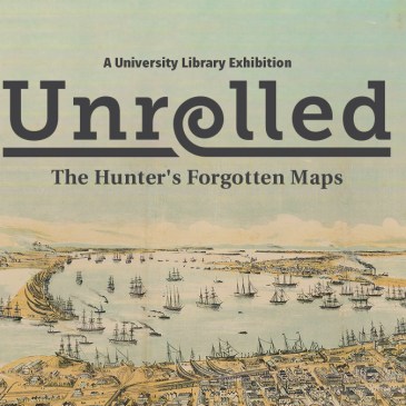
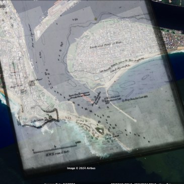
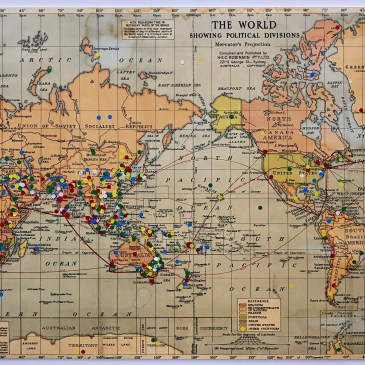
Unrolled Comes to an end Our Unrolled Exhibition featuring The Hunter Region’s Forgotten Maps has now come to an end. You can relive it here: https://hunterlivinghistories.com/2024/10/30/unrolled-forgotten-maps/ Where in the World Are You From? One of the highlights was this circa 1940s map of the World where we invited our students, staff and visitors to pin … More Where Do Our Uni Students Come From?

Unrolled: The Hunter’s Forgotten Maps Exhibition Launch

Discover the beautiful art and science of mapmaking. Throughout human history, the practice of mapmaking has helped us to navigate the world around us and understand our place in it. This exhibition highlights key maps of the Hunter region from our collections, including surveys from the late 18th century and the mapping of later urban … More Unrolled: The Hunter’s Forgotten Maps Exhibition Launch

Hunter Living Histories September Showcase – Mapping The Regions

Hunter Living Histories Showcase Monday, 2 September 2024 1.00pm-2.30pm Join us at 1pm-2.30pm for the University Library’s monthly Hunter Living Histories showcase. All Welcome. WHERE: Virtually via (ZOOM link HERE) or physically in Room L326, Auchmuty Library, Callaghan Campus, Newcastle. (Type Room no. into ONLINE MAP) WHEN –  Monday 2 September 2024 (1.00pm-2.30pm) WELCOME & … More Hunter Living Histories September Showcase – Mapping The Regions

Do the Shipwrecks on Jeffreys’ 1816 Survey of Hunter’s River Still Exist?

The Original Jeffrey’s Chart in the Hydrographic Office, London The original chart (below), in red ink, titled Part of Hunters River (or the Coal River) – Survey’d by Lieut. C Jeffreys (a) Commander of H M C. Brig – Kangaroo March 1816 is located at the Hydrographic Office in London, where all the important mapping … More Do the Shipwrecks on Jeffreys’ 1816 Survey of Hunter’s River Still Exist?

Remembering Lost Lives & Legacies: W. S. Procter and the 1841 Procter Chart

DOWNLOAD AND READ W.S. PROCTER AND THE 1841 PROCTER CHART BY SHANE FROST (58MB PDF) First Navigational Chart of Lake Macquarie The Procter Chart is the first navigational chart of “Reid’s Mistake”, a.k.a. Lake Macquarie, New South Wales produced in 1841. It has fascinated researchers attempting to understand and unlock its annotations and references to … More Remembering Lost Lives & Legacies: W. S. Procter and the 1841 Procter Chart

Hunter Valley Research Foundation Archives

“The Hunter Valley Research Foundation is an expression of the determination of the citizens of this Valley to bring knowledge gained from scientific research to the solution of the problems they face in bringing the resources of the Valley to full development and in contributing still further to the prosperity of the Commonwealth. It is … More Hunter Valley Research Foundation Archives

Plan of the Port of Newcastle (1882) Hand Coloured

This is a beautiful acquisition of the University of Newcastle’s Special Collections in the Auchmuty Library. This hand coloured plan shows the Port of Newcastle as it looked in 1882. Many thanks to David Threlfo who produced this promotional video as Episode 11 of his 4 Local Stories of Us series. Maps of the Port … More Plan of the Port of Newcastle (1882) Hand Coloured

Newcastle in 1889 (The Original Colour Lithograph)

Acquisition of Original Newcastle 1889 Colour Lithograph Special Collections in the Auchmuty Library of the University of Newcastle (Australia) recently acquired this original colour lithograph of Newcastle NSW in 1889. Please click on the image above to access the high resolution version in exquisite detail. Many thanks to David Threlfo who produced this promotional video … More Newcastle in 1889 (The Original Colour Lithograph)

Did Captain Cook Sight and Draw the “Small Round Rock or Island” now known as Nobbys Whibayganba on 10th May 1770?

Cook sights the “small round rock or island” According to the 1790 published account of Captain Cook’s Voyages Round the World, around noon on the 10th May 1770, Cook sights the “small round rock or island” later to be known to Europeans as “Nobbys” and to the Aboriginal people of Newcastle Mulubinba as “Whibayganba”. At … More Did Captain Cook Sight and Draw the “Small Round Rock or Island” now known as Nobbys Whibayganba on 10th May 1770?

The Australian Commonwealth and The World in 1925

  The Australian Commonwealth & The World (c.1925/1926) The two maps above are the front and back of the same item, donated to the University of Newcastle’s Cultural Collections (now Special Collections) in 2012 from the Estate of the late Doug Brown, Mayfield resident. Researchers may be familiar with Doug’s wonderful photographs of life in … More The Australian Commonwealth and The World in 1925