Plan of the Town of Maitland (East) [cartographic material] : County of Northumberland, N.S.W
Sydney : Surveyor General’s Office, [1861]
Scale [1:6 336]. 8 chains to an in. (E 151°34ʹ34ʺ/S 32°44’54”)
1 map ; 73 x 60 cm., on sheet 100 x 67 cm
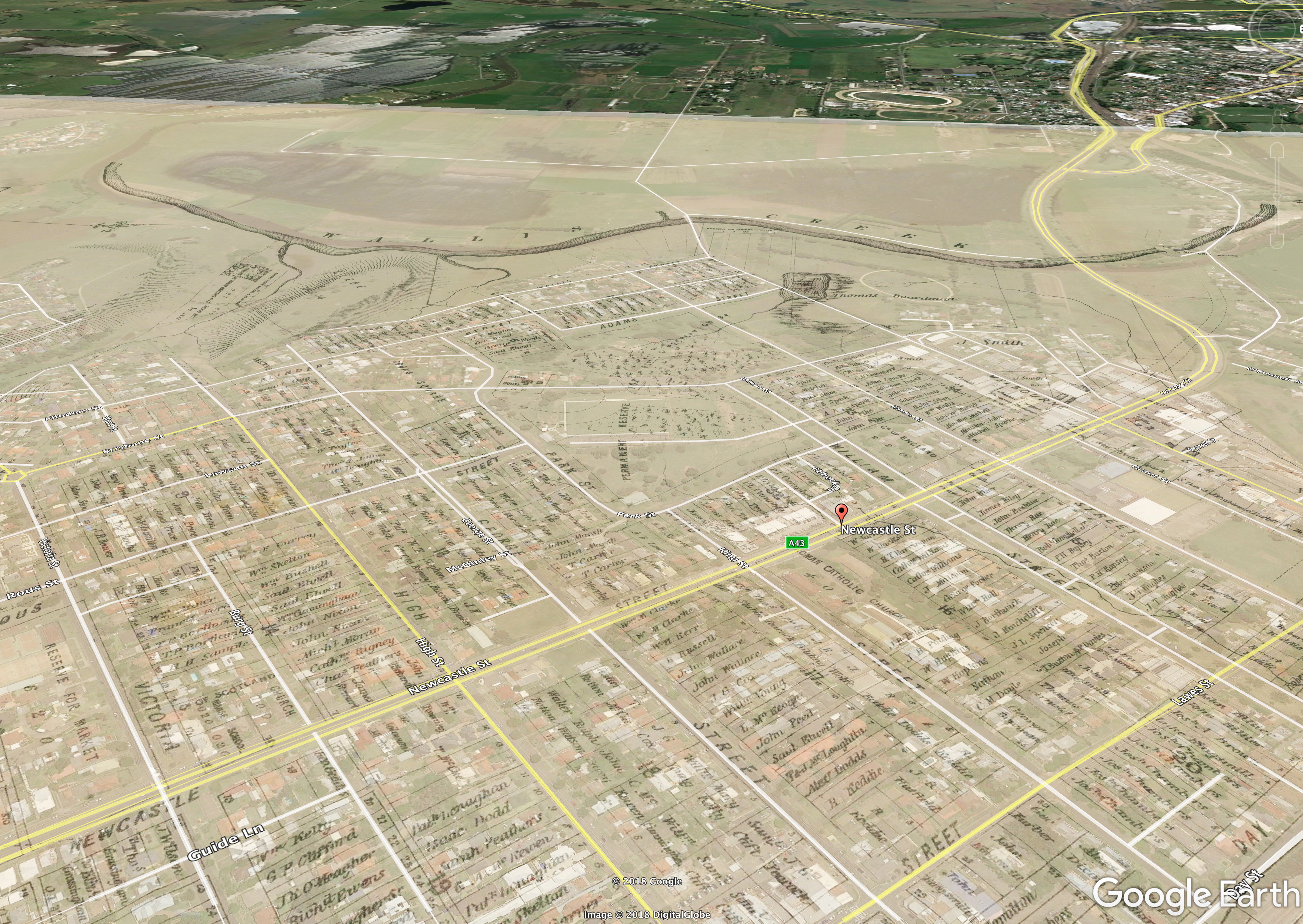
Cadastral map of East Maitland, New South Wales showing Police District boundaries, reserved lands and land holdings “Feby, 1861”
Area: From Wallis Creek to area described as “Hickey is allowed to occupy for his life”, from “Temporary Reserve for Pastorage, 250-300 ac.” to George Mitchell’s, F. Dixon’s and E.C. Close’s respective holdings
Shows measured, numbered allotments and portions, landowners’ names, named (and unnamed) streets, glebe, school house, quarry, cemeteries, various inns, various reserves (including reserve for race course and public recreation, reserve for court house and gaol, reserve for market, “Temporary Reserve for Pastorage”), Cooks Square, Roman Catholic Church, Anglican church, Wallis Creek, Hunter River.
Digitised in high resolution by the University of Newcastle (Australia) and shared freely with the global community with help from the Vera Deacon Regional History Fund. Donate today.
DOWNLOAD THE GOOGLE EARTH OVERLAY (1861 East Maitand.kmz 21.8MB) –
Open in Google Earth and use the opacity slider to view 1861 East Maitland over 2018 Google Earth Satellite Imagery.

NEWCAT Record: https://library.newcastle.edu.au/search/X?SEARCH=maitland+1861&SORT=D&searchscope=16
LIVINGHISTORIES@UON: http://livinghistories.newcastle.edu.au/nodes/view/79037
Gionni Di Gravio
University Archivist & Chair, Hunter Living Histories
18 July 2018
2 thoughts on “Maitland in 1861”