Indigenising the City: Embodying Aboriginal knowledge and wisdom into planning frameworks to create sustainable cities of the future
Paper presented at the Spaces and Flows: Sixth International Conference on
Urban and ExtraUrban Studies
‘Decline Belt Cities and Places: Prospects, Problems, Possibilities’
University Center Chicago
Chicago, USA
15-16 October 2015
This work is conducted in memory and respectfully honours the First Australian People, the Aboriginal People of this land.
Abstract
This paper refers to the port city of Newcastle in New South Wales, Australia and examines how cultural understandings can be indigenised and, thus, be incorporated into the urban planning system. Human beings have inhabited the landscape of Newcastle for at least the past 6,500 years. Newcastle’s Aboriginal name was Mulubinba, after the indigenous fern called the mulubin. We discuss the current planning instruments used in New South Wales and the complex issues facing this post-industrial city of Newcastle since the major employer BHP closed in 1999. The study explores new ways of embedding culture and history into planning, discussing the relevance of historic archival sources in new urban planning models and how Indigenous knowledges of past land use can guide how future cities are shaped. Although revitalisation has been occurring in Newcastle, local communities continue to be dissatisfied with certain urban planning decisions, and there is divisiveness over future plans for the historic city. This article seeks to better understand the dynamics and stakeholders at play and explore alternate approaches that embed cultural understandings into government planning instruments in order to create sustainable cities that can continue to exist for the next 7000 years.
Acknowledgement of Native American Country
For the following information on the American Indian Tribes associated with the Chicago area we sincerely thank the creators of Access Geneaology, Newberry Library and Native American Tribes of Ilinois websites for their information and insights that have assisted in providing comparison between the native landscapes of Chicago, USA with those of Newcastle, Australia.
The original inhabitants of the area of Chicago were the “Illinois” – Algonquian Indian word, comes from the Miami-Illinois tribal name “Illiniwek” = “the people”. By 1671 the Illinois had been driven from their lands from the Iroquois people. In their place came the Miami, another Algonquian Tribe. From the close of the 17th C to the year 1833, the tribe associated with Chicago area were the Potawatomi people. After then, they were moved onto reservations and their traditional territories relinquished.
We acknowledge the traditional Native American custodians of the lands, and respect their elders past, present and those yet to be.
Is there a better way to sustain our environment ?
While ingenuity has made the impossible possible, and allowed outstanding progress in the evolution of how humans live, work and congregate in cities, we have also brought mass destruction and degradation to our environment and all who live, and share it with us. We live in a world being ‘engineered’ and ‘clevered’ to death.
The ‘walls’ of geometric ingenuity are now fast closing in on us. Every environmental indicator is in decline, and we alone are custodians of a planet currently in the grip of one of the largest mass extinctions now underway with 41 per cent of all amphibians, 26 per cent of mammals and 13 per cent of birds all facing extinction.(1)
Our lands are polluted, our lives poisoned with a cocktail of chemicals that we have used to subjugate and make the world better for us. But the Faustian pact is a two way street and our reckoning is about to come, if not already arrived in a world of environmental chaos, conflict, inequality, injustice and depravity.
We need to adopt the land use and sustainability principles of Aboriginal Indigenous cultures that we have been progressively swamped by Western civilisation and scientific progress over the past 2000 years.
Are we advocating a return to the “Stone Age”?
No. We are advocating a return to the sustainable custody principles of the land and its creatures in the same way that Aboriginal peoples did, ensuring that everything continued on and on for thousands and thousands of years.
Aboriginal habitation and culture in Newcastle and the Hunter Region dates back at least 7,000 to 50,000 years. In the past 200 years since European ‘custody’ we are either unable (or unwilling) to adequately house, feed and educate the people we now have in an expansive country. Aboriginal culture not only sustained itself and the land over thousands of years, but enabled the creatures to flourish, and lands properly managed in co-operative and life-sustaining ways. And provided enough of a fertile backdrop to provide to an unfettered, drunken and irresponsible European culture such as ours, 200 years of prosperity to the present.
How can we know what Aboriginal culture did or did not do? They left no written records.
Yes, there was no written record. But fragments remain in the writings of European visitors, naval commanders, missionaries, surveyors, and the mapping they created across the land in the form of cave paintings and engravings. These ‘fragments’ are similar to the musical notation of a song that continues to play, like a radio frequency. While we speak loudly, we cannot hear it. Once we become silent, and listen to the landscape, that ancient voice, or band width begins to be heard. Only then, can we also tune in and understand how Aboriginal people lived in this land.
Indigenous Understanding
The key to the Aboriginal understanding is the original landscape. Within metres of the conference venue in Chicago was an Indian trail as shown in the following plan. Indian Tribes associated with the area of Chicago are the “Illinois”, an Algonquian Indian word that comes from the Miami-Illinois tribal name “Illiniwek”, meaning “the people”.


During our stay in Chicago, we sought to trace where this Indian Trail now was. It appears to now be South Michigan Avenue, the main thoroughfare of Chicago.
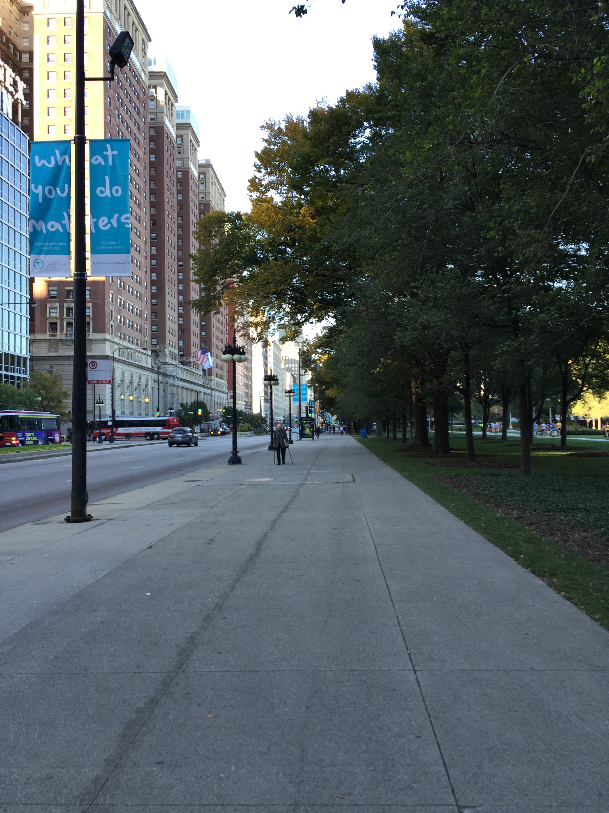
When we went looking for any recognition of this ancient path, we discoverered no plaques or signs. But we did find two great bronze states of Native braves on horseback, that may have been official recognition.

But on closer examination, there was no mention of any Indian Trail or recognition of Native American history. It appeared to be a philanthropic group that financed the creation and placement of bronze sculptures. Whether or not they were aware of the significance of the placing of these sculptures we would like to know.

This is the earliest representation of the Newcastle area drawn as an ‘eyesketch’ by its European ‘discoverer’ Lieutenant John Shortland in 1797. “Natives” are marked in two places on the plan, which were later omitted when the plan was officially published in 1810.

The 1801 Plan by Francis Barrallier is the first proper survey of the Hunter Region. Mapping in the European sense was “white man’s magic”, drawing a landscape was a means of exploiting its resources, and stealing it on behalf of the crown.
Contrast this form of ‘map making’ with that of Indian Aboriginal peoples.

“Native Americans had different mapping traditions. Their traditions were not based on the precise measuring of physical space. They were based on how much time it took to travel, what happened along the way, and what was important to remember about places. The maps were narratives that reflected the seasons of the year and events. Some of the maps were histories of the people.” Drawing from a Native American skin map, circa 1825, Raymond Wood, Illinois State Museum (Ref: http://www.museum.state.il.us/exhibits/lewis_clark_il/htmls/resources/mapping/native_american_mapping.html )
Compare this with Australian Aboriginal map site engraved in sandstone rock located in the Hunter Region. A sky hero stands guardian, along with a series of depictions of anthropomorphic, animal and spiritual beings, possibly connected to the stars and tracks leading to various territories outlining stories and important teachings connected to country.


Emu woman points to women’s country with engraved emu tracks pointing the way. Aboriginal map making was also about survival in the landscape, but not exploitative. It was designed to provide vital astronomical data, and its correlations to the appearance of food sources at various times of the year. “When this star in is in this position, you can go to that country to eat this.” Ella Simon recorded that watching birds taught them what to eat, and how to eat it. Some birds also warned them of the presence of hazards such as snakes. As well as conveying news of deaths of loved ones. The sounds of the birds were also incorporated into Aboriginal language.(2) The ancient Etruscans, one of the indigenous races of Italy, also sought knowledge of the placement of cities and towns through the study of the entrails of birds and animals, but not for superstitious purposes such as magic or prophesy as has been incorrectly assumed. The condition of the livers of birds and animals allowed the Etruscans to understand whether the landscape to sustain them properly. If the animals had been healthy, as evidenced by the condition of their internal organs, then man could be sustained as well.(3)
Newcastle 1989 Earthquake and Story of the Kangaroo in Nobbys
The following story of the Kangaroo within Nobbys was recorded by the Rev L.E. Threlkeld in the Christian Herald, 17th February 1855, Vol.III, p.5-6. [Published in Australian Reminiscences & Papers of L.E.Threlkeld, Missionary to the Aborigines, 1824-1859. 2 vols, ed. Niel Gunson. Canberra: Australian Institute of Aboriginal Studies, 1974:65]: “At the entrance of Newcastle there is a small high island, called by the English Nobby’s Island. (4) The blacks have a tradition that it is the abode of an immensely large Kangaroo which resides within the centre of the high rock, that occasionally he shakes himself which causes the Island to tremble and large pieces to fall down, as any one can perceive has been, and still continues to be the case, on the eastern side of the Island. It is evident on the slightest inspection, that at some early period the Island formed part of the main land, the strata correspond with the similar ones of coal, sand, and other stone to those on the opposite shore, nothing but a general convulsion of nature could have affected such a change. Manual labour is now employed to fill up the space betwixt the Island and the main land so as to form a breakwater for the protection of the harbour at Newcastle, and a great part of the top of Nobby’s Island has been taken down without reaching the monster kangaroo said to dwell within the rock!” The 1989 Earthquake again reminded us that Newcastle is prone to earthquake activity, forgotten until then, which forced a review in building codes in order to make Newcastle’s newer structures more resilient to seismic activity.

This overlay shows the ancient Aboriginal landscape underneath the geometric overlay of our modern streetscape. You can see the ancient dune system wended its way around from a factory site on the harbour shoreline, which in 2009 was discovered evidence of three ways of human habitation dating back 7000 years. In the superstorm of 2007, the areas of Steel Streets and King, went back to their swampy origins.


The fundamental difference between the ways that Aboriginal and European cultures view the Earth is a spatial one. We divide the landscape into geometric blocks and squares, our lives are governed by geometry real and imagined.
To Aboriginal people their borders are not mathematical or geometrical constructs. Their boundaries are natural; i.e. land, sea, mountain, sky etc.
In order to begin to create, and evolve cities that are truly sustainable across many thousands of years we have to alter the way we see the world around us, and adopt the key principles of Aboriginal peoples.
Every man and every woman does not own the land, the land owns you. To Aboriginal people owning the land, is like owning a piece of the sky. It is ridiculous.
Our job is to ensure that every living thing, and every natural thing continues on, and is there for the next generation. There is no waste. Our work with nature has to be co-operative, and not exploitative in order to be sustainable.
A 7000 year old engaged city
The contrasts between Indigenous and colonial mapping reveal distinctions in land use that imply an interaction with the land rather than a use or abuse of the land , being part of nature, rather than trying to control nature.
Unthinking development which buries our histories, both ancient and more recent obscures not only the lives of those who came before but misses out on the opportunity to reveal insights into the way people were able to engage with geographic spaces over thousands of years.
As we claim to re-vitalise our cities, those with power continue to seek to exploit on the basis of profit with the argument that financial growth will somehow flow down and nourish our souls and the city. Yet traditional planning processes here and elsewhere reveal the inadequacies of a modernist planning paradigm which needs to be overturned as it places development needs over cultural significance (Sandercock, 2000).
Taking out the rail line just cuts out a connection with the city, at a time when we need to be focussing on the ways in which we connect and share spaces, not the opposite. The connectivity in our city gives us good social foundations, which then need to be linked to designs which facilitate spaces for all to belong. In calling for an approach to planning which recognises the need to be responsive to diverse ways of being, Sandercock (2000 p9) asserts there is an need for diverse identities to “be present and active in the public sphere and to occupy public space.”
So how do we reverse these current ethnocentric profit driven development paradigms?
Calling on Hawaiian knowledge Johnson et al, (2005,p81) suggest we need to turn our bodies to face the past as a place we know and can draw upon, while we need to stand with our backs to the future, which is not known and we can thus draw on the past as we consider how we move forward. To unveil this past, building on the work of Paulo Friere , they (ibid) call for a critical cartographic literacy to reveal how maps are a form of power.
In drawing on the past to shape our future what learnings can we take with us? Indigenous cartographies and Indigenous storytelling and the work of archivists and historians can reveal how spaces were used. These histories such as the Kangaroo at Nobby’s or the old waterlines or the native trails in Chicago, not only inform the past but they re-present the future. The acknowledgement through place names, through art works and rediscovered stories are relevant to ancestors and descendants alike. For the youth walking to school what symbols can they read of what was once there and what is still there. How can the visibility of culture and their ability to read the land relate to ways in which they feel they belong to a place and inform an ethics of care for that place for future generations?
Maybe our planners and those who fund them can shape our future not by the high rise they are so keen to construct today but through a foundational legacy for an ecologically sound future. What if they were to invest in our schools the teaching of histories through maps? What if we invested in education so our children were taught critical cartographies that are founded in Indigenous histories so people can learn to walk forward by first looking back? Our legacies should not be cheap unimaginative high rise or ripped up public facilities such as rail line that once was. Our legacies should be a reflection of how we live in and care for space, how we can invest in our young people as future custodians and how we reveal these hidden histories through funding the creation of new spaces, and installations which link us both present and past.
We need to reinvent our cities based not on the mode of production but on the basis of connection , let us invest in our Indigenous histories, our cultural diversity and re-engage people young and old. A 7000 year old city is possible if we want it to be.
Indigenous Understanding, Planning & Urban Sustainability
Building healthy cities or restoring health of existing cities is complex, when thinking about urban design models they should encompass all environmental disciplines (science, philosophy, politics, culture, gender, history). Planners need to look at the missing components, consider disciplines independently and what can be included to the planning equation. From an Australian perspective what is absent in planning models is traditional customary practice of Indigenous cultures, which can provide a better understanding of local topography and the environment.
Historical research of archives and artefacts associated with Indigenous knowledge and culture is necessary when considering planning.
Aboriginal people in Australia have been living sustainably for thousands of years and survived 60 000 years – this is now broken, and it is urgent that we re-invest in science and knowledge about Indigenous cultures to learn how to survive sustainably for the next 60 000 yrs. Australian Indigenous people have not been active participants in planning, however, Indigenous planning has always existed. Planners talk of the ‘liveability’ of cities, ‘new urbanism’, ‘smart cities’, and ‘sustainability’- but unfortunately in Australia planners have not considered the ancient landscape in which Indigenous people lived, how they moved around ‘country’ adapting to change in climate and conditions. Environmentally Australian Aboriginals have been smart, they have used the land and resources wisely as Bill Gammage describes in his book The Biggest Estate on Earth.

Human beings have inhabited the Newcastle landscape for at least the past 6,500 years.
Indigenous culture and concepts can be embedded into planning instruments to benefit all communities, to be used in planning more generally, and to enhance the health of wider communities. In Newcastle the current situation is complex, cultural heritage and public spaces are threatened with plans to sell off public assets. Revitalisation is occurring without inclusive engagement with local communities and there is dissatisfaction at a local level that the state government is spending a lot of money on an expensive ‘PR’ exercise to win over public confidence. In this climate it is difficult to introduce new concepts such as the one discussed here – indigenising cities- however, it is important that we begin a discussion about such issues.
In NSW there is a two tier heritage system (Aboriginal / Non Aboriginal heritage). Non-Aboriginal heritage is often site specific and Aboriginal heritage mostly found in National Parks, when actually whole landscapes (as in Newcastle) are culturally significant, having a mix of Aboriginal and non-Aboriginal heritage.
In NSW planning instruments are too narrow, only considers parts of the urban environment, and not the wider context.
Our current approach to re-making cities and communities is economically driven, we let developers call the shots, they have the money, and government and community bend to their vision of financial viability. This approach leaves little room for other ideas and concepts to be implemented, that is from the community.
A somewhat radical approach is to embed cultural understandings into general government planning instruments in order to create sustainable cities. This would include input from Indigenous and other communities – a change from exploiting, devaluing, oppressing Indigenous culture, to one of empowerment and inclusion.
How do we indigenise the planning system
At present we have a top down approach to planning. We can begin to conceptualise urban planning from the bottom up, rather than the top down, to explore how Indigenous elements (and other local and regional fundamentals) can be incorporated into urban planning models. By reversing the way that planning is undertaken (from the ground up) this inevitably means that organisations at many levels can interactive and engage with one another. Another way to indigenise planning is to consider archival sources and artefacts and how these can guide, inform and inspire new thinking about planning. Indigenous elements can be an important consideration alongside ‘grass roots’ and local community based aspects to urban planning as shown in the model below.


This reversal of approach gets back to the local and communities – something echoed by ideas Marcus Westbury discusses in his new book ‘Creating Cities’, inspired by his hometown of Newcastle, activating empty buildings, and now inspiring hundreds of creative local communities across Australia, and the world.(6) He writes how in a globalised age, local creativity has access to new possibilities.
The key here is “local”, tapping into local people and stories, and their connection with place. Aboriginal people in Australia talk about their connection to ‘country’ – this concept in essence is something that non-Indigenous people also relate- having commitment to place and a desire to care for that place.
The current planning regime is not working in NSW, so what can we learn from Indigenous culture/history? We need to see planning through the Indigenous lens, learn to read the landscape and consider new ways of embedding culture.
Key Messages
- UNDERSTANDING INDIGENOUS CULTURE– Read and seek out written sources, talk to Indigenous people to comprehend history and origins of Indigenous culture. Consider Dreamtime stories and ideas about sustainability.
- RESEARCH & NEW KNOWLEDGE – Importance of archival sources in developing new knowledge about Indigenous tradition and custom.
- EMBED INTO PLANNING– Embed new Indigenous thinking into planning. Liaise with policy makers about Indigenous culture and new planning models.
- LOCAL DECISION MAKING– Encourage a community focus and consider Aboriginal land use, respect for land, and consider local viewpoints. Important to interpret stories in the place they are meaningful.
- HEALTHY PLANNING– Respect and valuing Indigenous cultural heritage, ‘closing the gap’ philosophy around healthy planning. Healthiest & happiest research.
- CO-OPERATIVE GOVERNMENTS– For a distinct form of planning to evolve we need co-operation from all levels of government. Overturn planning that preferences development needs over cultural significance.
- LOCAL IDENTITIES – Indigenous culture visible and active in the public domain and occupying public space, for example dual naming.
In conclusion, this paper has considered how cities such as Newcastle (Mulubinba) can be re-moulded using archives and cultural sources as catalysts to visualising ‘lost’ past and future possibilities. Science is telling us that climate change is real, so dependence on coal cannot continue, where is our sustainability? Where is the “All-Seeing-Eye” of the planner in the revitalisation and ongoing design of our post-industrial intercultural cities? We hear very little about Indigenising our local environment, however by doing so just may be the key to solving some of the current urban planning problems. We need to start a discussion among planning professionals and related disciplines.
Dr Ann Hardy – Cultural Collections , University of Newcastle
Gionni di Gravio- Cultural Collections , University of Newcastle
Bill Robertson- University of Newcastle PhD Candidate – Sociology and Anthropology
(Authors are currently writing a journal article expanding further some of the ideas & concepts from this paper)
REFERENCES
http://www.nature.com/news/biodiversity-life-a-status-report-16523
Ella Simon. Through My Eyes, pp. 32-34.
Vitruvius, Ten Books of Architecture, Book 1, Chapter IV
Rev L.E. Threlkeld in the Christian Herald, 17th February 1855, Vol.III, p.5-6. [Published in Australian Reminiscences & Papers of L.E.Threlkeld, Missionary to the Aborigines, 1824-1859. 2 vols, ed. Niel Gunson. Canberra: Australian Institute of Aboriginal Studies, 1974:65].
Bill Gammage (2011) The Biggest Estate on Earth. Allen & Unwin.
Marcus Westbury (2015) Creating Cities.
Johnson, J. T., Louis, R. P., & Pramono, A. H. (2005). Facing the future: encouraging critical cartographic literacies in indigenous communities.
Sandercock, L. (2000). Cities of (in) difference and the challenge for planning. disP-The Planning Review, 36(140), 7-15