Skip to content

Hunter Living Histories

University of Newcastle

  • Home
  • Digital Collections
  • About
    • Meetings
    • Contact Us
    • Newsletter
  • Dreaming
  • History
  • New Research
  • GLAMx
    • WIL student placements

Tag: White 1844 Survey

Image of White's 1844 Plan of the Hunter Region

1844 Plan of the Hunter Region

October 20, 2021

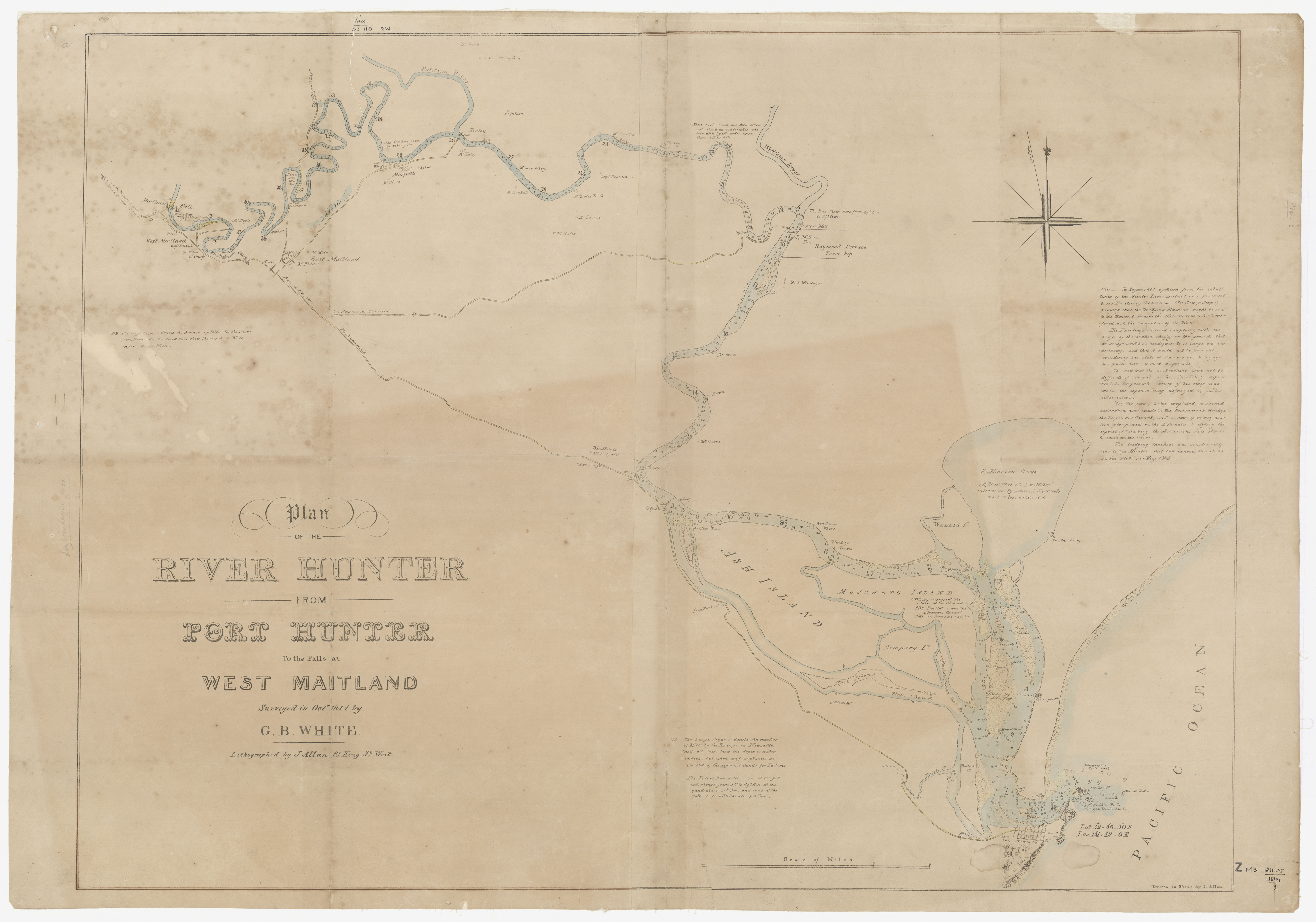
Here are two digital copies of G.B White’s 1844 Plan of the Hunter Region from the Port Hunter (Newcastle) to the Maitland Falls. Title Plan of the River Hunter  from Port Hunter to the Falls at West Maitland Surveyed in October 1844 by G.B White. Lithographed by J. Allen 81 King St. West.   1844 … More 1844 Plan of the Hunter Region

3 Comments 1844 Plan of the Hunter Region

Projects

Facebook

Facebook

Follow Us

  • Facebook
  • Instagram
  • Twitter
  • Flickr
  • SoundCloud

Living Histories

Living Histories Data Platform

DONATE TODAY

Blogroll

  • Aboriginal Studies
  • Anglican Diocese of Newcastle Archives
  • Art of Early Newcastle
  • Breath of Life
  • Coal River Flickr
  • Coquun-Hunter
  • CRWP Media
  • Ed Tonks Historian
  • Fort Scratchley
  • Government Domain
  • Hidden Hamilton
  • Hunter National Trust
  • Industrial Heritage
  • Lachlan Wetherall – "A bit of this, a bit of that"
  • Living Histories
  • Lost Newcastle
  • Multifaith Newcastle
  • Museums of History NSW
  • Newcastle Industrial School
  • Newcastle on the Edge
  • Noel Butlin Archives
  • Noel Butlin Archives – AACo
  • NSW State Archives
  • Parks and Playgrounds
  • Paterson River
  • Radical Newcastle
  • SC YouTube
  • Search Everything
  • Singleton & Patricks Plains – Terry Callaghan
  • Spatial Services NSW
  • Special Collections
  • State Library NSW
  • Terry Callaghan History & Genealogy
  • The Old AAco Road
  • The Tanner Society
  • Trove
  • UONCC Blog
  • Vera Deacon Fund

Walking Tours

  • Walking Tours

SEARCH EVERYTHING


Archives

Powered by WordPress.com.
 

Loading Comments...