The Coquun Hunter Estuary: A Visual Imagery Sourcebook

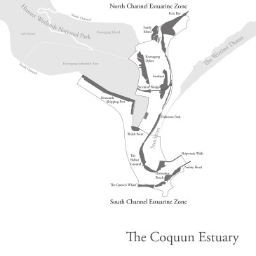
This work is conducted in memory and respectfully honours the First Australian People, the Aboriginal People of this land. Focus of Presentation: The Coquun Hunter Estuary The Coquun Estuary. On the formation of the lower estuary, specifically around the Stockton Sandspit and the Newcastle Shipping Port to Nobby Head. Introduction to the Archives. How your … More The Coquun Hunter Estuary: A Visual Imagery Sourcebook

Remembering Lost Lives & Legacies: W. S. Procter and the 1841 Procter Chart

DOWNLOAD AND READ W.S. PROCTER AND THE 1841 PROCTER CHART BY SHANE FROST (58MB PDF) First Navigational Chart of Lake Macquarie The Procter Chart is the first navigational chart of “Reid’s Mistake”, a.k.a. Lake Macquarie, New South Wales produced in 1841. It has fascinated researchers attempting to understand and unlock its annotations and references to … More Remembering Lost Lives & Legacies: W. S. Procter and the 1841 Procter Chart