


[August 25, 2014 Update]
Please find updated post with new high resolution scans courtesy of Greg and Sylvia Ray here:
https://hunterlivinghistories.com/2014/08/25/newcastle-aerial-photos/
[August 2014 Update]
We contacted Mr Phillip Warren who was able to shed further light on the origin of the images.
The originals were held in the archives of the former A. Goninan & Co. Ltd. originally established in 1899, which later changed its name to United Goninan before being taken over by the United Group in 1999.
The company designs manufactures and undertakes maintenance work on railway rolling stock, locomotives and light rail vehicles.
Phillip arranged the original glass negatives to be re-scanned by Greg and Sylvia Ray. They have kindly provided us with the higher resolution files to assist in dating the images. We will upload as soon as we can.
Along with the digital files was a scan of an original listing of the glass negatives undertaken in 1988 by a J.L.N. Southern.
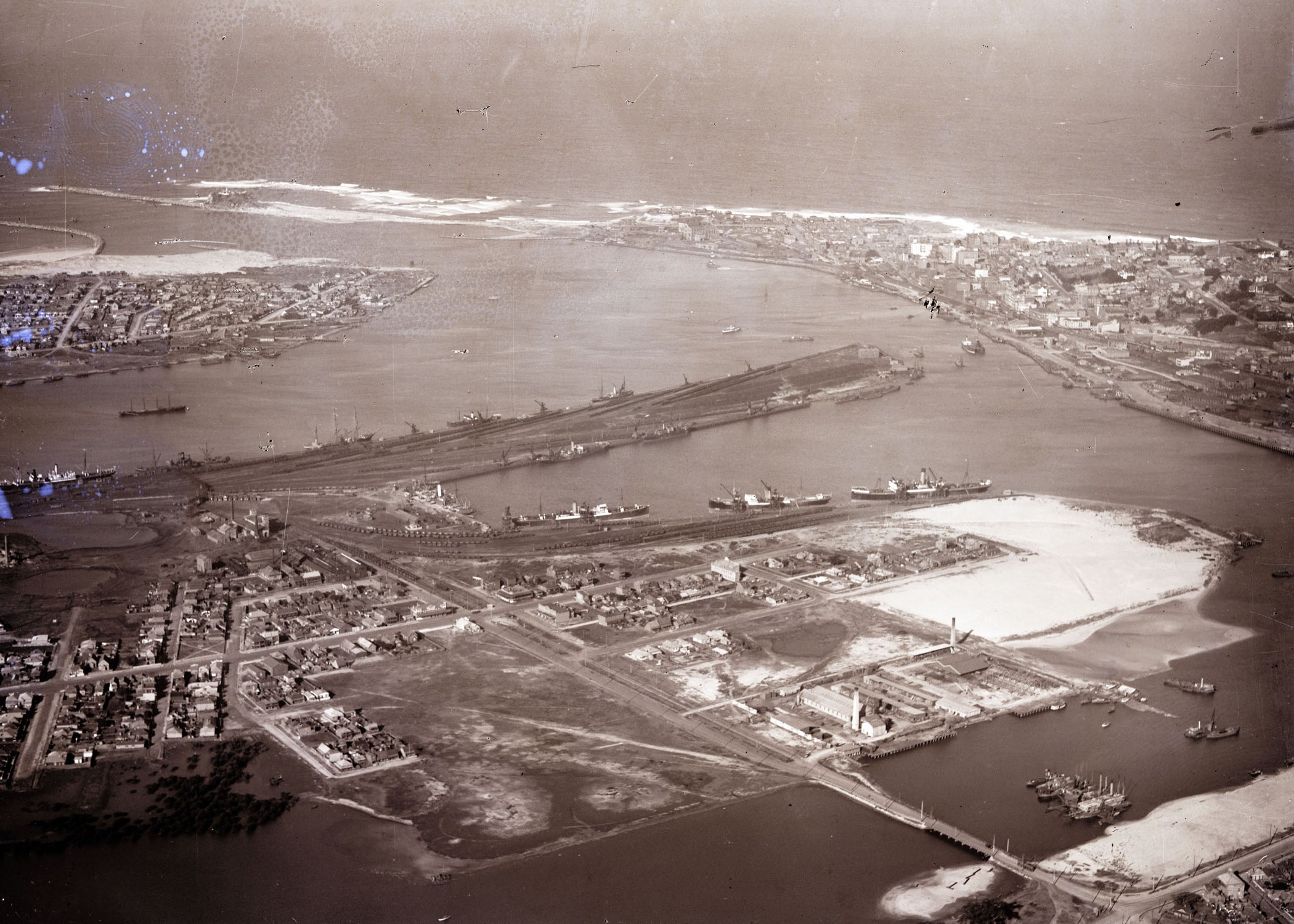
The original negatives were aerial photographs taken by Milton Kent Airplane Photographs, Sydney.
The title of the document is “Aerial Photographs of Port Hunter, Stockton, Newcastle, Carrington, Walsh Island, Port Waratah, Morandoo, Tirrikiba, Mayfield, Georgetown, Swansea Heads by Milton Kent Airplane Photographs, Sydney.”
It appears Southern was responsible for the numbering and dating of the images.
Original Post
These aerial photographs were taken over Newcastle during the late 1920s, providing a bird’s eye view of the Newcastle landscape. We thank Phillip Warren for sharing these images with us.
Please click on the images to view the larger photographs.
We are always interested in people’s thoughts and comments, and any further information they wish to share. Please leave a comment in the box below the post.
We also thank Mr Russell Rigby for observing that there is no Newcastle Town Hall (dating the photographs to pre-1929) and Cathedral is under building scaffold for alterations (circa 1928). Dr Ann Hardy also relayed news from her son that the last photograph was of the Swansea Channel, rather than the Newcastle peninsula. Further comments and corrections are welcome.


Gionni Di Gravio
University Archivist, and Chair, Coal River Working Party
July 2014.